geo.wikisort.org - Mountains
Mount Pinacle (French: Le Pinacle) is a mountain located in Coaticook, Quebec Canada. The mountain has five hiking trails of varying difficulty, covering approximately 7 kilometres (4.3 mi), that visitors can explore with the purchase of an admission ticket.[4] Experienced rock climbers may scale the face of the hill starting from Lake Lyster. The mountain is exploited for its abundance of maples, with a sugar bush running along a portion of its trails.
| Mount Pinacle | |
|---|---|
| Le Pinacle | |
 View of the Mount Pinacle, Baldwin Mill's | |
| Highest point | |
| Elevation | 665 m (2,182 ft)[1] |
| Prominence | 120 m (390 ft)[2] |
| Isolation | 2.49 km (1.55 mi)[2] |
| Coordinates | 45°01′25″N 71°53′49″W[3] |
| Geography | |
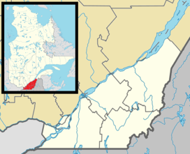 Mount Pinacle Quebec, Canada | |
| Parent range | Northern Appalachians |
| Topo map | NTS 21E4 Coaticook |
| Climbing | |
| Easiest route | hiking, rock climbing |
History
The hill has been officially known as Le Pinacle since 1978.[3]
In 2013, part of the hill was closed to rock climbing due to the nesting of peregrine falcons on Mount Pinacle.[5]: 35
In June 2014, a 10-year-old child on a field trip went to the emergency department after surviving a 10-metre fall down a crevice on the mountain. Approximately a dozen firefighters were onsite for two hours rescuing the child, although he was not gravely injured.[6][7]
References
- "Parc Découverte Nature | Mont Pinacle". Archived from the original on 15 August 2014. Retrieved 8 August 2014.
- "Le Pinacle". Peakbagger.com. Retrieved 8 August 2014.
- Reference number 84332 of the Commission de toponymie du Québec (in French)
- "Randonnée pédestre". Parc Harold F. Baldwin (in French). Retrieved 2022-05-24.
- "Rapport annuel 2013" (PDF) (in French). Fédération québécoise de la montagne et de l'escalade. Retrieved 8 August 2014.
- "Mont Pinacle : le garçon tombé entre les roches est sain et sauf" (in French). Radio-Canada. 26 June 2014. Retrieved 8 August 2014.
- Girard, Pierre-Olivier (26 June 2014). "Un enfant chute au Mont Pinacle" (in French). Progrès de Coaticook. Archived from the original on 11 August 2014. Retrieved 8 August 2014.
External links
- (in French) Official website of the park
- (in French) Coaticook Historical Society's page on Mont Pinacle
This Estrie location article is a stub. You can help Wikipedia by expanding it. |
На других языках
- [en] Mount Pinacle
[fr] Le Pinacle (Coaticook)
Le Pinacle est une colline située à Coaticook, au Québec (Canada), à moins de deux kilomètres au nord de la frontière américaine avec le Vermont.Другой контент может иметь иную лицензию. Перед использованием материалов сайта WikiSort.org внимательно изучите правила лицензирования конкретных элементов наполнения сайта.
WikiSort.org - проект по пересортировке и дополнению контента Википедии