geo.wikisort.org - Mountains
Mount Tambuyukon or Tamboyukon (Malay: Gunung Tambuyukon) is a mountain located at the West Coast Division of Sabah, Malaysia. It is considered the third-highest mountain in the country with height at 2,579 metres (8,461 ft),[1][2] lying north of the highest Mount Kinabalu.[3]
| Mount Tambuyukon | |
|---|---|
 Summit of Mount Tambuyukon. | |
| Highest point | |
| Elevation | 2,579 m (8,461 ft) |
| Prominence | 833 m (2,733 ft) |
| Listing | Ribu |
| Coordinates | 6°12′31″N 116°39′29″E |
| Naming | |
| Native name | Gunung Tambuyukon (Malay) |
| Geography | |
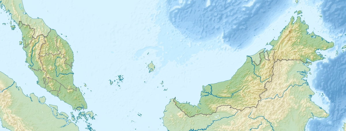 Mount Tambuyukon Map showing location of Mount Tambuyukon within Malaysia. | |
| Location | West Coast Division, Sabah, Malaysia |
| Parent range | Crocker Range |
Geology
The glaciated summit plateaus and Pleistocene glacial tills of the Kinabalu area including similar deposits near to Mount Tambuyukon indicate that the summits of Tambuyukon, Kinabalu and possibly Trusmadi were significantly higher than other parts of the Crocker Range by the Pleistocene.[4] Together with Mount Kinabalu, it is part of the Wariu Formation.[5]
Biodiversity
The mountain supports a wide range of unique flora and fauna, including a number of pitcher plant species of the genus Nepenthes.[6][7][8] A mammal survey in 2012 and 2013 from 300 metres (984 ft) to the summit, recorded the second known population of the summit rat,[9] and a total of 44 mammal species.[10]
Features
There are two climbing trails towards the mountain summit, one from Monggis Village and the other from Sabah Parks substation with permission from the park authority needing to be obtained before the climbing.[11] The mountain is considered one of Sabah's ecotourism destination.[12]
 The mountain peak signboard.
 The mountain trail.
 Trees on the mountain.


References
- George Argent; Anthony Lamb; Anthea Phillipps (2007). The Rhododendrons of Sabah, Malaysian Borneo. Natural History Publications (Borneo). ISBN 978-983-812-111-8.
- Lawrence S. Hamilton; James O. Juvik; F.N. Scatena (6 December 2012). Tropical Montane Cloud Forests. Springer Science & Business Media. p. 194. ISBN 978-1-4612-2500-3.
- "Mount Tambuyukon". Sabah Tourism. Archived from the original on 2 July 2019. Retrieved 2 July 2019.
- Alex Burton-Johnson; Colin G. Macpherson; Robert Hall (2017). "Internal structure and emplacement mechanism of composite plutons: Evidence from Mt Kinabalu, Borneo" (PDF). Journal of the Geological Society. 174 (1): 5/39. Bibcode:2017JGSoc.174..180B. doi:10.1144/jgs2016-041. S2CID 132602468. Archived from the original (PDF) on 2 July 2019.
- H.D. Tjia (1988). "Accretion Tectonics in Sabah: Kinabalu Suture and East Sabah accreted terrane" (PDF). Universiti Kebangsaan Malaysia. 22: 241. Archived from the original (PDF) on 2 July 2019. Retrieved 2 July 2019 – via Geological Society of Malaysia.
- Clarke, C.M. 1997. Nepenthes of Borneo. Natural History Publications (Borneo), Kota Kinabalu.
- Clarke, C.M. 1998. The Nepenthes of Mount Tambuyukon, Kinabalu Park. Sabah Parks Nature Journal 1: 1–8.
- L. A. Bruijnzeel; F. N. Scatena; L. S. Hamilton (6 January 2011). Tropical Montane Cloud Forests: Science for Conservation and Management. Cambridge University Press. p. 116. ISBN 978-1-139-49455-7.
- Miguel Camacho-Sanchez; Irene Quintanilla; Melissa T. R. Hawkins; Fred Y. Y. Tuh; Konstans Wells; Jesus E. Maldonado; Jennifer A. Leonard (2018). "Interglacial refugia on tropical mountains: Novel insights from the summit rat (Rattus baluensis), a Borneo mountain endemic". Diversity and Distributions. 24 (9): 1252–1266. doi:10.1111/ddi.12761.
- Melissa T. R. Hawkins; Miguel Camacho-Sanchez; Fred Tuh Yit Yuh; Jesus E Maldonado; Jennifer A Leonard (2018). "Small mammal diversity along two neighboring Bornean mountains". PeerJ Preprints. doi:10.7287/peerj.preprints.26523v1.
- "Mount Tambuyukon Climbing". Sabah Parks. Archived from the original on 2 July 2019. Retrieved 2 July 2019.
- Er Ah Choy; Chong Sheau Tsuey; Alim Biun; Jumaat Adam (2011). "The Nascent Ecotourism Journey for Mt. Tambuyukon" (PDF). Australian Journal of Basic and Applied Sciences. ISSN 1991-8178. Archived from the original (PDF) on 2 July 2019.
External links
 Media related to Mount Tambuyukon at Wikimedia Commons
На других языках
[de] Tambuyukon
Der Tambuyukon (mal. Gunung Tambuyukon) ist Malaysias dritthöchster Berg. Er befindet sich im Bundesstaat Sabah, 18 Kilometer nordöstlich des Kinabalu. Der Tambuyukon ist Teil der Gebirgskette Crocker Range.- [en] Mount Tambuyukon
[fr] Mont Tambuyukon
Le mont Tambuyukon ou Tamboyukon (en malais : Gunung Tambuyukon) est le troisième plus haut sommet de Malaisie à 2 579 m d'altitude. Il est situé près du mont Kinabalu. La mont est le lieu de vie d'une large variété de flore et de faune unique, en particulier du Nepenthes rajah.Другой контент может иметь иную лицензию. Перед использованием материалов сайта WikiSort.org внимательно изучите правила лицензирования конкретных элементов наполнения сайта.
WikiSort.org - проект по пересортировке и дополнению контента Википедии