geo.wikisort.org - Mountains
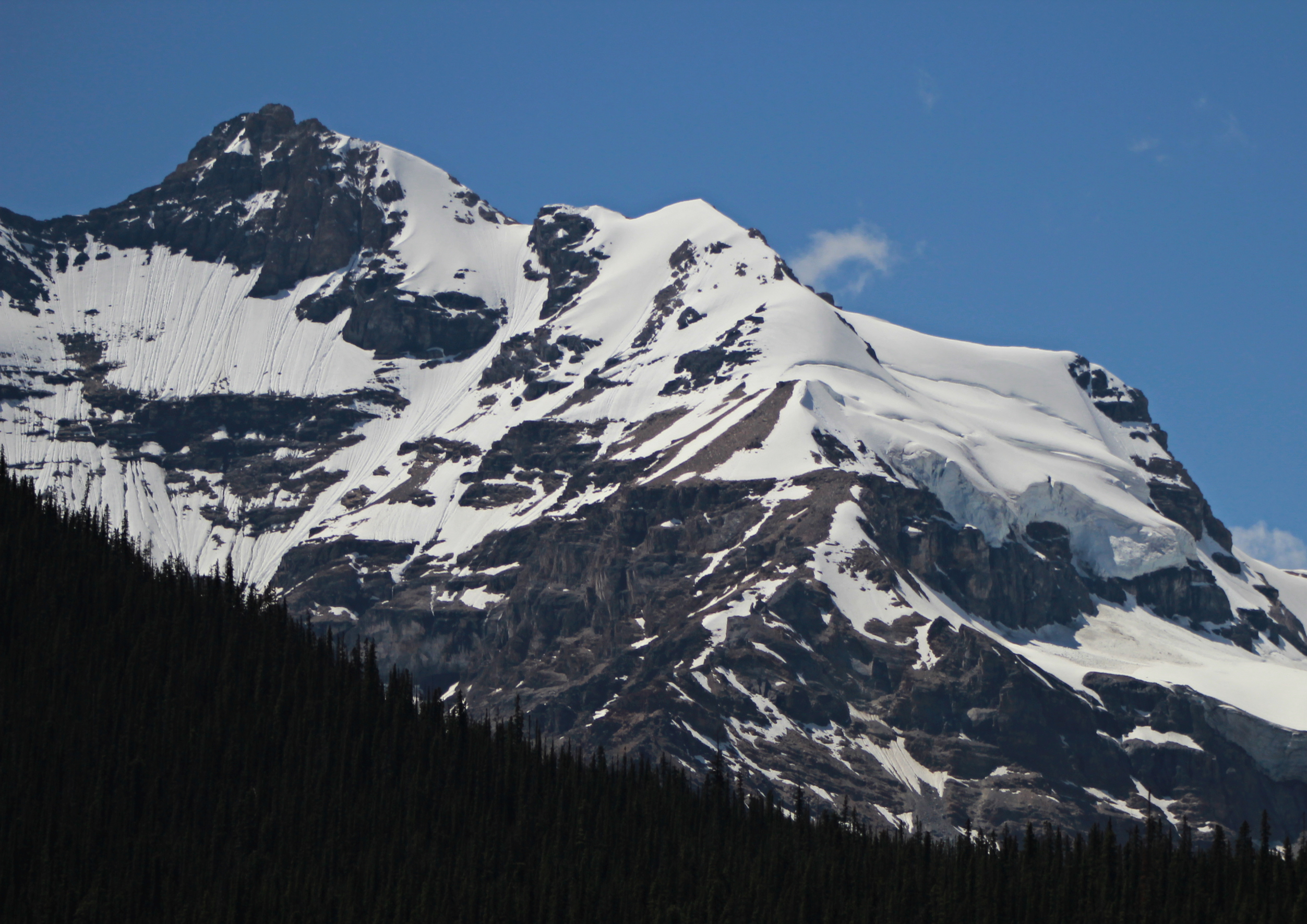
Mount Engelhard is a 3,270-metre (10,730-foot) mountain summit located between the Athabasca River valley and Sunwapta River valley of Jasper National Park, in the Canadian Rockies of Alberta, Canada. Engelhard lies one kilometre northwest of Mount Cromwell, and three km NNE of the east summit of Stutfield Peak.[4] The mountain was named in 1966 after Georgia Engelhard, an American who climbed for 15 years in the Canadian Rockies.[1]
| Mount Engelhard | |
|---|---|
 NE face of Mt. Engelhard | |
| Highest point | |
| Elevation | 3,270 m (10,730 ft)[1][2] |
| Prominence | 210 m (690 ft)[2] |
| Parent peak | Mount Cromwell ((3380 m)[2] |
| Listing | Mountains of Alberta |
| Coordinates | 52°16′31″N 117°24′25″W[3] |
| Geography | |
Mount Engelhard Location of Mount Engelhard in Alberta  Mount Engelhard Mount Engelhard (Canada) | |
| Location | Jasper National Park Alberta, Canada |
| Parent range | Winston Churchill Range |
| Topo map | NTS 83C6 Sunwapta Peak[3] |
| Climbing | |
| First ascent | 1930 |
| Easiest route | rock/snow climb |
The first ascent was made in 1930 by W. Hainsworth, J.F. Lehmann, M.M. Strumia, and N.D. Waffl.[1]
Climate
Based on the Köppen climate classification, Mount Engelhard is located in a subarctic climate with cold, snowy winters, and mild summers.[5] Temperatures can drop below -20 °C with wind chill factors below -30 °C. Precipitation runoff from the mountain drains into tributaries of the Athabasca River.
See also
- List of mountains in the Canadian Rockies
- Geography of Alberta
References
- "Mount Engelhard". PeakFinder.com. Retrieved 2004-06-05.
- "Mount Engelhard". Bivouac.com. Retrieved 2021-03-28.
- "Mount Engelhard". Geographical Names Data Base. Natural Resources Canada. Retrieved 2021-03-28.
- "Topographic map of Mount Engelhard". opentopomap.org. Retrieved 2021-03-28.
- Peel, M. C.; Finlayson, B. L. & McMahon, T. A. (2007). "Updated world map of the Köppen−Geiger climate classification". Hydrol. Earth Syst. Sci. 11: 1633–1644. ISSN 1027-5606.
External links
- Parks Canada web site: Jasper National Park
На других языках
- [en] Mount Engelhard
[ru] Энгелхард (гора)
Энгелхард (англ. Mount Engelhard) — гора в долине реки Санвапта в национальном парке Джаспер (Альберта, Канада). Расположена в 1 км к северо-западу от горы Кромвель и в 3 км к северо-северо-востоку от восточной вершины Статфилд-Пика в хребте Уинстона Черчилля Канадских Скалистых гор. Высота горы — 3270 м над уровнем моря.Другой контент может иметь иную лицензию. Перед использованием материалов сайта WikiSort.org внимательно изучите правила лицензирования конкретных элементов наполнения сайта.
WikiSort.org - проект по пересортировке и дополнению контента Википедии