geo.wikisort.org - Mountains
Mary Barclay's Mountain is a 2,260-metre (7,410-foot) summit located in the Kananaskis Range of the Canadian Rockies of Alberta, Canada. Mary Barclay's Mountain can be seen from Highway 40 in Kananaskis Country. The mountain's nearest higher neighbor is Skogan Peak, 3.0 km (1.9 mi) to the west, and Mount Lorette is to the immediate southwest.[1]
| Mary Barclay's Mountain | |
|---|---|
 Mary Barclay's Mountain | |
| Highest point | |
| Elevation | 2,260 m (7,410 ft)[1] |
| Prominence | 160 m (520 ft)[1] |
| Parent peak | Skogan Peak (2662 m)[1] |
| Listing | Mountains of Alberta |
| Coordinates | 50°59′58″N 115°06′15″W[1] |
| Geography | |
Mary Barclay's Mountain Location of Mary Barclay's Mountain in Alberta  Mary Barclay's Mountain Mary Barclay's Mountain (Canada) | |
| Location | Alberta, Canada |
| Parent range | Kananaskis Range[2] Canadian Rockies |
| Topo map | NTS 82J14 Spray Lakes Reservoir |
| Geology | |
| Age of rock | Cambrian |
| Type of rock | Limestone |
| Climbing | |
| Easiest route | Scramble via south ridge[3] |
History
This summit honors Mary Belle Barclay (1912-1983), who founded the first of the Canadian Youth Hostels in 1933 at Bragg Creek near Calgary, Alberta.[4] With her sister, Catherine, together they officially founded and registered the Canadian Youth Hostel Association in 1938.
Geology
Mary Barclay's Mountain is composed of sedimentary rock laid down during the Precambrian to Jurassic periods. Formed in shallow seas, this sedimentary rock was pushed east and over the top of younger rock during the Laramide orogeny.[5]
Climate
Based on the Köppen climate classification, Mary Barclay's Mountain is located in a subarctic climate zone with cold, snowy winters, and mild summers.[6] Temperatures can drop below −20 °C with wind chill factors below −30 °C. Precipitation runoff from the mountain drains into the Kananaskis River which is a tributary of the Bow River.
See also
References
- "Mary Barclay's Mountain". Bivouac.com. Retrieved 2018-11-30.
- "Mary Barclay's Mountain". Peakbagger.com. Retrieved 2021-03-12.
- More Scrambles in the Canadian Rockies, 2nd edition, Andrew Nugara, page 273, Rocky Mountain Books, 2014
- Sanderson, Kay (1999). 200 Remarkable Alberta Women. Calgary: Famous Five Foundation. p. 95.
- Gadd, Ben (2008), Geology of the Rocky Mountains and Columbias
- Peel, M. C.; Finlayson, B. L.; McMahon, T. A. (2007). "Updated world map of the Köppen−Geiger climate classification". Hydrol. Earth Syst. Sci. 11: 1633–1644. ISSN 1027-5606.
Gallery
 Mary Barclay's Mountain seen from Mount Lorette Ponds
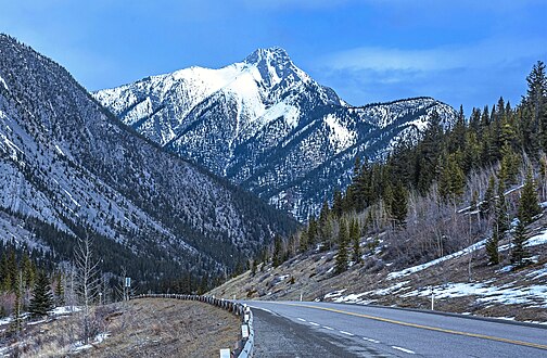 Mary Barclays Mountain from Highway 40


Places adjacent to Mary Barclay's Mountain | ||||||||||||||||
|---|---|---|---|---|---|---|---|---|---|---|---|---|---|---|---|---|
| ||||||||||||||||
Другой контент может иметь иную лицензию. Перед использованием материалов сайта WikiSort.org внимательно изучите правила лицензирования конкретных элементов наполнения сайта.
WikiSort.org - проект по пересортировке и дополнению контента Википедии