geo.wikisort.org - Mountains
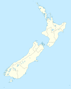
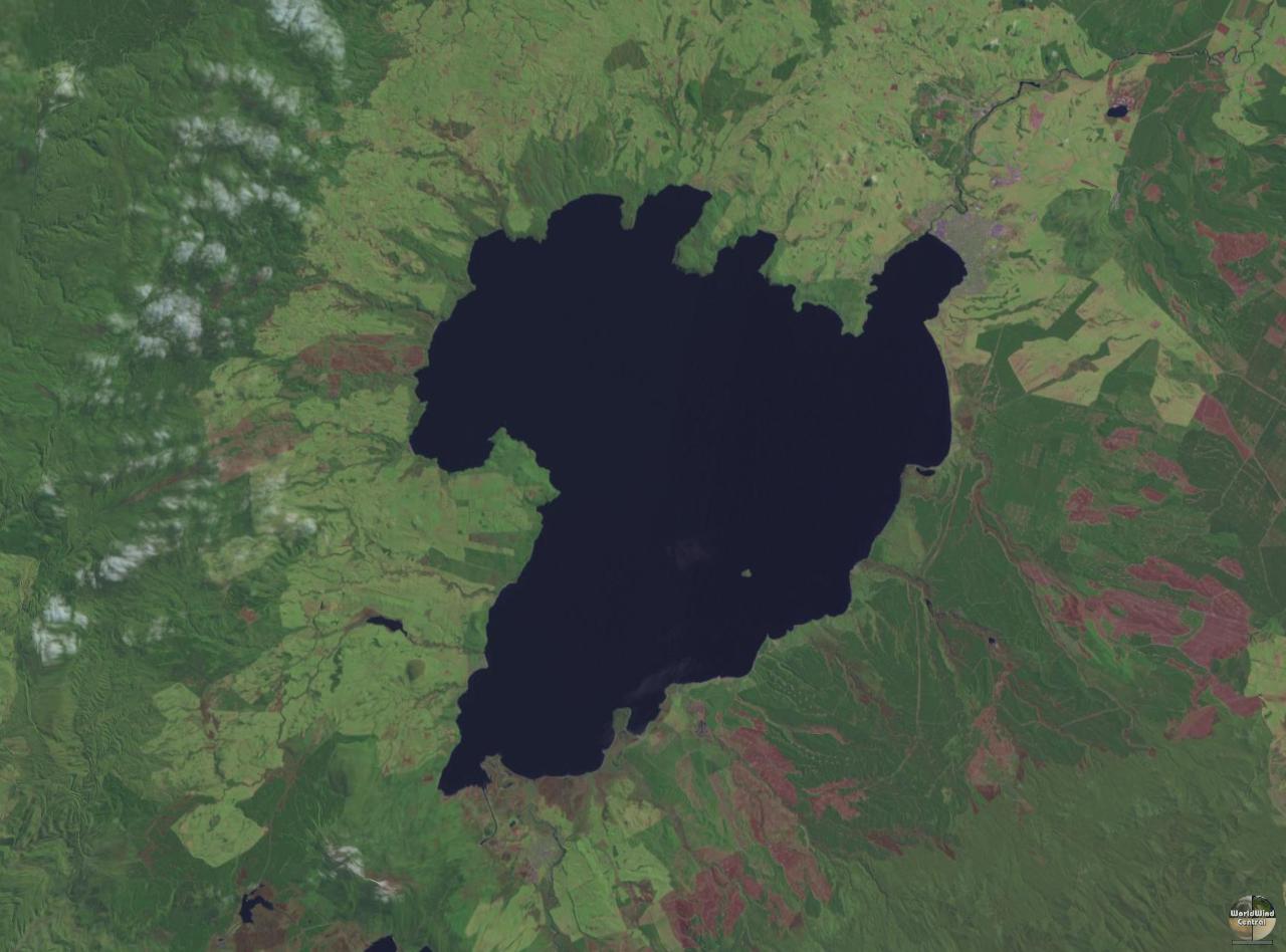
Lake Taupō (also spelled Taupo; Māori: Taupō-nui-a-Tia or Taupōmoana) is a large crater lake in New Zealand's North Island, located in the caldera of the Taupō Volcano. The lake is the namesake of the town of Taupō, which sits on a bay in the lake's northeastern shore. With a surface area of 616 km2 (238 sq mi), it is the largest lake by surface area in New Zealand, and the second largest freshwater lake by surface area in geopolitical Oceania after Lake Murray in Papua New Guinea. Motutaiko Island lies in the southeastern area of the lake.
| Lake Taupō | |
|---|---|
| Lake Taupo | |
 | |
 Lake Taupō  Lake Taupō | |
| Location | Taupō District, Waikato region, North Island |
| Coordinates | 38°48′25″S 175°54′28″E |
| Type | Crater lake, oligotrophic |
| Native name |
|
| Etymology | From Taupō-nui-a-Tia, Māori for "great cloak of Tia" |
| Primary inflows | Waitahanui River, Tongariro River, Tauranga Taupō River |
| Primary outflows | Waikato River |
| Catchment area | 3,487 km2 (1,346 sq mi) |
| Basin countries | New Zealand |
| Max. length | 46 km (29 mi) |
| Max. width | 33 km (21 mi) |
| Surface area | 616 km2 (238 sq mi) |
| Average depth | 110 m (360 ft) |
| Max. depth | 186 m (610 ft) |
| Water volume | 59 km3 (14 cu mi) |
| Residence time | 10.5 years |
| Shore length1 | 193 km (120 mi) |
| Surface elevation | 356 m (1,168 ft)[1] |
| Islands | Motutaiko Island (11 ha)[2][3] |
| 1 Shore length is not a well-defined measure. | |
Lake Taupō has a perimeter of approximately 193 km (120 mi) and a maximum depth of 186 m (610 ft). It is drained by the Waikato River (New Zealand's longest river), and its main tributaries are the Waitahanui River, the Tongariro River, and the Tauranga Taupō River. It is a noted trout fishery with stocks of introduced brown and rainbow trout.
The level of the lake is controlled by Mercury Energy, the owner of the eight hydroelectric dams on the Waikato River downstream of Lake Taupō, using gates built in 1940–41. The gates are used to reduce flooding, conserve water and ensure a minimum flow of 50 m3/s (1,800 cu ft/s) in the Waikato River. The resource consent allows the level of the lake to be varied between 355.85 and 357.25 metres (1,167.5 and 1,172.1 ft) above sea level.[4]
Lake formation and volcanism
Lake Taupō is in a caldera created mainly by a supervolcanic eruption which occurred approximately 25,600 years ago.[5] According to geological records, the volcano has erupted 29 times in the last 30,000 years.[6] It has ejected mostly rhyolitic lava, although Mount Tauhara formed from dacitic lava.
Taupō has been active for 300,000 years with a very large event known as the Oruanui eruption occurring approximately 25,600 years ago.[5] It was the world's largest known eruption over the past 70,000 years, ejecting 1170 cubic kilometres of material and causing several hundred square kilometres of surrounding land to collapse and form the caldera. The caldera later filled with water to form Lake Taupō, eventually overflowing to cause a huge outburst flood.[7]
Several later eruptions occurred over the millennia before the most recent major eruption, which was traditionally dated as about 181 CE from Greenland ice-core records. Tree ring data from two studies suggests a later date of 232 CE ± 5[8] and this is now accepted.[9] Known as the Hatepe eruption, it is believed to have ejected 100 cubic kilometres of material, of which 30 cubic kilometres was ejected in a few minutes. This was one of the most violent eruptions in the last 5000 years (alongside the Minoan eruption in the 2nd millennium BCE, the Tianchi eruption of Baekdu around 1000 CE and the 1815 eruption of Tambora), with a Volcanic Explosivity Index rating of 7; and there appears to be a correlation, to within a few years, of a year in which the sky was red over Rome and China. The eruption devastated much of the North Island and further expanded the lake. The area was uninhabited by humans at the time of the eruption, as New Zealand was not settled by Māori until about 1280. Possible climatic effects of the eruption would have been concentrated on the Southern Hemisphere due to the southerly position of Lake Taupō.[10] Taupō's last known eruption occurred around 30 years later, with lava dome extrusion forming the Horomatangi Reefs, but that eruption was much smaller than the Hatepe eruption.
Underwater hydrothermal activity continues near the Horomatangi vent,[11] and nearby geothermal fields with associated hot springs are found north and south of the lake, for example at Rotokawa and Tūrangi. These springs are the site of occurrence of certain extremophile micro-organisms, that are capable of surviving in extremely hot environments.[12]
The volcano is currently considered to be dormant rather than extinct because of moderate fumarole activity and hot springs along the shores of the lake.
Biota
Much of the watershed of Lake Taupō is a beech and podocarp forest with associate understory ferns being Blechnum filiforme, Asplenium flaccidum, Doodia media, Hymenophyllum demissum, Microsorum pustulatum and Dendroconche scandens, and some prominent associate shrubs being Olearia rani and Alseuosmia quercifolia.[13]
Native faunal species in the lake include northern kōura or crayfish (Paranephrops planifrons) and kōkopu or whitebait (Galaxias species). The lake is noted for stocks of brown trout (Salmo trutta) and rainbow trout (Oncorhynchus mykiss), introduced from Europe and California respectively in the late nineteenth century. There has also been a subsequent introduction of smelt (Retropinnidae species) as a food for the trout.
A community of sponges and associated invertebrates live around the underwater geothermal vents.[11]
Tourism


Tourism is a major component of Taupō's commercial sector. The busiest time for the industry is the high summer season around Christmas and New Year.
The lake area has a temperate climate. Daily maximum temperatures recorded for Taupō range from an average of 23.3 °C in January and February to 11.2 °C in July,[14] while the nighttime minimum temperatures range from 11.6 °C in February down to 2.2 °C in July.[15] Rain falls in all seasons but is greatest in winter and spring, from June to December.[16]
Taupō hosts the Lake Taupo Cycle Challenge, a cycling tour around the lake which can take anywhere between four and ten hours. Skydiving is a popular local sport and tourist attraction. Taupō also hosts the Kellogg's Ironman event.
Crossing the 40.2 km length of the lake is a challenge for open-water swimmers. In 2020, Michael Wells from Darwin, Australia, was the first to breaststroke across the lake.[17]
Māori rock carving
On the north-west side of Lake Taupō on the cliffs of Mine Bay, there are Māori rock carvings created in the late 1970s by Matahi Whakataka-Brightwell and John Randall. Carved in the likeness of Ngātoro-i-rangi, a navigator who guided the Tūwharetoa and Te Arawa tribes to the Taupō area over a thousand years ago according to Māori legend.[18] The 10-metre-high carving is intended to protect Lake Taupō from volcanic activities underneath. The cliff has become a popular tourist destination with hundreds of boats and yachts visiting the spot yearly.
Māori tribes
Lake Taupō is a taonga (treasure or something special to the person) of Ngāti Tūwharetoa from the Te Arawa waka. Ngāti Tūwharetoa owns the bed of the lake and its tributaries. They grant the public free access for recreational use.[19]
See also
- List of lakes in New Zealand
- Taupō Volcanic Zone
References
- "Lake levels". Te Tari Taiwhenua | Department of Internal Affairs. Retrieved 14 January 2020.
- "Motutaiko Island: Current Nga Whenua Rahui and Matauranga Kura Taiao projects". Department of Conservation. Archived from the original on 4 March 2014.
- Cussen, Laurence (1887). "Notes on the Physiography and Geology of the King Country". Transactions of the Royal Society of New Zealand. 20: 317–332. See Lake Taupō, pp 328–331
- Opus International Consultants Limited (27 February 2009). "Lake Level History" (PDF).
- Dunbar, Nelia W.; Iverson, Nels A.; Van Eaton, Alexa R.; Sigl, Michael; Alloway, Brent V.; Kurbatov, Andrei V.; Mastin, Larry G.; McConnell, Joseph R.; Wilson, Colin J. N. (25 September 2017). "New Zealand supereruption provides time marker for the Last Glacial Maximum in Antarctica". Scientific Reports. 7: 12238. doi:10.1038/s41598-017-11758-0. PMID 28947829. Retrieved 13 February 2022.
- "GeoNet volcano data underpins new research of Taupō volcano". Geonet NZ. Retrieved 13 February 2022.
- Manville, Vern; Wilson, Colin J. N.]] (2004). "The 26.5 ka Oruanui eruption, New Zealand: a review of the roles of volcanism and climate in the post-eruptive sedimentary response". New Zealand Journal of Geology & Geophysics. 47 (3): 525–547. doi:10.1080/00288306.2004.9515074.
- Hogg, A.; Lowe, D.J.; Palmer, J.; Boswijk, G.; Ramsey, C.B. (2011). "Revised calendar date for the Taupo eruption derived by 14C wiggle-matching using a New Zealand kauri 14C calibration data set". The Holocene. 22 (4): 439–449. Bibcode:2012Holoc..22..439H. doi:10.1177/0959683611425551. hdl:10289/5936. S2CID 129928745.
- Illsley-Kemp, Finnigan; Barker, Simon J.; Wilson, Colin J. N.; Chamberlain, Calum J.; Hreinsdóttir, Sigrún; Ellis, Susan; Hamling, Ian J.; Savage, Martha K.; Mestel, Eleanor R. H.; Wadsworth, Fabian B. (1 June 2021). "Volcanic Unrest at Taupō Volcano in 2019: Causes, Mechanisms and Implications". Geochemistry, Geophysics, Geosystems. 22 (6): 1–27. doi:10.1029/2021GC009803.
- Climate, History and the Modern World, Lamb, H. (1995), Routledge
- de Ronde, C. E. J.; Stoffers, P.; Garbe-Schönberg, D.; Christenson, B. W.; Jones, B.; Manconi, R.; Browne, P. R. L.; Hissmann, K.; Botz, R.; Davy, B. W.; Schmitt, M.; Battershill, C. N. (2002). "Discovery of active hydrothermal venting in Lake Taupo, New Zealand". Journal of Volcanology and Geothermal Research. 115 (3–4): 257–275. Bibcode:2002JVGR..115..257D. doi:10.1016/S0377-0273(01)00332-8.
- C.Michael Hogan. 2010. Extremophile. eds. E.Monosson and C.Cleveland. Encyclopedia of Earth. National Council for Science and the Environment, Washington DC
- C. Michael Hogan. 2009. Crown Fern: Blechnum discolor, Globaltwitcher.com, ed. N. Stromberg Archived 13 February 2012 at the Wayback Machine
- "Mean Daily Maximum Temperatures". NIWA. Archived from the original on 19 January 2012. Retrieved 1 September 2011.
- "Mean Daily Minimum Temperatures". NIWA. Archived from the original on 19 January 2012. Retrieved 1 September 2011.
- "Mean Monthly Rainfall". NIWA. Archived from the original on 19 January 2012. Retrieved 1 September 2011.
- Byrne, Conor (19 January 2020). "'Exhaustion, exposure, hypothermia' all possible in Lake Taupo record swim". ABC News. Retrieved 27 February 2020.
- "Maori Rock Carvings Lake Taupo".
- "New deed of settlement for Lake Taupo" (Press release).
Further reading
- Ben G. Mason; David M. Pyle; Clive Oppenheimer (2004). "The size and frequency of the largest explosive eruptions on Earth". Bulletin of Volcanology. 66 (8): 735–748. Bibcode:2004BVol...66..735M. doi:10.1007/s00445-004-0355-9. S2CID 129680497.
- "Taupo". Global Volcanism Program. Smithsonian Institution. Retrieved 1 January 2009.
External links
- Great Lake Taupō Official Visitor Information Website
- Tūrangi and Lake Taupō Website
- Lake Taupō Webcam
- Lake Taupō at the Waikato Regional Council
- Lake Taupō area at the Department of Conservation
Authority control | |
|---|---|
| General |
|
| National libraries | |
На других языках
[de] Lake Taupo
Der Lake Taupo (Māori: Taupo nui a Tia) in Neuseeland ist der Kratersee eines vor rund 26.500 Jahren kollabierten Vulkans und der größte See des Landes.[1]- [en] Lake Taupō
[es] Lago Taupo
El lago Taupo (en māori: Taupō-nui-a-Tia o Taupōmoana) es el más extenso de Nueva Zelanda. Se encuentra situado a 356 metros de altura en la zona central de la isla Norte. Tiene una profundidad máxima de 186 metros y se alimenta de las aguas de los ríos Waitahanui, Tongariro y Tauranga Taupo, y su principal desagüe es el río Waikato. La fauna nativa del lago incluye la trucha marrón, trucha arcoíris y la Anguilla australis. También es una importante zona turística.[fr] Lac Taupo
Le lac Taupo est un lac de la région de Waikato dans l'île du Nord de la Nouvelle-Zélande.[it] Lago Taupo
Il lago Taupo è un lago di origine vulcanica situato nell'Isola del Nord in Nuova Zelanda. Con una superficie di 616 chilometri quadrati è il più grande lago per superficie del paese, e il più grande lago d'acqua dolce dell'intera Oceania.[ru] Таупо (озеро)
Та́упо[1][5] (англ. Taupo[2], маори Taupomoana[6]) — озеро в кальдере одноимённого вулкана на Северном острове Новой Зеландии. На северо-восточном берегу озера располагается город с одноименным названием. Крупнейший остров озера носит название Мотутаико[1]. Из озера вытекает крупнейшая река страны Уаикато[1][5]. Всего в озеро впадает около 30 рек. Наиболее глубокая точка находится к востоку от центральной части озера[4].Другой контент может иметь иную лицензию. Перед использованием материалов сайта WikiSort.org внимательно изучите правила лицензирования конкретных элементов наполнения сайта.
WikiSort.org - проект по пересортировке и дополнению контента Википедии