geo.wikisort.org - Reservoir
Lake Kimihia is located approximately 5 km to the Northeast of Huntly, in the Waikato Region of New Zealand. Lake Kimihia is a riverine lake, which links to the Waikato River.[1]
| Lake Kimihia | |
|---|---|
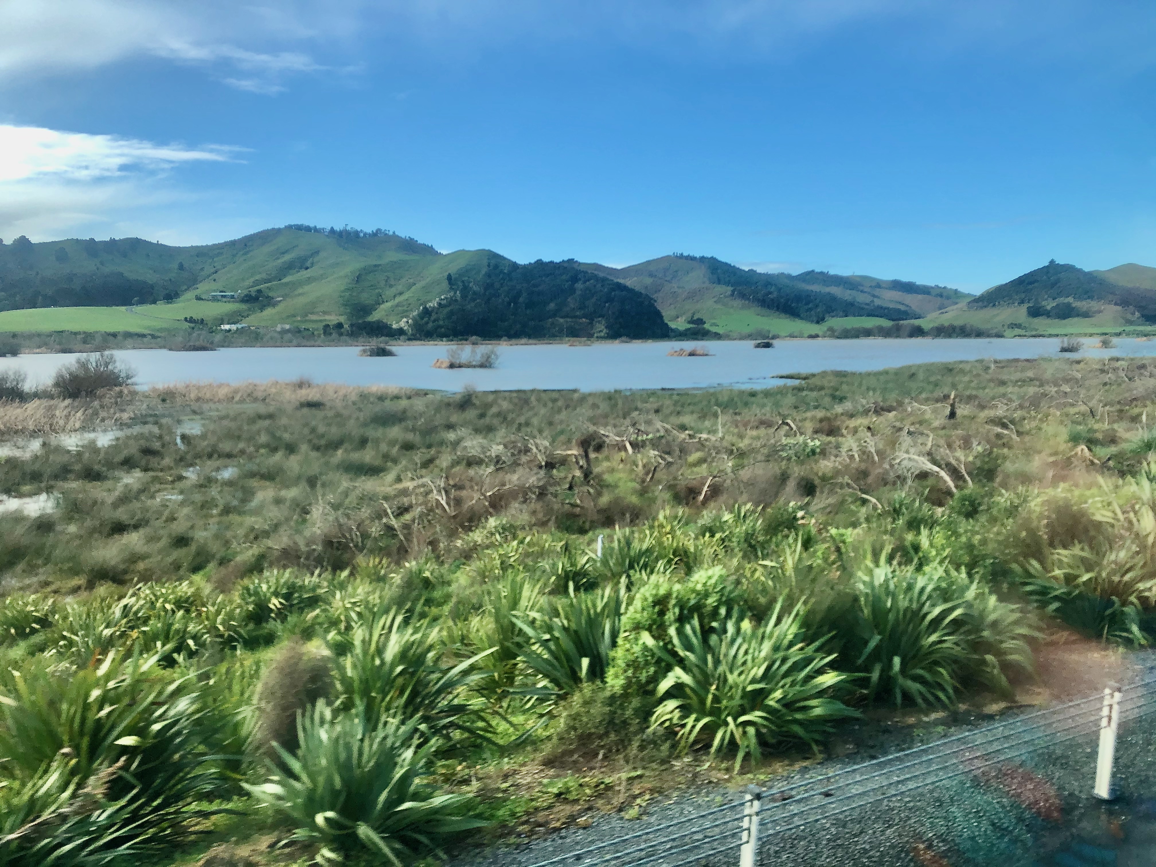 Lake Kimihia from Waikato Expressway in 2021 | |
 Lake Kimihia | |
| Location | North Island |
| Coordinates | 37°31′30″S 175°11′30″E |
| Type | riverine lake |
| Catchment area | 1,485 ha (3,670 acres) |
| Basin countries | New Zealand |
| Max. length | 1.1 km (0.68 mi) |
| Max. width | 0.4 km (0.25 mi) |
| Surface area | 0.55 km2 (140 acres) |
| Average depth | 3.3 m (11 ft) |
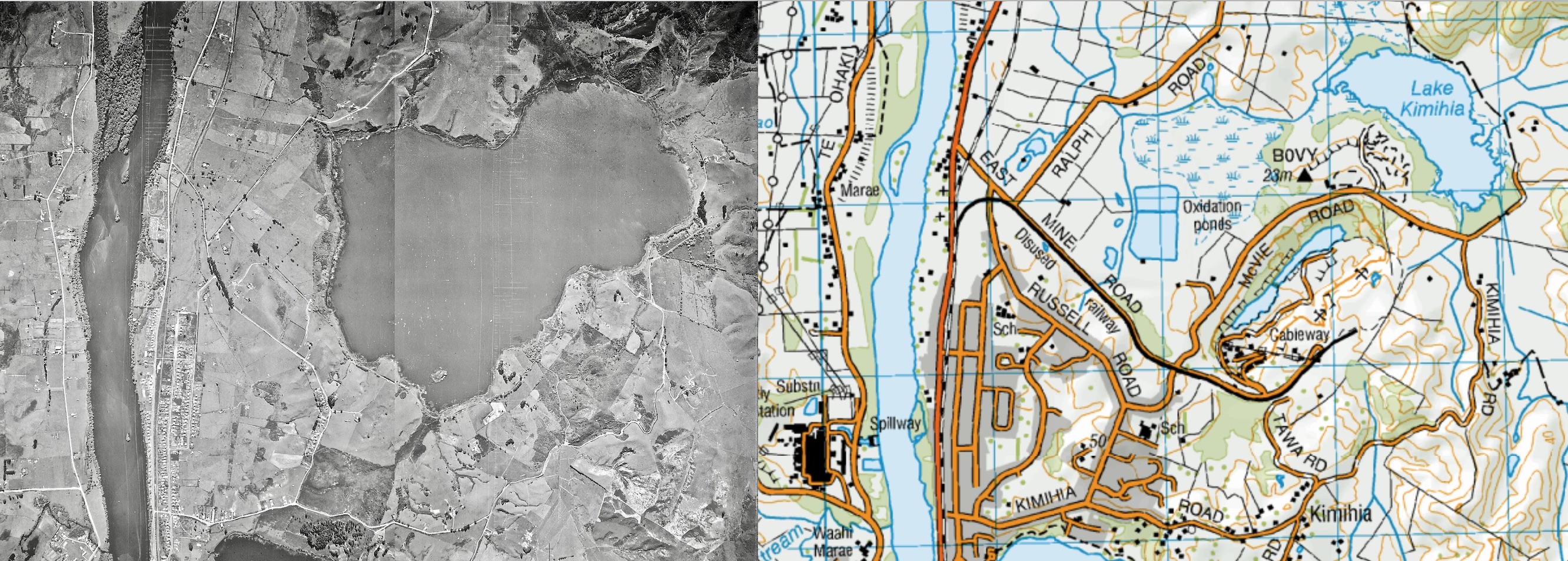
Lake Kimihia was significantly modified as a result of open cast coal mining, around the early 1940s.[2] A cofferdam was built to allow mining over most of the bed, by reducing the lake from its previous 318 ha (790 acres).[3] In the 1960s there were two lakes,[4] but the westerly one has been replaced by a wetland.[5]
The lake is situated within predominantly pastoral land. An area at the southern end of the lake is being developed into a wetland,[6] as the Huntly bypass of the Waikato Expressway is built across part of the former lakebed.[7]
References
- "Riverine Lakes". Waikato Regional Council.
- "Waikato region shallow lakes management plan: Volume 2". Waikato Regional Council. Retrieved 25 December 2018.
- "Kimihia Mine, Huntly, Waikato District, Waikato Region, North Island, New Zealand". www.mindat.org. Retrieved 3 February 2019.
- "Sheet 56 One inch to One mile map". www.mapspast.org.nz. 1 January 1965. Retrieved 4 February 2019.
- "Sheet 56 1989 One inch to One mile map". www.mapspast.org.nz. Retrieved 3 February 2019.
- Lines-MacKenzie, J., "NZ Transport Agency developing Huntly wetland," stuff.co.nz 25 February 2018. retrieved 26 December 2018.
- "Lake Kimihia - Building four lanes over a reclaimed lake" (PDF).
External links
- Waikato River lower lakes, Te Ara: The Encyclopedia of New Zealand
This Waikato geography article is a stub. You can help Wikipedia by expanding it. |
Другой контент может иметь иную лицензию. Перед использованием материалов сайта WikiSort.org внимательно изучите правила лицензирования конкретных элементов наполнения сайта.
WikiSort.org - проект по пересортировке и дополнению контента Википедии