geo.wikisort.org - Mountains
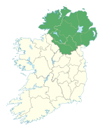
Donald's Hill (Irish: Cnoc Dhónaill) is a hill in County Londonderry, Northern Ireland. The summit reaches 399 metres above sea level and classifies as a Marilyn. Located at the edge of the Sperrin Mountains, the village of Drumsurn sits at the foot of the hill.
This article needs additional citations for verification. (March 2020) |
| Donald's Hill | |
|---|---|
| Cnoc Dhónaill | |
 | |
| Highest point | |
| Elevation | 399 m (1,309 ft) |
| Listing | Marilyn |
| Geography | |
| Location | Drumsurn, Londonderry, Northern Ireland |
| OSI/OSNI grid | C758178 |
The Ordnance Survey Memoirs of 1834 records an alternative name of Knocknahurkle, which is believed to be derived from Irish Cnoc na hEarcola.[1]
An ignimbrite formation can be found at the western edge of the plateau with approximately 30 kilometres of outcrop between Donald's Hill and Magherafelt.
Donald's Hill lies on the route of the North Sperrins Way section of the Ulster Way long distance walking circuit.
References
Links
Текст в блоке "Читать" взят с сайта "Википедия" и доступен по лицензии Creative Commons Attribution-ShareAlike; в отдельных случаях могут действовать дополнительные условия.
Другой контент может иметь иную лицензию. Перед использованием материалов сайта WikiSort.org внимательно изучите правила лицензирования конкретных элементов наполнения сайта.
Другой контент может иметь иную лицензию. Перед использованием материалов сайта WikiSort.org внимательно изучите правила лицензирования конкретных элементов наполнения сайта.
2019-2025
WikiSort.org - проект по пересортировке и дополнению контента Википедии
WikiSort.org - проект по пересортировке и дополнению контента Википедии

