geo.wikisort.org - Island
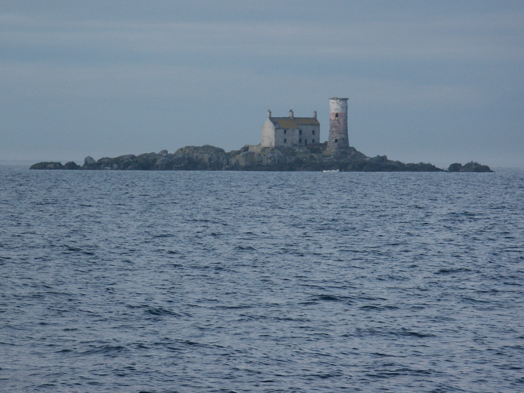
The Maidens (Irish: Na Maighdeanacha[1]) or Hulin Rocks (Irish: Na Faoilinn, meaning 'the seagulls[2]') are two islets and several skerries in the North Channel off County Antrim in Northern Ireland. The Eastern Maiden or Southern Rock lies about 9 km from the coast at Ballygalley,[3] or 13 miles from Larne.[4] The West Maiden or Northern Rock is about half a mile further out.[4][5] Lighthouses were built on both rocks; the West Maiden was abandoned in 1903 and the East Maiden was automated in 1977.[5]
Geology
The Maidens is an example of an olivine-dolerite sill, one of many similar intrusions along the Antrim coast. They were formed during the Paleogene and Neogene periods (66 million to 2.6 million years ago), a period of intense volcanic activity in Northern Ireland. The Giant's Causeway, also from this time period, was created by volcanic eruption. At the Maidens, magma was forced underground through layers of weakness, but never reached the surface. It cooled more slowly, solidifying and leaving a hard rock, relatively resistant to weathering compared to the strata around it and so forming the islands left today. Other examples of nearby sills are Fair Head, the Portrush sill which forms Ramore Head and the Skerries, and the Knocksoghey Sill near Ballintoy, part of which forms Sheep Island.[6]
See also
- Geology of Northern Ireland
References
- "The Maidens or Hulin Rocks". logainm.ie. Dublin: Placenames Branch, Department of Culture, Heritage and the Gaeltacht. Retrieved 6 June 2020.
- McKay, Patrick (1999). A dictionary of Ulster place-names. Institute of Irish Studies, Queen's University of Belfast. p. 104. ISBN 978-0-85389-742-2.
- Walsh, David (31 July 2004). Oileain: A Guide to the Irish Islands. Pesda Press. pp. 20–21. ISBN 978-0-9531956-9-5. Retrieved 16 October 2010.
- Dillon, Jim (1996). "Memoirs of a Lighthouse Keeper". The Beam. Commissioners of Irish Lights. 26.
- Rowlett, Russ. "Lighthouses of Northern Ireland". The Lighthouse Directory. University of North Carolina at Chapel Hill. Retrieved 16 October 2010.
- Wilson, H. E. (1972). Regional Geology of Northern Ireland. HMSO. p. 77.
Geology of Northern Ireland | ||
|---|---|---|
| Volcanism |  | |
| Volcanic plugs |
| |
| Dykes and Sills |
| |
| Metamorphic | ||
| Sedimentary |
| |
| Lists |
| |
На других языках
- [en] The Maidens
[fr] The Maidens
The Maidens (Irlandais: Na Maighdeanacha ou Rocks Hulin) sont composées de deux îlots et plusieurs récifs situés dans le canal du Nord au large du comté d'Antrim de l'Irlande du Nord. L'Eastern Maiden ou Southern Rock se trouve à environ 9 km de la côte ; West Maiden est à environ 800 mètres plus loin.Другой контент может иметь иную лицензию. Перед использованием материалов сайта WikiSort.org внимательно изучите правила лицензирования конкретных элементов наполнения сайта.
WikiSort.org - проект по пересортировке и дополнению контента Википедии