 The Adirondack Mountains of Upstate New York form the southernmost zone in the Eastern forest-boreal transition ecoregion of North America.
 The hydrologic source of the Hudson River is near or at Lake Tear of the Clouds, a small tarn in the Adironacks, photo circa 19th-century.
 Lake George, one of numerous oligotrophic lakes in the Adirondack region, is nicknamed the Queen of American Lakes.
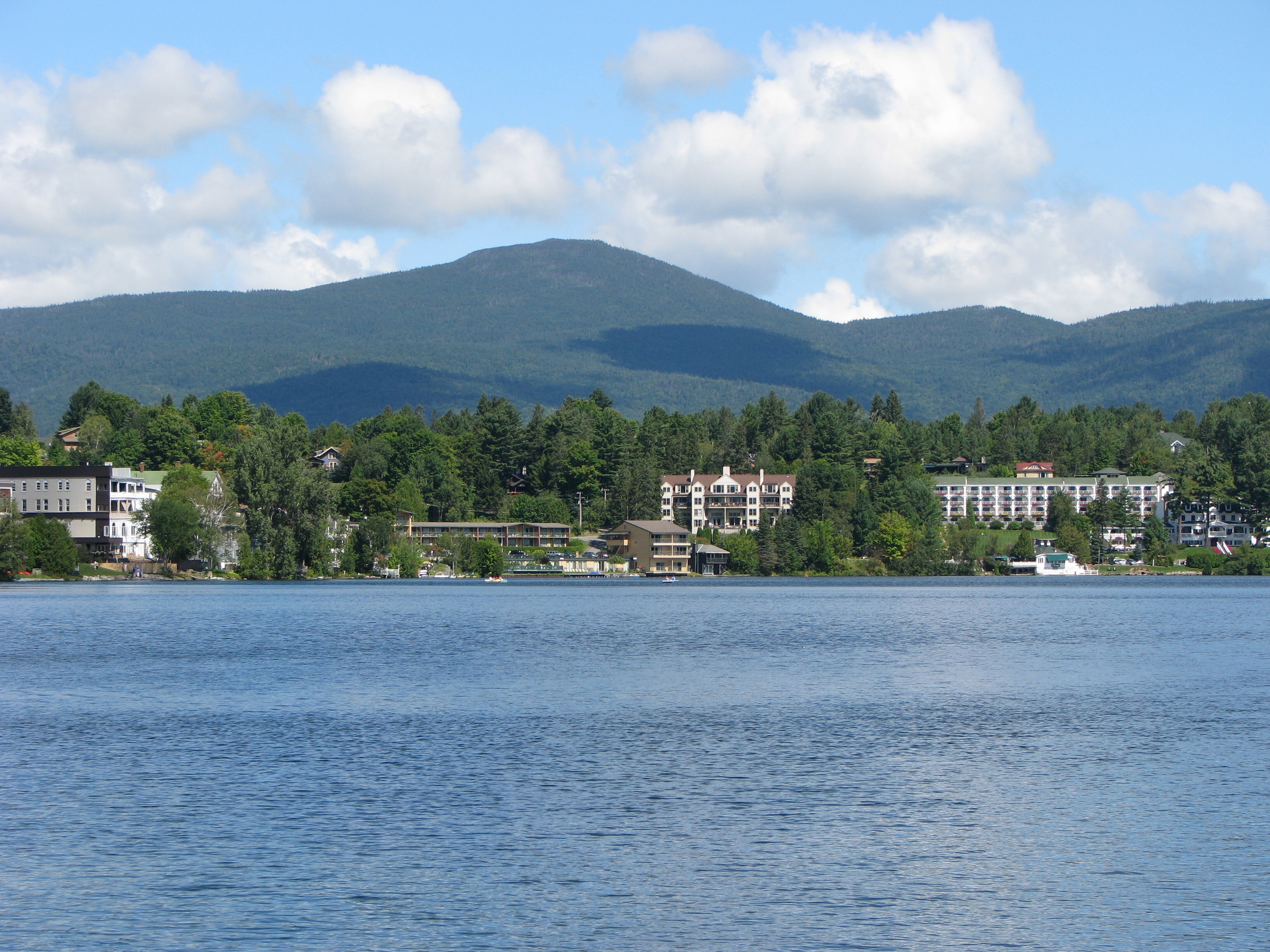
 Mirror Lake in the Village of Lake Placid in the Adirondacks, site of the 1932 and the 1980 Winter Olympics.
 Lake Flower in the Village of Saranac Lake, nicknamed the Capital of the Adirondacks.
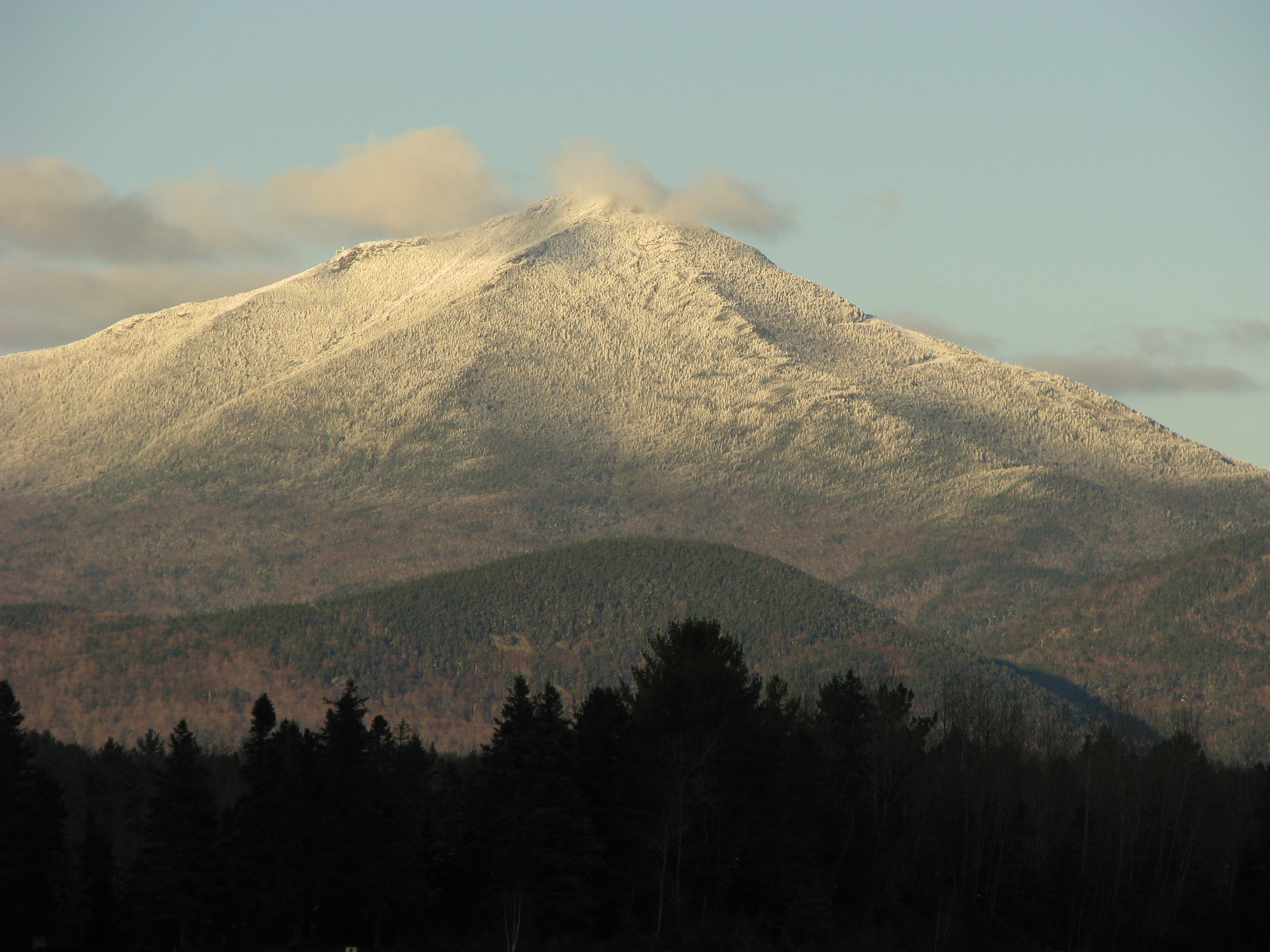
 The Adirondack High Peaks region.
geo.wikisort.org - Mountains
The Adirondack Mountains (/ædɪˈrɒndæk/) form a massif in northeastern New York with boundaries that correspond roughly to those of Adirondack Park. They cover about 5,000 square miles (13,000 km2).[1] The mountains form a roughly circular dome, about 160 miles (260 km) in diameter and about 1 mile (1,600 m) high. The current relief owes much to glaciation. There are more than 200 lakes around the mountains, including Lake George, Lake Placid, and Lake Tear of the Clouds, which is the source of the Hudson River.[1] The Adirondack Region is also home to hundreds of mountain summits, with some reaching heights of 5,000 feet (1,500 meters) or more.
| Adirondack Mountains | |
|---|---|
 The Adirondack Mountains from Whiteface Mountain | |
| Highest point | |
| Peak | Mount Marcy |
| Elevation | 1,629 m (5,344 ft) |
| Listing |
|
| Coordinates | 44°06′45″N 73°55′26″W |
| Geography | |
 A map of the main mountainous regions of the northeastern United States. The Adirondacks are a part of the Canadian Shield range having much different origins from the surrounding Appalachian Chain.
| |
| Country | United States |
| State | New York |
| Geology | |
| Orogeny | Grenville Orogeny |
| Age of rock | Tonian |
Etymology
The word Adirondack is thought to come from the Mohawk word ha-de-ron-dah meaning "eaters of trees". The earliest written use of the name was in 1635 by Harmen Meyndertsz Van Den Bogaert in his Mohawk to Dutch glossary, found in his Journey into Mohawk Country. He spelled it Adirondakx and said that it stood for Frenchmen, meaning the Algonquians who allied with the French.[2] Another early use of the name, spelled Rontaks, was in 1729 by French missionary Joseph-François Lafitau. He explained that the word was used by the Iroquois as a derogatory term for groups of Algonquians who did not practice agriculture and therefore sometimes had to eat tree bark to survive harsh winters.[3]
The Mohawks had no written language, so Europeans used various phonetic spellings of the word, including Achkokx, Rondaxe, and Adirondax.[3] Such words were strongly associated with the region, but they were not yet considered a place name; an English map from 1761 labels the area simply Deer Hunting Country. In 1837, the mountains were named Adirondacks by Ebenezer Emmons.[4]
Human history
Humans have lived in the region of the Adirondack Mountains since the Paleo-Indian period (15,000 to 7,000 BC), shortly after the last ice age. The first group to move into the area came south from the St. Lawrence River Valley and settled along the shores of the Champlain Sea around 13,000 BC.[5] These Archaic period people, known as the Laurentian culture, were semi-nomadic hunter-gatherers. Evidence for their presence in the Adirondacks includes a projectile point of red-brown chert found in 2007 at the edge of Tupper Lake.[5]
Over the next 11,000 or so years, the region's climate slowly warmed, and forests began to replace the original tundra.[5] Transitioning from the Archaic Period to the Woodland period, multiple different cultures— Sylvan Lake, River, Middlesex, Point Peninsula, and Owasco cultures— replaced the Laurentian culture over time.[6] By the time of the Owasco culture, around 0 AD, maize and beans were being cultivated in the Adirondack uplands.[5]
The first Iroquoian peoples, the Mohawk (or Kanyengehaga) and the Oneida (or Oneyotdehaga), arrived in the Adirondack region between 4,000 and 1,200 years ago. Both groups claimed the Adirondack Mountains as hunting grounds. According to Haudenosaunee historian Rick Hill, the region was considered a 'Dish with One Spoon,' symbolizing shared hunting resources between the groups. A group of Algonquian people, known as the Mahicans, also occupied the region, particularly the Hudson River Valley.[6]
These were the groups that the first European explorers of the area encountered. European presence in the area began with a battle between Samuel de Champlain and a group of Mohawks, in what is now Ticonderoga in 1609. The Jesuit missionary Isaac Jogues became the first recorded European to travel through the center of the Adirondacks, as the captive of a Mohawk hunting party, in 1642.[7]
The early European perception of the Adirondacks was of a vast, inhospitable wilderness. One map of the area from 1771 shows the region as a blank space in the northeastern corner of New York. In 1784, Thomas Pownhall wrote that the Native Americans referred to the area as "the Dismal Wilderness, or the Habitation of Winter," and that the area was "either not much known to them, or, if known, very wisely by them kept from the Knowledge of the Europeans."[8] He clearly had the impression that native people did not live within the Adirondack mountains.[5]
Because local Iroquoian and Algonquian tribes had been decimated first by smallpox and measles in the 1600s, then by wars with encroaching European settlers, there likely were very few people living in the region by the time Pownhall wrote his description. It is only relatively recently that numerous archaeological finds have definitively shown that Native Americans were indeed very present in the Adirondacks before European contact, hunting, making pottery, and practicing agriculture.[5]
The European impression of a wild region devoid of human connection set up a narrative about wilderness that would persist through the next 200-some years of the region's history. While society's perception of the Adirondacks' value changed, they were always seen as a land of natural resources and physical beauty, not of human history.[5] First the area was an inhospitable tangle, then a lucrative store of lumber.[8] After the American Revolutionary War, New York State gained ownership of most of the land in the region.[9]
Needing money to discharge war debts, the government sold nearly all the original public acreage about 7 million acres for pennies an acre. Lumbermen were welcomed to the interior, with few restraints, resulting in massive deforestation.[9] Later, the wilderness character of the region became popular with the rise of the Romantic movement, and the Adirondacks became a destination for those wishing to escape the evils of city life. Rising concern over water quality and deforestation led to the creation of the Adirondack Park in 1885.[8] In 1989, part of the Adirondack region was designated by UNESCO as the Champlain-Adirondack Biosphere Reserve.[10]
For the more recent human history of the Adirondack region, see the page Adirondack Park.
Geology
The rocks of the Adirondack mountains originated about two billion years ago as 50,000 feet (ca. 15,240 m) thick sediments at the bottom of a sea located near the equator.[11] Because of plate tectonics these collided with Laurentia (the precursor of modern North America) in a mountain building episode known as the Grenville orogeny. During this time the sedimentary rock was changed into metamorphic rock. It is these Proterozoic minerals and lithologies that make up the core of the massif. Minerals of interest include:
- wollastonite, mined near Harrisville
- magnetite and hematite, formerly mined at the Benson Mines,[12] Lyon Mountain, Mineville, Tahawus, and Witherbee.
- graphite, mined near Hague and Ticonderoga.
- garnet, mined at the Barton Mine, north of Gore Mountain.
- anorthosite, visible in road cuts on the New York State Route 3 between Saranac Lake and Tupper Lake.[13]
- marble
- zinc: The Balmat-Edwards district on the northwest flank of the massif also in St. Lawrence County was a major zinc ore deposit
- titanium was mined at Tahawus.
Note: the Adirondacks are uplifted by a hot spot in the Canadian Shield in contrast to other mountain ranges in New York which are a part of the Appalachian chain (not to be confused with the cultural region of Appalachia).[14]
Around 600 million years ago, as Laurentia drifted away from Baltica (European Craton), the area began to be pulled apart forming the Iapetus Ocean. Faults developed, running north to northeast which formed valleys and deep lakes. Examples visible today include the grabens Lake George and Schroon Lake. By this time the Grenville mountains had been eroded away and the area was covered by a shallow sea. Several thousand feet of sediment accumulated on the sea bed. Trilobites were the principal life-form of the sea bed, and fossil tracks can be seen in the Potsdam sandstone floor of the Paul Smiths Visitor Interpretive Center.[13]
About 10 million years ago, the region began to be uplifted. It has been lifted about 7000 feet (ca. 2,134 meters) and is continuing at about 2 millimeters per year, which is greater than the rate of denudation. The cause of the uplift is unknown, but geologists theorize that it is caused by a hot spot in the earth's crust.[13] A recent study has revealed a column of seismically slow materials about 50–80 km deep beneath the Adirondack Mountains,[15] which was interpreted to be the upwelling asthenosphere contributing to the uplift of the mountains. The occurrence of earthquake swarms near the center of the massif at Blue Mountain Lake may be evidence of this. Some of the earthquakes have exceeded 5 on the Richter magnitude scale.
Starting about 2.5 million years ago, a cycle of Pleistocene glacial and interglacial periods began which covered the area in ice. During the most recent episode, the Laurentide Ice Sheet covered most of northern North America between about 95,000 and c. 20,000 years ago.[16] After this the climate warmed, but it took nearly 10,000 years for a 10,000 feet (ca. 3,048 m) thick layer of ice to completely melt. Evidence of this period includes:
- Eskers: the Rainbow Lake esker bisects the eponymous lake and extends discontinuously for 85 miles (ca. 137 km). Another long discontinuous esker extends from Mountain Pond through Keese Mill, passing between Upper St. Regis Lake and the Spectacle Ponds, and continuing to Ochre, Fish, and Lydia Ponds in the St. Regis Canoe Area. A 150-foot-high esker bisects the Five Ponds Wilderness Area.[17]
- Glacial erratics: there is a large one at the Newcomb Visitor Information Center next to the Rich Lake Trail.
- Kames
- Moraines
- The cirques that characterize the Whiteface Mountain.
- Outwash plains: St. Regis Canoe Area is an outwash plain pitted with kettle holes.
Soils in the area are generally thin, sandy, acidic, and infertile, having developed since the glacial retreat.
Climate
The climate is strongly continental, with high humidity and precipitation year-round. The Adirondacks typically experience pleasantly warm, rainy weather in the summer (June-August), with temperatures in the range of 66–73 °F (19–23 °C), cooler than the rest of New York State due to the higher elevation. Summer evenings in the Adirondacks are chilly, with temperatures ranging on average between 45–54 °F (7–12 °C). Winters (December-March) are long, cold, snowy and harsh, with temperatures ranging from 18 to 23 °F (−8 to −5 °C). Winter nights are frigid, with temperatures between −2 and 4 °F (−19 and −16 °C).[18] Spring (April-May) and fall (September-November) are short transitional seasons.
| Climate data for Lake Placid, NY. Elevation: 2,054 ft (626 m) | |||||||||||||
|---|---|---|---|---|---|---|---|---|---|---|---|---|---|
| Month | Jan | Feb | Mar | Apr | May | Jun | Jul | Aug | Sep | Oct | Nov | Dec | Year |
| Average high °F (°C) | 23.4 (−4.8) |
24.6 (−4.1) |
30.7 (−0.7) |
44.8 (7.1) |
60.5 (15.8) |
67.9 (19.9) |
71.6 (22.0) |
70.6 (21.4) |
63.7 (17.6) |
50.3 (10.2) |
40.1 (4.5) |
30.6 (−0.8) |
50.3 (10.2) |
| Daily mean °F (°C) | 17.5 (−8.1) |
20.6 (−6.3) |
25.0 (−3.9) |
38.4 (3.6) |
49.9 (9.9) |
58.4 (14.7) |
62.3 (16.8) |
61.3 (16.3) |
54.7 (12.6) |
44.1 (6.7) |
34.5 (1.4) |
23.4 (−4.8) |
41.4 (5.2) |
| Average low °F (°C) | 2.9 (−16.2) |
3.7 (−15.7) |
15.9 (−8.9) |
27.9 (−2.3) |
38.9 (3.8) |
48.9 (9.4) |
52.9 (11.6) |
52.0 (11.1) |
44.7 (7.1) |
32.6 (0.3) |
24.7 (−4.1) |
13.9 (−10.1) |
32.4 (0.2) |
| Average precipitation inches (mm) | 4.56 (116) |
3.98 (101) |
5.31 (135) |
5.40 (137) |
5.59 (142) |
5.79 (147) |
6.13 (156) |
5.29 (134) |
6.22 (158) |
6.97 (177) |
5.83 (148) |
5.22 (133) |
66.29 (1,684) |
| Average relative humidity (%) | 71.1 | 66.2 | 62.4 | 60.1 | 63.8 | 70.4 | 70.8 | 72.8 | 73.0 | 70.7 | 69.9 | 72.0 | 68.6 |
| Average dew point °F (°C) | 10.7 (−11.8) |
11.1 (−11.6) |
16.8 (−8.4) |
26.5 (−3.1) |
38.3 (3.5) |
48.8 (9.3) |
52.7 (11.5) |
52.5 (11.4) |
46.2 (7.9) |
35.2 (1.8) |
25.7 (−3.5) |
15.7 (−9.1) |
31.7 (−0.2) |
| Source: PRISM Climate Group[19] | |||||||||||||
Ecology

The Adirondack Mountains form the southernmost part of the Eastern forest-boreal transition ecoregion.[20] They are heavily forested, and contain one of the southernmost distributions of the taiga ecotype in North America. The forests of the Adirondacks include spruce, pine and deciduous trees. Lumbering, once an important industry, has been much restricted by the creation of state forest preserve.[21]
The mountains include many wetlands, of which there are three kinds:[13]
- swamps, any wetland including trees and shrubs.
- marshes, wetlands with water stagnation. These may support bullfrogs, spring peepers, spotted salamanders, great blue herons, American bitterns, and painted turtles. Pickerel weed often forms large colonies.
- bogs, characterized by plants like sphagnum moss, orchids, and pitcher plants.
Breeding birds include northern forest specialists not found anywhere else in the state, such as boreal chickadees, Canada jays, spruce grouse, black-backed woodpeckers, common loons and crossbills.[22] Mammals include raccoons, beavers, river otters, bobcats, moose, black bears, and coyotes. Extirpated or extinct mammals that formerly roamed the Adirondacks include the eastern cougar, eastern elk, wolverine, caribou, eastern wolf, and the Canada lynx.[23] Attempted reintroductions of elk and lynx in the 20th century failed for numerous reasons, including poaching, vehicle collisions, and conservation incompetence.[24][25]
Nearly 60 percent of the park is covered with northern hardwood forest. Above 2600 feet (~792 meters), conditions are too poor for hardwoods to thrive, and the trees become mixed with or replaced by balsam fir and red spruce. Above 3500 feet (~1,067 meters) black spruce replace red. Higher still, only trees short enough to be covered in snow during the winter can survive.
Only a tiny fraction of the area above the tree line is classified as having an alpine climate.
Scenes from the Adirondacks


References
- The Young people's encyclopedia of the United States. Shapiro, William E. Brookfield, Conn.: Millbrook Press. 1993. ISBN 1-56294-514-9. OCLC 30932823.
{{cite book}}: CS1 maint: others (link) - Journey Into Mohawk Country, 1635, Harmen Meyndertsz Van Den Bogaert
- Sulavik, Stephen B. (2007). Adirondack : of Indians and mountains, 1535–1838. Fleischmanns, N.Y.: Purple Mountain Press. pp. 21–51. ISBN 978-1930098794.
- Cherniak, D. J. "Ebenezer Emmons (1799–1863)". Rensselaer Polytechnic Institute. Archived from the original on May 27, 2012. Retrieved June 23, 2015.
- Stager, Curt (May 2017). "Hidden Heritage" (PDF). Adirondack Life. Retrieved 30 October 2019.
- "Adirondacks: Native Americans". National Park Service. 2019. Retrieved 30 October 2019.
- Sulavik, Stephen B. (2007). Adirondack : of Indians and mountains, 1535–1838. Fleischmanns, N.Y.: Purple Mountain Press. pp. 21–51. ISBN 978-1930098794.
- Terrie, Philip (1999). Contested Terrain. Syracuse: Syracuse University Press.
- "History of the Adirondack Park". New York State Adirondack Park Agency. Retrieved June 23, 2015.
- "UNESCO – MAB Biosphere Reserves Directory". www.unesco.org. Retrieved 2016-05-21.
- "Ancient 'bones' of the Adirondacks". NCPR. Retrieved 2020-11-30.
- Ridge, J. D. (1968). Ore Deposits of the United States, 1933–1967. New York: The American Institute of Mining, Metallurgical, and Petroleum Engineers, Inc.
- Storey, Mike (2006). Why the Adirondacks look the way they do : a natural history (2 ed.). [S.l.]: Storey. p. 22. ISBN 978-0-9777172-0-0.
- "Convergent Plate Boundaries—Collisional Mountain Ranges - Geology (U.S. National Park Service)". www.nps.gov. Retrieved 2020-12-01.
- Yang, Xiaotao; Gao, Haiying (June 6, 2018). "Full-Wave Seismic Tomography in the Northeastern United States: New Insights Into the Uplift Mechanism of the Adirondack Mountains". Geophysical Research Letters. 45 (12): 5992–6000. Bibcode:2018GeoRL..45.5992Y. doi:10.1029/2018GL078438.
- Dyke, A. S.; Prest, V. K. (1987). "Late Wisconsinan and Holocene History of the Laurentide Ice Sheet". Géographie Physique et Quaternaire. 41 (2): 237–263. doi:10.7202/032681ar.
- "Sea Serpents in the Adirondacks? You Bet!". Adirondack Almanack. 7 November 2009. Retrieved 2015-07-30.
- "Climate of New York", Wikipedia, 2020-02-05, retrieved 2020-02-29
- "PRISM Climate Group, Oregon State University". www.prism.oregonstate.edu. Retrieved July 9, 2019.
- Olson; D. M.; E. Dinerstein; et al. (2001), "Terrestrial Ecoregions of the World: A New Map of Life on Earth", BioScience, 51 (11): 933–938, doi:10.1641/0006-3568(2001)051[0933:TEOTWA]2.0.CO;2.
- Chisholm, Hugh, ed. (1911). . Encyclopædia Britannica. Vol. 1 (11th ed.). Cambridge University Press. p. 193.
- "Breeding Bird 2000-2005 Atlas". www.dec.ny.gov. New York State Department of Environmental Conservation.
- "Facts About Coyotes In The Adirondacks". Adirondack.net.
- Omohundro, John; Harris, Glenn R. (2012). An environmental history of New York's north country : the Adirondack Mountains and the St. Lawrence River Valley : case studies and neglected topics (1 ed.). Lewiston, New York: Edwin Mellen Press. pp. 99–111. ISBN 978-0773426283.
- "Canada Lynx - NYS Dept. of Environmental Conservation". www.dec.ny.gov. Retrieved 2021-07-03.
External links
![]() Media related to Adirondack Mountains at Wikimedia Commons
Media related to Adirondack Mountains at Wikimedia Commons
Authority control | |
|---|---|
| General | |
| National libraries | |
| Other | |
На других языках
[de] Adirondack Mountains
Die Adirondack Mountains oder Adirondacks[2] sind ein Gebirge im nordöstlichen Teil des US-Bundesstaates New York. Es bildet einen Teil der Wasserscheide zwischen Sankt-Lorenz-Strom und Hudson River und bildet eine größere geologische Einheit mit den Laurentinischen Bergen, nördlich des Sankt-Lorenz-Strom. Geographisch werden die Adirondacks häufig den Appalachen zugerechnet.[3]- [en] Adirondack Mountains
[es] Montañas Adirondack
Las montañas [de] Adirondack (en inglés, Adirondack Mountains, /ædᵻˈrɒndæk/) son un macizo montañoso de los Estados Unidos localizadas en el noreste del estado de Nueva York. Sus límites corresponden aproximadamente con los límites del actual Parque Adirondack. Comprenden una superficie de unos 13 000 km², entre montañas, tierras boscosas, colinas redondas, valles en forma de "U" y lagos..[1] Las montañas forman una cúpula más o menos circular, de aproximadamente 260 km de diámetro y aproximadamente 1600 m de altura. El relieve actual debe mucho a la acción de la glaciación. Hay más de 200 lagos alrededor de las montañas, como los lagos George, Placid y Lago Tear of the Clouds, que es la fuente del río Hudson.[1] La región de las Adirondack también alberga cientos de cumbres montañosas, algunas de las cuales alcanzan alturas de 5000 pies o más.[fr] Adirondacks
Les monts Adirondacks sont un massif cristallin dans le nord-est de l'État de New York. Situés dans le prolongement des montagnes Appalaches, ils sont pourtant géologiquement constitués des mêmes roches que les monts Laurentides du Canada. Ils sont bordés à l'est par le lac Champlain et le lac George, qui les séparent des montagnes Vertes (Vermont). La limite sud est constituée par la vallée de la Mohawk. Au-delà de la rivière Noire, on trouve à l'ouest le plateau de Tug Hill, et au nord le fleuve Saint-Laurent. Les Adirondacks représentent un cinquième de la superficie de l'État de New York et comptent 4 000 cours d'eau[1].[it] Monti Adirondack
I monti Adirondack sono un massiccio cristallino che attraversa lo stato di New York (44° 7' N; 73° 55' W); in particolare, fanno parte delle contee di Clinton, Essex, Franklin, Hamilton, Herkimer, Lewis e Warren.[ru] Адирондак
Адиро́ндак[2] (англ. Adirondack Mountains, Adirondacks) — горный хребет на северо-востоке штата Нью-Йорк. Иногда включается в горную систему Аппалачей, хотя имеет другое геологическое происхождение.Текст в блоке "Читать" взят с сайта "Википедия" и доступен по лицензии Creative Commons Attribution-ShareAlike; в отдельных случаях могут действовать дополнительные условия.
Другой контент может иметь иную лицензию. Перед использованием материалов сайта WikiSort.org внимательно изучите правила лицензирования конкретных элементов наполнения сайта.
Другой контент может иметь иную лицензию. Перед использованием материалов сайта WikiSort.org внимательно изучите правила лицензирования конкретных элементов наполнения сайта.
2019-2026
WikiSort.org - проект по пересортировке и дополнению контента Википедии
WikiSort.org - проект по пересортировке и дополнению контента Википедии