geo.wikisort.org - Mountains
Whiteface Mountain is the fifth-highest mountain in the U.S. state of New York, and one of the High Peaks of the Adirondack Mountains. Set apart from most of the other High Peaks, the summit offers a 360-degree view of the Adirondacks and clear-day glimpses of Vermont and even Canada, where the skyscrapers of Montreal, 80 miles (130 km) away, can be seen on a very clear day. Located in the town of Wilmington, about 13 miles (21 km) from Lake Placid, the mountain's east slope is home to a major ski area with the greatest vertical drop east of the Rockies,[1] which hosted the alpine skiing competitions of the 1980 Winter Olympics. Unique among the High Peaks, Whiteface features a developed summit and seasonal accessibility by motor vehicle. Whiteface Memorial Highway reaches a parking area at an elevation of 4,600 feet (1,400 m), with the remaining 267 feet (81 m) being obtained by tunnel and elevator.
| Whiteface Mountain | |
|---|---|
 Whiteface Mountain | |
| Highest point | |
| Elevation | 4,867 ft (1,483 m) |
| Prominence | 3,110 ft (950 m) |
| Listing | #5 Adirondack High Peaks |
| Coordinates | 44°21′57″N 73°54′10″W |
| Geography | |
 Whiteface Mountain Location of Whiteface, northeast of Lake Placid  Whiteface Mountain Whiteface Mountain (the United States) | |
| Location | Wilmington, New York, U.S. |
| Parent range | Adirondacks |
| Topo map | USGS Lake Placid |
| Climbing | |
| Easiest route | road |
Conceived and initiated prior to the Great Depression, Whiteface Castle and the Whiteface Mountain Veterans Memorial Highway were funded entirely by the state of New York, though the timing of the project led to a widespread belief that they were Depression-era public works projects arising from the New Deal.[2] Construction on the toll road began in 1929, after passage of a necessary amendment to the state constitution, with a groundbreaking ceremony featuring then-New York State Governor Franklin D. Roosevelt. Eventually costing 1.2 million dollars (18 million in 2020 dollars[3]) and ending vertically within 300 feet (90 m) of the summit the roadway is 5 miles (8 km) long and features an impressively steep 8% average grade. Officially opened July 20, 1935, in a ceremony featuring Roosevelt, by then President, the highway was dedicated to veterans of the Great War. The Highway is usually open to vehicles from May to October.
Whiteface Castle, built with granite excavated during the road construction, dominates the summit area. From the adjacent parking lot there are two routes to the summit proper. The first route is the Stairway Ridge Trail, a footpath with handrails and intermittent cement and stone steps approximately 0.2 miles (0.32 km) long. The second is a 424-foot (129 m) long tunnel into the core of the mountain. At the end of the tunnel is an elevator, which rises 276 feet (84 m), approximately 27 stories, to the summit.
Whiteface Mountain Ski Area
| Whiteface Mountain Ski Area | |
|---|---|
 | |
| Location | Wilmington, New York, U.S. |
| Nearest major city | Lake Placid - 13 miles (21 km) |
| Coordinates | 44°21′57″N 73°54′10″W |
| Vertical | 3,166 ft (965 m) (lift-served) 3,430 ft (1,045 m) |
| Top elevation | 4,386 ft (1,337 m) (lift-served) 4,650 ft (1,417 m) |
| Base elevation | 1,220 ft (372 m) |
| Skiable area | 314 acres (127 ha) |
| Runs | 87 total |
| Lift system | 1 gondola 9 chairlifts 1 conveyor lift |
| Terrain parks | 7 |
| Snowfall | 190 in (480 cm)[4] |
| Snowmaking | yes |
| Night skiing | no |
| Website | Whiteface.com |
Whiteface was part of the post-World War II growth in recreational skiing attributed to the efforts of returning veterans of the U.S. Army's 10th Mountain Division. It is a major ski area, run by the Olympic Regional Development Authority. Known for its big-mountain skiing, Whiteface is consistently ranked as one of the top ski resorts in the Northeast. It was a prime venue of the 1980 Winter Olympics, hosting all six of the alpine ski events.[5] Whiteface regularly hosts major alpine ski events, such as the US Alpine Skiing Championships, most recently in 2010, and is a U.S. Olympic Training Site.
Whiteface's ski area boasts 90 trails stretching over 25 miles and encompassing three peaks.[6] Whiteface's highest lift unloads at 4,386 feet (1,337 m), a vertical drop of 3,166 ft (965 m) to the base area at 1,220 ft (372 m). Its hike-to terrain, The Slides, is 264 ft (80 m) higher at 4,650 ft (1,417 m), providing Whiteface with the greatest continuous vertical drop in eastern North America at 3,430 feet (1,045 m). Its neighbor, Little Whiteface, tops in elevation at 3,676 ft (1,120 m). Whiteface has a total of 22 miles (35 km) of ski terrain, spread out over 88 trails. 314 acres (127 ha) of skiing area includes 35 in-bounds, off-piste double-black diamond wilderness terrain skiing on "The Slides" (conditions permitting), 85.5 acres (34.6 ha) of tree skiing, 35 acres (14 ha) of expert extreme adventure terrain. The Slides is an unmaintained wilderness area that is rarely open due to safety hazards. They can only be accessed by hiking from the top of the Summit Quad. Whiteface has a separate area for beginners known as Bear Den Mountain (formerly Kids Kampus).
In recent years there have been major improvements in snowmaking and grooming. Whiteface contains 90 trails accessible by one gondola, nine chairlifts, and one conveyor lift. Some 98% of the trails are covered by snowmaking, excluding the glades and the Slides. The Slides are double-black diamond runs that are usually only open at the end of the skiing season due to avalanche danger. They are between 35 and 40 degrees with high natural hazards (such as waterfalls, rocks, cliffs, trees, and variable conditions) vertically for over 1,250 feet (381 m). The Slides are considered[by whom?] to be one of the most challenging[further explanation needed] ski slopes that are marked on a trail map in the Northeast.[7]
In summer, Whiteface Mountain offers gondola rides and mountain biking.
History
In July 1909, a fire lookout was established on the mountain, but no tower was built due to unobstructed views due to lack of tree cover. The original lookout was a pole frame structure with a canvas tent stretched over it for the observer to get out of the weather. The shelter was later improved to a stone hut. In 1919, a 22-foot-tall (6.7 m) steel Aermotor tower was built on the mountain. In 1930, along with the construction of the memorial highway, a 46-foot-tall (14 m) memorial tower with a 60 inches (150 cm) revolving light to honor the Veterans of the World War. It was later proposed through legislative process, that the tower be built of stone and be 70-foot-tall (21 m). The legislation was vetoed by Governor Lehman. After the completion of the memorial highway, a dispute arose over whether the Conservation Department or the State Highway Department would have control over the fire lookout tower. In June 1935, Governor Lehman intervened and ruled in favor of the Conservation Department. In 1937, the state completed the improvements on the mountaintop which included the Summit House along with the tunnel and elevator. Due to increased use of aerial fire detection, the tower was closed at the end of the 1970 fire lookout season. On May 23, 1972, the fire tower was removed and was one of the first of many towers to be removed from Adirondack Mountains. New York State Forest Rangers and Operations personnel dismantled the tower and marked the pieces for possible future use. The tower's historical sign remained on the mountain for an additional year. The sign was then removed and donated along with the tower to the Adirondack Museum at Blue Mountain Lake.[8]
Climate
Whiteface Mountain has a subarctic climate (Dfc) according to the Köppen climate classification, with severely cold, snowy winters and cool to mild wet summers. The average snowfall at Whiteface Mountain averages 190 inches per year plus 99% of the mountain trails are serviced by snowmaking. During the 2016-2017 season Whiteface boasted a record-breaking 281 inches of natural snowfall.[9] The wind chill temperature at Whiteface Mountain has hit below -100 degrees F several times. For example, in February 2016, Whiteface Mountain hit a wind chill temperature of -114 degrees F, which compared to Antarctica, the record low temperature was -129 degrees F, making Whiteface Mountain in NY one of the coldest places on earth. [10] Similarly, the wind chill temperature reached as low as -110 degrees F on February 2015. [11]
| Climate data for Whiteface Mountain, New York (1937-1946 normals, extremes 1937-1946) | |||||||||||||
|---|---|---|---|---|---|---|---|---|---|---|---|---|---|
| Month | Jan | Feb | Mar | Apr | May | Jun | Jul | Aug | Sep | Oct | Nov | Dec | Year |
| Record high °F (°C) | 42 (6) |
41 (5) |
63 (17) |
69 (21) |
73 (23) |
79 (26) |
78 (26) |
78 (26) |
75 (24) |
69 (21) |
57 (14) |
52 (11) |
79 (26) |
| Average high °F (°C) | 16.3 (−8.7) |
17.8 (−7.9) |
26.3 (−3.2) |
36.3 (2.4) |
50.9 (10.5) |
59.6 (15.3) |
62.7 (17.1) |
59.9 (15.5) |
53.9 (12.2) |
42.1 (5.6) |
30.9 (−0.6) |
20.0 (−6.7) |
39.7 (4.3) |
| Daily mean °F (°C) | 7.5 (−13.6) |
8.4 (−13.1) |
17.5 (−8.1) |
28.2 (−2.1) |
42.6 (5.9) |
51.4 (10.8) |
55.3 (12.9) |
53.1 (11.7) |
46.1 (7.8) |
33.6 (0.9) |
23.5 (−4.7) |
11.4 (−11.4) |
31.6 (−0.3) |
| Average low °F (°C) | −1.8 (−18.8) |
−1.1 (−18.4) |
8.7 (−12.9) |
20.1 (−6.6) |
34.2 (1.2) |
43.2 (6.2) |
47.9 (8.8) |
46.0 (7.8) |
38.3 (3.5) |
27.1 (−2.7) |
16.0 (−8.9) |
3.0 (−16.1) |
23.5 (−4.7) |
| Record low °F (°C) | −36 (−38) |
−35 (−37) |
−35 (−37) |
−18 (−28) |
9 (−13) |
16 (−9) |
28 (−2) |
28 (−2) |
16 (−9) |
6 (−14) |
−10 (−23) |
−34 (−37) |
−36 (−38) |
| Average precipitation inches (mm) | 4.11 (104) |
3.76 (96) |
3.27 (83) |
4.26 (108) |
3.84 (98) |
3.26 (83) |
4.20 (107) |
3.56 (90) |
4.48 (114) |
3.71 (94) |
4.08 (104) |
4.27 (108) |
46.80 (1,189) |
| Average snowfall inches (cm) | 27.0 (69) |
29.7 (75) |
19.2 (49) |
11.4 (29) |
1.1 (2.8) |
0.0 (0.0) |
0.0 (0.0) |
0.0 (0.0) |
0.2 (0.51) |
10.1 (26) |
23.2 (59) |
17.8 (45) |
139.7 (355.31) |
| Source: Western Regional Climate Center[12] | |||||||||||||
Gallery
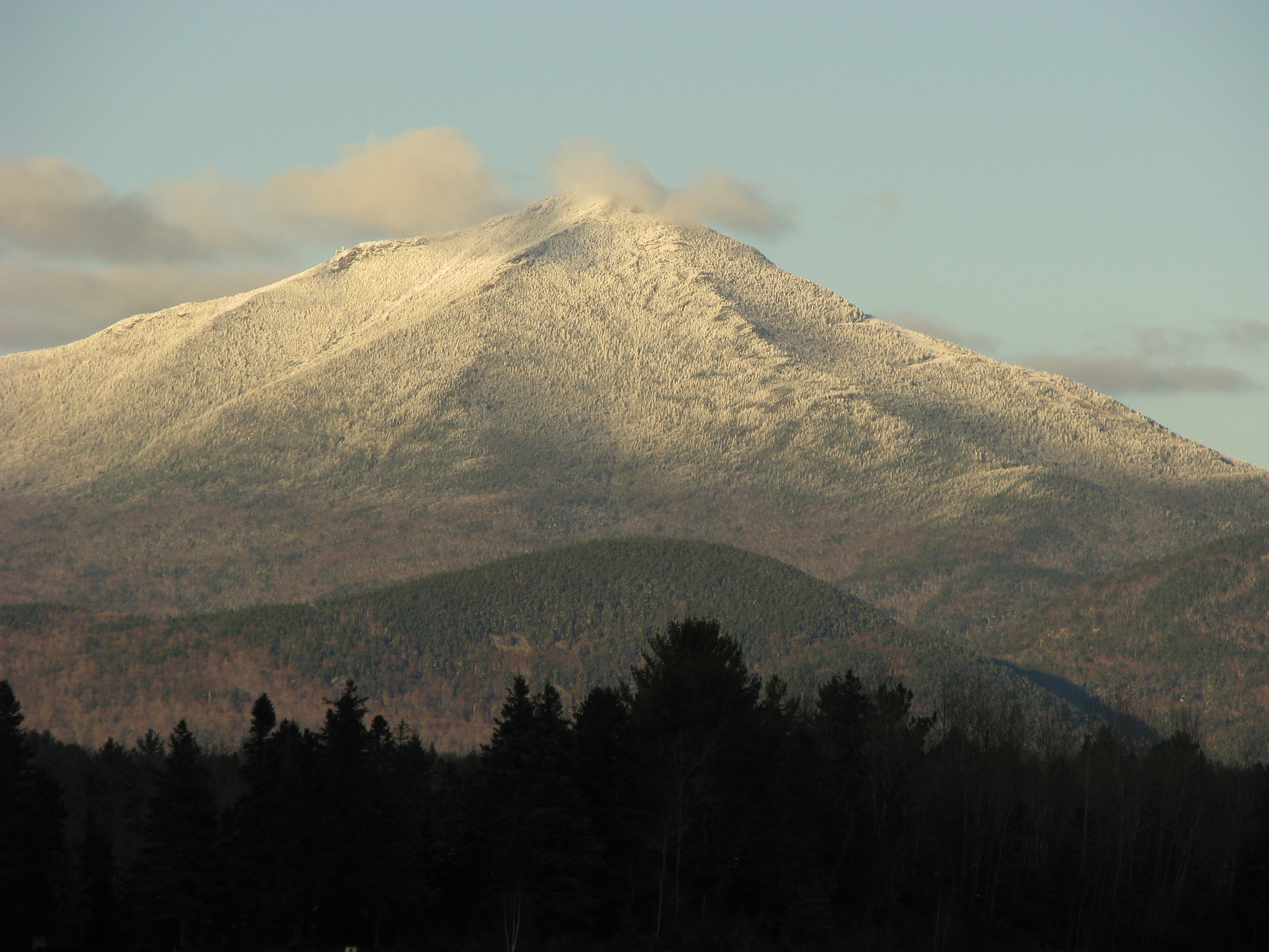
 Whiteface Mountain
 Whiteface Mountain from near Franklin Falls NY
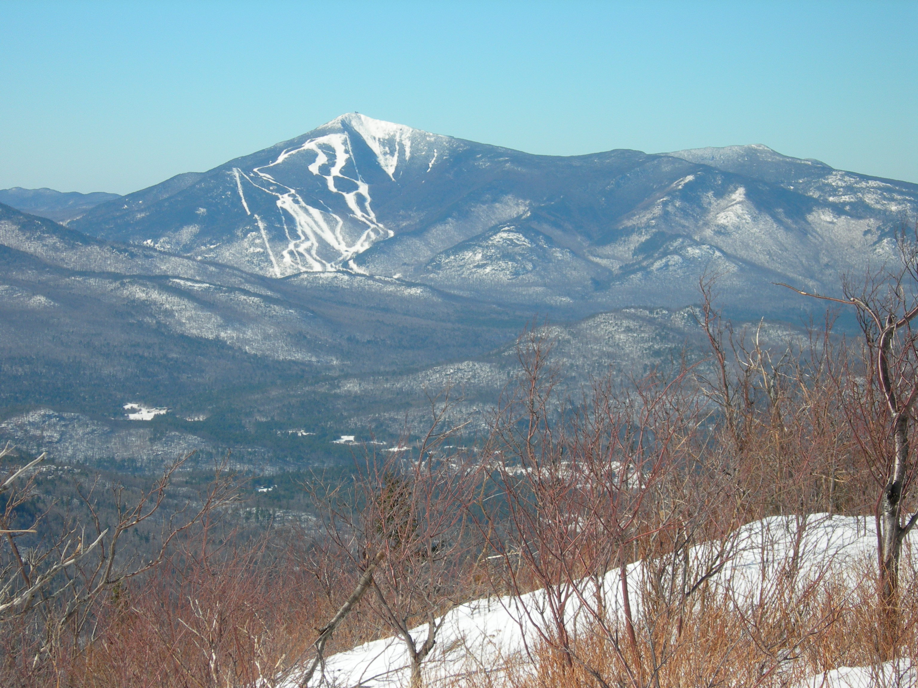
 Whiteface Mountain as seen from Esther Mountain
 View from the Cloudsplitter Gondola on the way to the summit of Little Whiteface
 A view of nearby Lake Placid from the summit of Whiteface Mountain


References
- "Interactive Trail Map - Check Open Lifts and Trails". Whiteface Mountain. Retrieved 2021-04-15.
- Plattsburgh Press-Republican, September 14, 2010, Whiteface Memorial Highway feted at 75 (full text here)
- Johnston, Louis; Williamson, Samuel H. (2022). "What Was the U.S. GDP Then?". MeasuringWorth. Retrieved February 12, 2022. United States Gross Domestic Product deflator figures follow the Measuring Worth series.
- Whiteface Stats - mountain stats
- 1980 Winter Olympics official report. Volume 1. pp. 20-8.
- "Interactive Trail Map - Check Open Lifts and Trails". Whiteface Mountain. Retrieved 2021-04-15.
- "Best Ski Towns In America". Retrieved 15 September 2015.
- "Searchable list of NY Fire Towers". nysffla.org. The New York State Chapter of the Forest Fire Lookout Association. Retrieved November 10, 2021.
- "Whiteface Mountain Ski Resort | SkiCentral.com". www.skicentral.com. Retrieved 2021-02-18.
- Nevres, M. Özgür (2016-02-15). "Whiteface Mountain (New York) hits -114 °F (-81.11 °C) wind chill at its summit". Our Planet. Retrieved 2022-09-12.
- Wheeler, Dave "Wheels" WheelerDave "Wheels". "Wind Chills Record At Whiteface Mountain Peak Reaches -110". Big Frog 104. Retrieved 2022-09-12.
- "WHITEFACE MOUNTAIN, NY". Western Regional Climate Center. Retrieved May 23, 2020.
External links
- Whiteface Mountain website
- Wilmington Historical Society Photos
- U.S. Geological Survey Geographic Names Information System: Whiteface Mountain
- Peakbagger.com: Whiteface Mountain
- Summitpost.org: Whiteface Mountain
- The History of Whiteface Mountain Ski Center
Olympic venues in alpine skiing | ||
|---|---|---|
| 1900s |
|  |
| 2000s |
| |
Authority control | |
|---|---|
| General |
|
| National libraries | |
На других языках
[de] Whiteface Mountain
Der Whiteface Mountain ist mit einer Höhe von 1483 m der fünfthöchste Berg im US-Bundesstaat New York und einer der höchsten der Adirondack Mountains.- [en] Whiteface Mountain
[fr] Whiteface Mountain
Whiteface Mountain est le cinquième plus haut sommet de l'État de New York et l'un des plus hauts sommets des Adirondacks. Cette montagne est notamment connue pour avoir abrité les épreuves de ski alpin lors des Jeux olympiques d'hiver de 1980 qui se sont déroulés à Lake Placid.[ru] Уайтфейс (Нью-Йорк)
Уайтфейс[1] (англ. Whiteface Mountain) — пятая по высоте гора в штате Нью-Йорк (США) и один из высоких пиков Адирондакских гор. Находясь в стороне от большинства других высоких пиков, вершина предлагает 360-градусный вид на Адирондак, Вермонт и даже Канаду, где небоскребы Монреаля, находящиеся на расстоянии 130 км, можно увидеть в очень ясный день. Уникальность среди высоких пиков делает развитая система на вершине и сезонная доступность проезда на автомобиле.Другой контент может иметь иную лицензию. Перед использованием материалов сайта WikiSort.org внимательно изучите правила лицензирования конкретных элементов наполнения сайта.
WikiSort.org - проект по пересортировке и дополнению контента Википедии