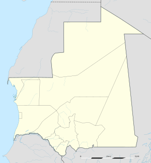
Arguin (Arabic: أرغين, Portuguese: Arguim) is an island off the western coast of Mauritania in the Bay of Arguin. It is approximately 6km ×2km (3.7mi ×1.2mi) in size, with extensive and dangerous reefs around it.[1] The island is now part of the Banc d'Arguin National Park.[2]
The island changed hands frequently during the colonial era. The first European to visit the island was the Portuguese explorer Nuno Tristão, in 1443.[3] In 1445, Prince Henry the Navigator set up a trading post on the island, which acquired gum arabic and slaves for Portugal. By 1455, 800 slaves were shipped from Arguin to Portugal every year.[4]
In 1633, during its Dutch-Portuguese War, the Netherlands seized control of Arguin. It remained under Dutch rule until 1678, with a brief interruption by English rule in 1665. France took over the island in September 1678, but it was then abandoned until 1685.[5] Arguin's aridity and its lack of a good anchorage made long-term European settlement difficult.[1]
Map of Banc d'Arguin including Arguin and Tidra Island
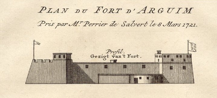
In 1685, Captain Cornelius Reers of the frigate Rother Löwe[de] occupied the old Portuguese fort on the island. He successfully concluded a treaty with the native king in which Brandenburg was accepted as a protecting power. The treaty was ratified in 1687 and was renewed in 1698.[6] Arguin remained a colony of Brandenburg until 1721 when the French successfully assaulted the fort and then took control of the island. The Dutch took the fort and island from the French the following year only to lose it again in 1724 to the French. This period of French rule lasted four years; in 1728, it reverted to the control of indigenous peoples.[5] The island was included in the territory of the French colony of Mauritania, and it remained under Mauritanian rule when that country became independent in 1960.[2]
In July 1816, the French frigate Méduse, bound for Senegal, was wrecked off Arguin and 350 people died.[1]
van der Heyden, Ulrich (1993). Rote Adler an Afrikas Küste: Die brandenburgisch-preußische Kolonie Großfriedrichsburg in Westafrika (seconded.). Berlin: Selignow. ISBN3-933889-04-9.
1 1975 is the year of East Timor's Declaration of Independence and subsequent invasion by Indonesia. In 2002, East Timor's independence was fully recognized.
3Became constituent countries of the Kingdom of the Netherlands; Suriname gained full independence in 1975, Curaçao and Dependencies was renamed to the Netherlands Antilles, which was eventually dissolved in 2010.
Другой контент может иметь иную лицензию. Перед использованием материалов сайта WikiSort.org внимательно изучите правила лицензирования конкретных элементов наполнения сайта.
2019-2026 WikiSort.org - проект по пересортировке и дополнению контента Википедии