geo.wikisort.org - Island
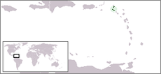
The SSS islands (Dutch: SSS-eilanden), locally also known as the Windward Islands (Bovenwindse Eilanden or Bovenwinden), is a collective term for the three territories of the Dutch Caribbean (formerly the Netherlands Antilles) that are located within the Leeward Islands group of the Lesser Antilles.[1][2][3] In order of population size, they are: Sint Maarten, Sint Eustatius and Saba. In some contexts, the term is also used to refer to the entire island of Saint Martin (which also includes the Collectivity of Saint Martin), alongside Sint Eustatius and Saba.
Windward Islands Bovenwindse Eilanden (Dutch) | |
|---|---|
 | |
| Geography | |
| Location | Leeward Islands, Caribbean Sea |
| Total islands | 3 |
| Major islands | Saint Martin Sint Eustatius Saba |
| Demographics | |
| Languages | |

The SSS islands were island territories of the Netherlands Antilles, until its dissolution in 2010. Since then, Sint Maarten is a constituent country of the Kingdom of the Netherlands, while Sint Eustatius and Saba are special municipalities of the Netherlands. "SSS" is an acronym of the islands' names, and is analogous to the ABC, CAS and BES islands, which are other commonly used subdivisions of the Dutch Caribbean.
History
The island of Saint Martin was split between France and the Netherlands in 1648.[4] The Dutch part, together with Sint Eustatius and Saba, became a single Dutch colony in 1815 as Sint Eustatius and Dependencies (Sint Eustatius en Onderhorigheden).[5] In 1828, this colony was merged with the colonies Curaçao and Dependencies (the ABC islands) and Surinam, with Paramaribo as its capital.[6] When this merger was partly reversed in 1845, the Dutch part of the SSS islands became part of Curaçao and Dependencies, with Willemstad as its capital.[7] This colony became the Netherlands Antilles in 1954.
As part of the Netherlands Antilles, the SSS islands initially formed a single island territory (eilandgebied) as the Windward Islands.[8] In 1983, it was split up into three separate island territories, with each a separate island council.[8] After the dissolution of the Netherlands Antilles on 10 October 2010, Sint Eustatius and Saba became special municipalities of the Netherlands, while Sint Maarten became an independent country within the Kingdom of the Netherlands.[9]
Composition
Political sense
| Flag | Territory | Sovereignty status | Capital | Area | Population (Jan 2019) |
Population density |
|---|---|---|---|---|---|---|
| Sint Maarten | Constituent country of the Kingdom of the Netherlands |
Philipsburg | 34 km2 (13 sq mi) | 41,486 | 1,221/km2 (3,160/sq mi) | |
| Sint Eustatius | Special municipality of the Netherlands | Oranjestad | 21 km2 (8.1 sq mi) | 3,138 | 150/km2 (390/sq mi) | |
| Saba | Special municipality of the Netherlands | The Bottom | 13 km2 (5.0 sq mi) | 1,915 | 148/km2 (380/sq mi) | |
| Total | 68 km2 (26 sq mi) | 46,539 | 684/km2 (1,770/sq mi) | |||
Geographical sense
| Map | Island | Country | Largest town | Area | Population (Jan 2019) |
Population density |
|---|---|---|---|---|---|---|
 |
Saint Martin | Lower Prince's Quarter | 87 km2 (34 sq mi) | 73,666 | 847/km2 (2,190/sq mi) | |
 |
Sint Eustatius | Oranjestad | 21 km2 (8.1 sq mi) | 3,138 | 150/km2 (390/sq mi) | |
 |
Saba | The Bottom | 13 km2 (5.0 sq mi) | 1,915 | 148/km2 (380/sq mi) | |
| Total | 121 km2 (47 sq mi) | 78,719 | 651/km2 (1,690/sq mi) | |||
See also
- Windward Islands People's Movement
References
- Ghosh, Diptarka (16 May 2021). "Netherlands Antilles". WorldAtlas. Retrieved 18 April 2022.
The islands that are situated in the Leeward Islands are Saba, Sint Eustatius, and Sint Maarten. These islands are collectively referred to as the "SSS Islands"
- "Netherlands Antilles (Windward Islands): Political Parties Material". Archives Hub. Jisc. Retrieved 18 April 2022.
With reference to the Netherlands Antilles, 'Windward Islands' (Bovenwindse Eilanden) means the north-eastern islands of Sint Maarten, Saba and Sint Eustatius, as opposed to the south-western islands of Aruba (which seceded from the Netherlands Antilles in 1986), Bonaire and Curaçao. Note that, confusingly, the Dutch 'Windward Islands' are considered to be part of the Leeward Island group, not the Windward Island group, in British English usage.
- De Freitas, J. A.; Rojer, A. C.; Nijhof, B. S. J.; Houtepen, E. A. T.; Debrot, A. O. (2020). "Landscape Ecological Vegetation Map of St. Maarten (Lesser Antilles)". Wageningen University & Research: 7.
Together with Saba and St. Eustatius, St. Maarten forms a cluster referred to as the Dutch Windward Islands (or "SSS" islands).
{{cite journal}}: Cite journal requires|journal=(help) - Van Aller 1994, p. 48
- Van Aller 1994, p. 30
- Van Aller 1994, p. 16
- Van Aller 1994, p. 32
- Van Aller 1994, p. 259
- "Dutch Antilles dissolves as two new countries created". Reuters. 10 October 2010. Retrieved 18 April 2022.
Bibliography
- Van Aller, H. B. (1994). Van kolonie tot koninkrijksdeel: de staatkundige geschiedenis van de Nederlandse Antillen en Aruba van 1634 tot 1994 (PDF) (PhD thesis) (in Dutch). Groningen, Netherlands: Wolters-Noordhoff. doi:10.26481/dis.19940908ha. ISBN 9001045901. Retrieved 18 April 2022 – via Maastricht University.
Island territories of the Netherlands Antilles | ||
|---|---|---|
| ||
На других языках
[de] SSS-Inseln
Als SSS-Inseln bezeichnet man die Gruppe der Inseln Sint Eustatius und Saba sowie Sint Maarten; letztere ist der niederländische Teil der Insel St. Martin. Die Inselgruppe gehört zu den Kleinen Antillen, unter diesen ist sie den Inseln über dem Winde zugehörig. Die SSS-Inseln sind der Niederländischen Karibik zugehörig.[1]- [en] SSS islands
[es] Islas SSS
Se conocen como Islas SSS (de norte a sur) o Islas 3S a Sint Maarten (parte neerlandesa de la Isla de San Martín), Saba y San Eustaquio; este acrónimo se desprende de las iniciales de los nombres de las tres islas que lo conforman.[fr] Îles SSS
L'appellation îles SSS ou parfois îles 3S est un sigle qui désigne les trois territoires insulaires dans les petites Antilles qui sont sous souveraineté néerlandaise :[it] Isole SSS
Per Isole SSS si intendono le tre isole, che ricadono sotto la sovranità del Regno dei Paesi Bassi, situate nell'arcipelago delle Isole Sopravento settentrionali, nelle Antille: Sint Maarten, Sint Eustatius e Saba. Tuttavia la parte settentrionale dell'isola di Saint Martin appartiene alla Francia mentre solo la parte meridionale è nazione costitutiva del regno, mentre Sint Eustatius e Saba sono due municipalità speciali dei Paesi Bassi.Другой контент может иметь иную лицензию. Перед использованием материалов сайта WikiSort.org внимательно изучите правила лицензирования конкретных элементов наполнения сайта.
WikiSort.org - проект по пересортировке и дополнению контента Википедии