geo.wikisort.org - River
The Tsipa (Russian: Ципа) is the largest tributary of the Vitim in Buryatia, Russia. It is 692 kilometres (430 mi) long, and has a drainage basin of 42,200 square kilometres (16,300 sq mi).[1] Maksim Perfilyev was the first Russian to reach the Tsipa in 1640.[2]
| Tsipa | |
|---|---|
 | |
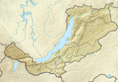 Mouth location in Buryatia, Russia | |
| Location | |
| Country | Russia |
| Physical characteristics | |
| Source | Southern Muya Range Stanovoy Highlands South Siberian System |
| • coordinates | 55°02′44″N 111°49′40″E |
| • elevation | 1,950 m (6,400 ft) |
| Mouth | Vitim |
• coordinates | 55.379°N 115.9325°E |
• elevation | 550 m (1,800 ft) |
| Length | 692 km (430 mi) |
| Basin size | 42,200 km2 (16,300 sq mi) |
| Basin features | |
| Progression | Vitim→ Lena→ Laptev Sea |
Perch, pike, lenok, grayling, taimen and whitefish are also found in the waters of the Tsipa.[3]
Course
The Tsipa is a western, left tributary of the Vitim. It has its sources in a tarn of the Southern Muya Range, in the area where this range merges with the Ikat Range. It is known as "Upper Tsipa" (Верхняя Ципа) in its upper course until its mouth in lake Baunt in the Baunt Depression in the northeastern part of the Vitim Plateau, near the Bolshoy Khapton Range. The river flows out of the lake in a NNE direction and slows down meandering across a swampy basin where there are many lakes, the largest of which is Busani. Then it turns south and crosses the Babanty Range through a narrow valley where it flows fast, forming rapids. After leaving the mountains it turns again northeast and finally it meets the Vitim about 120 km (75 mi) southeast of Taksimo.[3]
Its main tributaries are the 329 km (204 mi) long Tsipikan and the 374 km (232 mi) long Amalat from the right. There are 3,227 lakes in the Tsipa basin, with a total area of 478 km2 (185 sq mi).[3][4][1]
 |
See also
References
- "Река Ципа (Верх. Ципа, Ниж. Ципа) in the State Water Register of Russia". textual.ru (in Russian).
- Lantzeff, George V., and Richard A. Pierce (1973). Eastward to Empire: Exploration and Conquest on the Russian Open Frontier, to 1750. Montreal: McGill-Queen's U.P.
- Tsipa - Water of Russia
- Ципа / Great Soviet Encyclopedia: in 30 vols. / Ch. ed. A.M. Prokhorov. - 3rd ed. - M. Soviet Encyclopedia, 1969-1978.
This Buryatia location article is a stub. You can help Wikipedia by expanding it. |
This article related to a river in Russia is a stub. You can help Wikipedia by expanding it. |
На других языках
[de] Zipa
Die Zipa (russisch Ци́па) ist ein 692 km langer linker Nebenfluss des Witim in Ostsibirien (Russland). Im Oberlauf wird sie auch als Obere Zipa (russ. Верхняя Ципа/Werchnjaja Zipa) im Mittellauf als Untere Zipa (russ. Нижняя Ципа/Nischnjaja Zipa) bezeichnet.- [en] Tsipa
[it] Cipa (fiume)
La Cipa (in russo: Ципа?) è un fiume della Siberia Orientale, affluente di sinistra del Vitim, nel bacino della Lena. Scorre nel Bauntovskij ėvenkijskij rajon della Repubblica di Buriazia.[ru] Ципа
Ци́па (Верхняя Ципа, Ни́жняя Ци́па) — река на севере Бурятии, левый приток Витима. Течёт по территории Баунтовского эвенкийского района. Длина — 692[2] км). Площадь бассейна — 42200[2] км².Другой контент может иметь иную лицензию. Перед использованием материалов сайта WikiSort.org внимательно изучите правила лицензирования конкретных элементов наполнения сайта.
WikiSort.org - проект по пересортировке и дополнению контента Википедии