geo.wikisort.org - Mountains
The Bolshoy Khapton (Russian: Большой Хаптон) is a mountain range in Bauntovsky District, Buryatia, Russia.
| Bolshoy Khapton | |
|---|---|
 View of the Bolshoy Khapton. | |
| Highest point | |
| Peak | Mt Bolshoy Khapton |
| Elevation | 2,284 m (7,493 ft) |
| Coordinates | 55°05′25″N 112°52′25″E |
| Dimensions | |
| Length | 50 km (31 mi) NE-SW |
| Width | 10 km (6.2 mi) |
| Geography | |
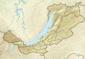 Location in Buryatia | |
| Country | Russia |
| Federal subject | Buryatia |
| Range coordinates | 55°0′N 112°43′E |
| Parent range | Vitim Plateau South Siberian System |
| Climbing | |
| Easiest route | From Bagdarin |
The nearest airport is Bagdarin Airport.[1]
Geography
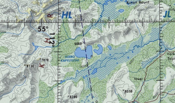
This mountain range is located in the northeastern part of the Vitim Plateau. It stretches from southwest to northeast for almost 50 km between the Kapylyushi lake group and the southern shores of Baunt lake. The Bolshoy Khapton range is part of the watershed of the Tsipikan and Upper Tsipa rivers. In its eastern section it reaches a maximum width of 10 km. The highest point of the range is 2,284 m (7,493 ft) high Mt Bolshoy Khapton.[1]
20 km (12 mi) to the south, across the Tsipikan River, rises the smaller Maly Khapton range, highest point 2,135 m (7,005 ft). It runs parallel to the Bolshoy Khapton at the southern limit of the Baunt Depression.[2]
 |
See also
References
- Google Earth
- "N-49 Chart (in Russian)". Retrieved 5 September 2021.
External links
 Media related to Bolshoy Khapton at Wikimedia Commons
This Buryatia location article is a stub. You can help Wikipedia by expanding it. |
На других языках
- [en] Bolshoy Khapton
[ru] Большой Хаптон (хребет)
Большо́й Хапто́н — горный хребет в Баунтовском эвенкийском районе Бурятии в южных пределах Баунтовской котловины.Другой контент может иметь иную лицензию. Перед использованием материалов сайта WikiSort.org внимательно изучите правила лицензирования конкретных элементов наполнения сайта.
WikiSort.org - проект по пересортировке и дополнению контента Википедии