geo.wikisort.org - Mountains
Vitim Plateau is a plateau in Buryatia and Zabaykalsky Krai, Russia. The plateau is sparsely populated, the main settlements are Romanovka and Bagdarin. An area of the plateau is an ancient volcanic field with a number of cinder cones and volcanoes, the last of which was active about 810,000 years before present.
| Vitim Plateau | |
|---|---|
| Вити́мское плоского́рье / Витимэй хадалиг газар | |
 The Vitim in its upper course flowing across the plateau | |
| Highest point | |
| Elevation | 1,846 m (6,056 ft) |
| Dimensions | |
| Length | 450 km (280 mi) |
| Width | 250 km (160 mi) |
| Area | 10,000 km2 (3,900 sq mi) |
| Geography | |
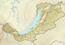 Location in Buryatia, Russia | |
| Country | Russia |
| Federal subject | Buryatia |
| Region | Transbaikalia |
| Range coordinates | 54°00′N 113°30′E |
| Parent range | South Siberian System |
| Climbing | |
| Easiest route | From Bagdarin Airport |

The P436 regional road connecting Ulan-Ude and Chita passes through Romanovka across the plateau.
Geography
The Vitim Plateau lies along the headwaters of the Vitim River, a tributary of the Lena[1] between the Southern Muya Range to the north, the Ikat Range to the west, the Yablonoi Mountains to the south,[2] and in the east with the lower reaches of the Kalakan River to the right bank of the lower reaches of the Karenga River (both Vitim tributaries) and the latter's right tributary, the Bugarikta.[3]
The Vitim River begins at the confluence of the China and Vitimkan rivers on the plateau and makes a wide bend around the volcanic zone before flowing northwards. Rivers Tsipa, Tsipikan and Amalat cut across the plateau and the Baunt Depression is located in the northwestern corner.[2]
The plateau has a surface area of 10,000 square kilometres (3,900 sq mi).[4] In it smooth, low mountain ranges such as the Bolshoy Khapton, with average heights between 1,200 metres (3,900 ft) and 1,600 metres (5,200 ft), alternate with intermontane basins. The Vitim Plateau is covered by larch taiga and forest steppe, as well as thickets of shrubby birches, meadows, and swampy areas in the river basins.[5] The volcanic field in its southwestern part has an area of 4,500 square kilometres (1,700 sq mi).[6][7] There are a number of lakes, such as Baunt, Busani, Kapylyushi, Telemba, Arakhley, Bolshoy and Maly Yeravna.[2] The area is marked by permafrost.
Volcanism
About five circular groups of volcanoes occur in the field, which is in turn subdivided into two major provinces.[1] Both central volcanoes and cinder cones occur in the volcanic field, with the largest volcanoes reaching heights of 150 metres (490 ft) and diameters of 1.5 kilometres (0.93 mi).[8]
Geology
Since the Oligocene and especially the Pliocene, the Asian Plate has been rifting apart in the Baikal Rift where the Siberian craton and a Paleozoic assembly of terranes (ancient microcontinents) form a contact zone. This rifting process is associated with volcanism in the neighbourhood of the rift zone, and this volcanism has produced about 5,000 cubic kilometres (1,200 cu mi) of volcanic rock in several volcanic fields,[9] including the Udokan Plateau and the Vitim Plateau which are the largest volcanic fields of the Baikal Rift.[10]
The reasons for the rifting process aren't well known. One theory holds that the collision between India and Asia and other tectonic processes triggered the pull-apart in the Baikal Rift. Another one postulates the existence of thermal anomalies such as a mantle plume beneath the Baikal Rift as the driving force of the rifting.[9]
The basement beneath the Baikal Rift is granitic and up to 20 kilometres (12 mi) thick. It may be of Paleozoic age. Other rocks in the region are sediments close to river valleys and Mesozoic volcanic rocks.[9]
Composition
Vitim Plateau volcanic rocks are mainly alkaline to subalkaline basalts, nephelinites and melanephelinites, with phenocryst phases containing clinopyroxene, olivine and plagioclase. Younger rocks have a tendency towards alkaline compositions.[9]
The melts that give rise to Vitim Plateau magmas appear to originate in the lithospheric mantle, starting from garnet pyroxenite and peridotite and leaving phlogopite as residual phase when starting from pyroxenite.[9] Petrology indicates that a complex magma production process takes place beneath the Vitim Plateau, including remelting and crystallization.[11]
Eruption history
Two volcanic phases have been identified in the Vitim Plateau. The first took place during the Miocene;[4] potassium-argon dating has yielded ages of 10.65 - 6.6 million years ago.[9]
The second occurred during the Pleistocene with the most recent eruption dated 810,000 years ago.[4] Later volcanic activity was concentrated in river valleys and cones on the surface of the plateau.[12]
References
- Litasov, Foley & Litasov 2000, p. 85.
- "N-49 Chart (in Russian)". Retrieved 30 September 2021.
- Энциклопедия Забайкалья - Vitim Plateau
- "Vitim Plateaz". Global Volcanism Program. Smithsonian Institution.
- Витимское плоскогорье - Great Soviet Encyclopedia: [in 30 vols.] / Ch. ed. A.M. Prokhorov. - 3rd ed. 1969-1978.
- Pyroxenites and megacrysts from Vitim picrite-basalts (Russia): polybaric fractionation of rising melts in the mantle?
- Chemical Variations in Peridotite Xenoliths from Vitim, Siberia: Inferences for REE and Hf Behaviour in the Garnet-Facies Upper Mantle
- Whitford-Stark, J.L. (1987). A survey of Cenozoic volcanism on mainland Asia. Boulder, Colorado: Geological Society of America. p. 26. ISBN 9780813722139.
- JOHNSON, J. S.; GIBSON, S. A.; THOMPSON, R. N.; NOWELL, G. M. (1 July 2005). "Volcanism in the Vitim Volcanic Field, Siberia: Geochemical Evidence for a Mantle Plume Beneath the Baikal Rift Zone". Journal of Petrology. 46 (7): 1309–1344. doi:10.1093/petrology/egi016. ISSN 0022-3530.
- Litasov, Foley & Litasov 2000, p. 84.
- Litasov, Foley & Litasov 2000, p. 111.
- Kiselev, A.I. (November 1987). "Volcanism of the Baikal rift zone". Tectonophysics. 143 (1–3): 238. Bibcode:1987Tectp.143..235K. doi:10.1016/0040-1951(87)90093-X. ISSN 0040-1951.
Sources
- Litasov, Konstantin D; Foley, Stephen F; Litasov, Yury D (October 2000). "Magmatic modification and metasomatism of the subcontinental mantle beneath the Vitim volcanic field (East Siberia): evidence from trace element data on pyroxenite and peridotite xenoliths from Miocene picrobasalt". Lithos. 54 (1–2): 83–114. Bibcode:2000Litho..54...83L. doi:10.1016/S0024-4937(00)00016-5. ISSN 0024-4937.
На других языках
[de] Witimplateau
Das Witimplateau (russisch Витимское плоскогорье/Witimskoje ploskogorje) in der Republik Burjatien, Sibirien, Russland (Asien) ist ein 1200 bis 1600 m[1] hohes Hochland der Südsibirischen Gebirge.- [en] Vitim Plateau
[fr] Plateau de Vitim
Le plateau de Vitim (en russe : Витимское плоскогорье, Vitimskoïe ploskogorie) est une formation volcanique située en Russie, présentant plusieurs cônes et volcans, dont le dernier était actif il y a 810 000 ans.[it] Altopiano del Vitim
L'altopiano del Vitim (in russo: Вити́мское плоского́рье?, Vitimskoe ploskogor'e) è una vasta zona rilevata nella Russia siberiana meridionale, compresa nei confini della Repubblica autonoma della Buriazia e del Territorio della Transbajkalia.[ru] Витимское плоскогорье
Вити́мское плоского́рье (бур. Витимэй хадалиг газар) — плоскогорье в бассейне верхнего течения реки Витим в Бурятии и Забайкальском крае. Его открыл Пётр Алексеевич Кропоткин.Другой контент может иметь иную лицензию. Перед использованием материалов сайта WikiSort.org внимательно изучите правила лицензирования конкретных элементов наполнения сайта.
WikiSort.org - проект по пересортировке и дополнению контента Википедии