geo.wikisort.org - Mountains
The Southern Muya Range (Russian: Южно-Муйский хребе́т, romanized: Yuzhno-Muyskiy khrebet) is a mountain range in Buryatia and Zabaykalsky Krai, Russia, part of the Stanovoy Highlands. The highest point of the range is 3,067 m high Muisky Gigant;[1] another important peak is 2363 m high Mount Shaman.[2][3]
| Southern Muya Range Южно-Муйский хребет | |
|---|---|
 View of a peak of the Southern Muya Range. | |
| Highest point | |
| Peak | Muisky Gigant |
| Elevation | 3,067 m (10,062 ft) |
| Coordinates | 55°58′38″N 114°26′21″E |
| Dimensions | |
| Length | 400 km (250 mi) ENE-WSW |
| Width | 80 km (50 mi) |
| Geography | |
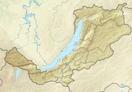 Location in Buryatia | |
| Country | Russia |
| Federal subject | Buryatia / Zabaykalsky Krai |
| Range coordinates | 55°43′N 114°05′E |
| Parent range | Stanovoy Highlands South Siberian System |
| Geology | |
| Type of rock | Granite, slate, limestone |
Geography
This mountain range is located in the Baikal Rift Zone, in the southwestern part of the Baikal-Stanovoy Region. It stretches from west to east for almost 400 km from the Barguzin river basin to the upper course of the Chara River. In its eastern part it reaches a maximum width of 80 km. The Ikat Range connects with it from the southwest. The Southern Muya Range is limited by the Muya-Kuanda Depression in the north, by the Baunt Depression in the south and in the east by the Bambuyka and Vitim rivers.
Hydrography
Rivers Pravaya Shurinda and Dyaltukta, right tributaries of the Muya originate from the northwestern slopes of the axial or main Southern Muya Range. Lake Dorong is located at the southwestern end.[4]
 |
Flora
The slopes of the range are mainly covered with mountain taiga, with pre-alpine woodland and bare summits (golets) at higher elevations.[2]
See also
References
- "HP Yuzhno Muiskyy Khrebet". PeakVisor.
- "Южно-Муйский хребет" [Southern Muya Range] (in Russian). Энциклопедия Забайкалья. Retrieved 28 July 2021. (in Russian)
- Google Earth
- "N-49 Chart (in Russian)". Retrieved 5 September 2021.
External links
 Media related to Southern Muya Range at Wikimedia Commons
This Buryatia location article is a stub. You can help Wikipedia by expanding it. |
This Zabaykalsky Krai location article is a stub. You can help Wikipedia by expanding it. |
На других языках
- [en] Southern Muya Range
[it] Monti Južno-Mujskij
I Monti Južno-Mujskij (in russo: Южно-Муйский хребет, Južno-Mujskij chrebet?) sono una catena montuosa della Siberia Orientale meridionale situata nei rajon Severo-Bajkal'skij, Mujskij e Bauntovskij ėvenkijskij della Buriazia, e nel Kalarskij rajon del Territorio della Transbajkalia, in Russia.[ru] Южно-Муйский хребет
Ю́жно-Му́йский хребе́т — горный хребет в центральной части Забайкалья, проходит по территории Северо-Байкальского, Муйского и Баунтовского эвенкийского районов Бурятии и Каларского района Забайкальского края.Другой контент может иметь иную лицензию. Перед использованием материалов сайта WikiSort.org внимательно изучите правила лицензирования конкретных элементов наполнения сайта.
WikiSort.org - проект по пересортировке и дополнению контента Википедии