geo.wikisort.org - River
The Pecos River (Spanish: Río Pecos) originates in north-central New Mexico and flows into Texas, emptying into the Rio Grande. Its headwaters are on the eastern slope of the Sangre de Cristo mountain range in Mora County north of Pecos, New Mexico, at an elevation of over 12,000 feet (3,700 m).[4] The river flows for 926 miles (1,490 km) before reaching the Rio Grande near Del Rio. Its drainage basin encompasses about 44,300 square miles (115,000 km2).[2]
| Pecos River Río Pecos Río Natagés | |
|---|---|
 Pecos River High Bridge, near Langtry, Val Verde County, Texas | |
 Map of the Pecos River watershed. | |
| Location | |
| Country | United States |
| State | Texas, New Mexico |
| Physical characteristics | |
| Source | Pecos Falls |
| • location | 29 mi (47 km) north of Pecos, New Mexico |
| • coordinates | 35°58′34″N 105°33′29″W[1] |
| • elevation | 11,759 ft (3,584 m) |
| Mouth | Rio Grande |
• location | Seminole Canyon, Val Verde County, 37 mi (60 km) northwest of Del Rio, Texas |
• coordinates | 29°41′59″N 101°22′17″W[1] |
• elevation | 1,115 ft (340 m) |
| Length | 926 mi (1,490 km)[2] |
| Basin size | 44,402 sq mi (115,000 km2)[2] |
| Discharge | |
| • location | IBWC station 08-4474.10 near Langtry, Texas[3] |
| • average | 265 cu ft/s (7.5 m3/s)[3] |
| • minimum | 42 cu ft/s (1.2 m3/s) |
| • maximum | 152,910 cu ft/s (4,330 m3/s) |
National Wild and Scenic River | |
| Type | Wild, Recreational |
| Designated | June 6, 1990 |
The name "Pecos" derives from the Keresan (Native American language) term for the Pecos Pueblo, [p'æyok'ona].[5] The river was also historically referred to as the Río Natagés for the Mescalero people.[6]
History
The river was the eastern territory of the Faraon (‘Pharaoh’) Apache Indians, a tribe of Apache, probably closely related to the Mescalero Apache, if not part of them. Their divisions were Ancavistis, Jacomis, Orejones, Carlanes, and Cuampes, but of these the Carlanes at least belonged to the Jicarillas. The river later played a large role in the exploration of Texas by the Spanish. In the latter half of the 19th century, "West of the Pecos" was a reference to the rugged desolation of the Wild West. The Texas storekeeper, bartender, and justice of the peace, Roy Bean, a native of Kentucky, was often described as "The Only Law West of the Pecos", a phrase made popular from the 1956 syndicated television series, Judge Roy Bean, with Edgar Buchanan in the starring role. In the series narration, "West of the Pecos" is described as:
the wildest spot in the United States ... virtually beyond the reach of the authorities, the railroads, then pushing their way west, attracted the most vicious characters in the country. It was said that all civilization and law stopped at the east bank of the Pecos. It took one man, a lone storekeeper who was sick of the lawlessness, to change all this. His name was Judge Roy Bean."[7]
New Mexico and Texas disputed water rights to the river until the U.S. government settled the dispute in 1949 with the Pecos River Compact.[8] The Pecos River Settlement Agreement was signed between New Mexico and Texas in 2003.[9]
Dams
Multiple dams have been built along the Pecos River. Santa Rosa Lake is 117 miles/188 km east of Albuquerque.[10] Sumner Lake, formed by the 1939 Sumner Dam, is located between Santa Rosa and Fort Sumner, NM.[11] Two dams are located north of Carlsbad, New Mexico, at Avalon Dam and Brantley Dam, to help irrigate about 25,000 acres (10,000 ha) as part of the Carlsbad reclamation project (established in 1906). Texas has also dammed the river at the Red Bluff Dam in the western part of that state to form the Red Bluff Reservoir. The portion of the reservoir that extends into New Mexico forms the lowest point in that state.
Wild and Scenic river
On June 6, 1990, 20.5 miles (33 km) of the Pecos River—from its headwaters to the townsite of Tererro—received National Wild and Scenic River designation. It includes 13.5 miles (22 km) designated "wild" and 7 miles (11 km) designated "recreational".[12]
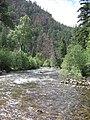 Pecos River between Terrerro and Pecos, New Mexico
 The Pecos River flowing south of Grandfalls, Texas
 Pecos River near the Rio Grande
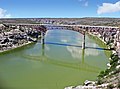 Pecos River Highway Bridge


Pecos River Flume

The Pecos River Flume is an aqueduct carrying irrigation water over the Pecos River. Construction took place from 1889 to 1890 and was part of the Pecos River Reclamation Project. It was originally constructed of wood and spanned 145 feet (44 m). It carried water at a depth of 8 feet (2.4 m). In 1902, a flood destroyed the flume and it was subsequently rebuilt using concrete. In 1902, it was identified as the largest concrete aqueduct in the world.[13][14]
The flume and its surrounding area have been reclaimed by the city of Carlsbad and transformed into a tourist attraction, with park improvements along the river and spotlights to give a spectacular nightly view.
See also
- List of longest rivers of the United States (by main stem)
- List of tributaries of the Rio Grande
- List of rivers of New Mexico
- List of rivers of Texas
References
- U.S. Geological Survey Geographic Names Information System: Pecos River
- Largest Rivers of the United States, USGS
- "Water Bulletin Number 75: Flow of the Rio Grande and Related Data; From Elephant Butte Dam, New Mexico to the Gulf of Mexico". International Boundary and Water Commission. 2005. Retrieved 17 July 2010.
- "Office of the State Engineer :: Interstate Stream Commission :: Basins and Programs :: Pecos River Basin". www.ose.state.nm.us. Archived from the original on 2005-11-14.
- Bright, William (2004). Native American placenames of the United States. University of Oklahoma Press. p. 375. ISBN 978-0-8061-3598-4. Retrieved 11 April 2011.
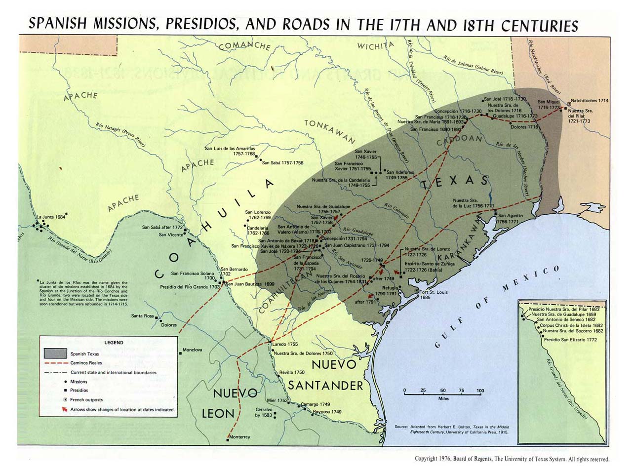
- https://legacy.lib.utexas.edu/maps/atlas_texas/texas_spanish_missions.jpg [bare URL image file]
- Billy Hathorn, "Roy Bean, Temple Houston, Bill Longley, Ranald Mackenzie, Buffalo Bill, Jr., and the Texas Rangers: Depictions of West Texans in Series Television, 1955 to 1967", West Texas Historical Review, Vol. 89 (2013), p. 109
- "Pecos River Compact". state.nm.us.
- Pecos River Settlement Agreement
- "EMNRD". www.emnrd.state.nm.us.
- "EMNRD". www.emnrd.state.nm.us.
- Pecos Wild and Scenic River, New Mexico Archived 2010-06-10 at the Wayback Machine - National Wild and Scenic Rivers System
- Phil T. Archuletta; Sharyl S. Holden (June 2003). Traveling New Mexico: a guide to the historical and state park markers. Sunstone Press. pp. 116–. ISBN 978-0-86534-400-6. Retrieved 3 December 2011.
- American Concrete Institute (2002). Concrete international. Design & construction. The Institute. Retrieved 3 December 2011.
External links
- Pecos River from the Handbook of Texas Online
- Public domain images of the Llano Estacado and West Texas
Authority control | |
|---|---|
| General |
|
| National libraries | |
| Other | |
На других языках
[de] Pecos River
Der Pecos entspringt nahe Santa Fe im US-Bundesstaat New Mexico und fließt über 1490 km durch den Ostteil dieses Bundesstaates und das benachbarte Texas, ehe er in der Nähe von Del Rio in den Rio Grande mündet. Der Fluss entwässert ein Gebiet von 114.700 km².- [en] Pecos River
[es] Río Pecos
El río Pecos (llamado Pecos River en Texas y río Pecos, en español, en Nuevo México) es un largo río del sur de Estados Unidos que fluye en dirección sureste a través de los estados de Nuevo México y Texas hasta desaguar en el río Bravo (llamado río Grande en Estados Unidos), del que es su mayor afluente, en la frontera con México. Tiene una longitud de 1450 km y drena una cuenca de 115 000 km².[1][it] Pecos (fiume)
Il Pecos o Rio Pecos, come talvolta è conosciuto nel Nuovo Messico, è un fiume degli Stati Uniti che trova le sue sorgenti in prossimità di Pecos nel Nuovo Messico.[ru] Пекос (река)
Пекос (англ. Pecos River[1]) — река в США, приток Рио-Гранде. Длина 1490 км, площадь бассейна 115 000 км². Протекает по территории штатов Нью-Мексико и Техас. Исток в горах Сангре-де-Кристо в округе Мора штата Нью-Мексико. Впадает в реку Рио-Гранде близ города Дель-Рио в штате Техас.Другой контент может иметь иную лицензию. Перед использованием материалов сайта WikiSort.org внимательно изучите правила лицензирования конкретных элементов наполнения сайта.
WikiSort.org - проект по пересортировке и дополнению контента Википедии