geo.wikisort.org - River
Lamandau River (Indonesian: Sungai Lamandau) is a river of Kalimantan, southern-central Borneo, Indonesia.[1][2] Downstream after passing the village of Nanga Bulik it becomes the Kotawaringin River.[3]
| Lamandau River Sungai Lamandau, Sungai Kotawaringin | |
|---|---|
 River mouth location  Lamandau River (Indonesia) | |
| Location | |
| Country | Indonesia |
| Physical characteristics | |
| Source | |
| • location | Kalimantan |
| Mouth | |
• location | Java Sea |
| Length | 300 km (190 mi) |
The ancient town of Kotawaringin is located in the valley formed by the river and its tributary along with gold and gemstone mining areas. In the upper reaches of the tributary valley of Arut River the Pangkalan Bun town flourishes on its banks.
Hydrology
Lamandau River flows through southern Central Kalimantan and Pangkalan Bun, discharging into the Java Sea near Kumai at 2°51′20″S 111°43′14″E. It is a major tributary of Kotawaringin River, known by this name after its confluence below Naga Bulik village. Tributaries include the Arut River, where in its upper reaches the Pangkalan Bun town is located. While the lower reaches of the river are densely populated, the upper reaches have contiguous forest areas where Orangutans can be seen.[3] Kotawaringin town to the west of the Lamandau River was an ancient capital of a Sultanate.[4]
The catchment of the Lamandau River comprises the western district of Central Kalimantan and West-Kotawaringin. West Kotawaringin district has a population of 200,000 people constituted by Tuman Dayaks (about 33%) who are Christians. The capital of this district is Pangkalan Bun, which has a sub district, a traditional area of the Dolang, close to the Kundangan city where 7000 Dayaks reside in about 100 longhouses spread over 19 villages.[5]
Pangkalan Bun town is a waterfront town, which has a plywood manufacturing plant. Its fame is due to the mines nearby where gold and amethyst stones are extracted. In support of these mining activities, several shops selling diesel sets for use in mining have been set up. Another spin-off from the mines is the establishment of a number of gem stores in the town. The particularly popular item of sale is the five set lucky stones of dark coloured amethysts, duly polished and made to shimmer for sale.[6]
Geography
| Lamandau River | ||||||||||||||||||||||||||||||||||||||||||||||||||||||||||||
|---|---|---|---|---|---|---|---|---|---|---|---|---|---|---|---|---|---|---|---|---|---|---|---|---|---|---|---|---|---|---|---|---|---|---|---|---|---|---|---|---|---|---|---|---|---|---|---|---|---|---|---|---|---|---|---|---|---|---|---|---|
| Climate chart (explanation) | ||||||||||||||||||||||||||||||||||||||||||||||||||||||||||||
| ||||||||||||||||||||||||||||||||||||||||||||||||||||||||||||
| ||||||||||||||||||||||||||||||||||||||||||||||||||||||||||||
The river flows in the midsouthern area of Borneo island with predominantly tropical rainforest climate (designated as Af in the Köppen-Geiger climate classification).[8] The annual average temperature in the area is 23 °C. The warmest month is October, when the average temperature is around 24 °C, and the coldest is January, at 22 °C.[7] The average annual rainfall is 2778 mm. The wettest month is November, with an average of 386 mm rainfall, and the driest is September, with 66 mm rainfall.[9]
People in the valley
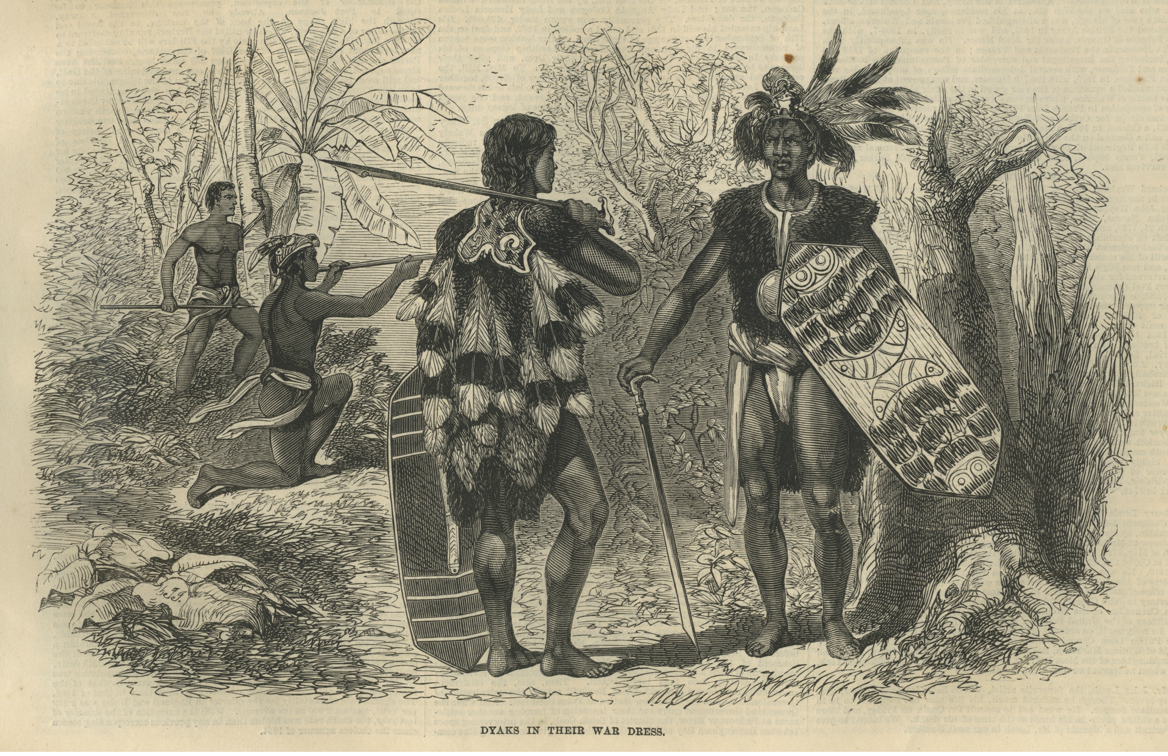

The river valley is inhabited by the Dayak peoples, particularly the Tumon in the upper course of the river. The river is popular with tourists who take trips along the rivers by speedboats and traditional klotok boats to visit and experience the lives of the Dayaks. Buddhist influence has also been traced in the Lamandau River valley in the Kotawaringin town. Buddhist statues with god's name of Dewata or Mahatara have been found here.[10]
Agriculture
Much of the land between the Jelai-Bila River and the Lamandau River is developed by agriculture.[3]
Lamandau River Wildlife Reserve

The river flows through the 76,000-hectare Lamandau River Wildlife Reserve, in the unique primary forest in Borneo, which has many endangered species, including Bornean orangutans. Human exploitation in the area has led to the pollution of the Lamandau River from gold and zircon mining, illegal logging and large-scale deforestation to create palm oil plantations. However, an awareness campaign has been initiated by NGOs to preserve the Orangutans in the park and also introduce agricultural practices compatible with forest preservation actions.[11]
Within the park, there are two camps namely, the Camp Siswoyo and Camp I, which are maintained by the Orangutan Foundation International (OFI). They are close to Pangkalan Bun and Pasir Pajang, on its eastern border. The infrastructure facilities in these camps have been improved here since September 2003, with funding provided by the Orangutan Foundation, United Kingdom. A guard post has also been established to prevent incursions into the forest or into the river by illegal loggers who had in the past created large-scale destruction of the forests in the region.[12]
See also
References
- Rand McNally, The New International Atlas, 1993.
- Sungai Lamandau at Geonames.org (cc-by); Last updated 17 January 2012; Database dump downloaded 27 November 2015
- H. D. Rijksen, E. Meijaard (1999). Our vanishing relative: the status of wild orang-utans at the close of the twentieth century. Springer. pp. 209–210. ISBN 0-7923-5754-X.
{{cite book}}: CS1 maint: uses authors parameter (link) - Dalton, Bill (1992). Indonesia. Passport books. p. 279. ISBN 0-8442-9692-9. Retrieved 1 November 2010.
- "Travel New asphalt and old totems". Discover Indonesia Online. Retrieved 1 November 2010.
- Backshall, Stephen (2003). The Rough Guide to Indonesia. The Rough Guide to Indonesia. p. 825. ISBN 1-85828-991-2. Retrieved 1 November 2010.
- "NASA Earth Observations Data Set Index". NASA. 30 January 2016.
- Peel, M C; Finlayson, B L; McMahon, T A (2007). "Updated world map of the Köppen-Geiger climate classification". Hydrology and Earth System Sciences. 11 (5): 1633–1644. Bibcode:2007HESS...11.1633P. doi:10.5194/hess-11-1633-2007.
- "NASA Earth Observations: Rainfall (1 month – TRMM)". NASA/Tropical Rainfall Monitoring Mission. 30 January 2016.
- Brown, Alfred Reginald Radcliffe-; Raymond Firth; Adolphus Peter Elkin (1946). Oceania: a journal devoted to the study of the native peoples of Australia, New Guinea, and the islands of the Pacific Ocean, Volumes 16–17. University of Sydney. p. 95. Retrieved 1 January 2010.
- "Support sustainable forest management in Borneo". National Geographic Global Action Atlas. Archived from the original on 18 July 2012. Retrieved 30 October 2010.
- "Lamandau Nature Reserve: An Orangutan Release Site". Orangutan Foundation International. Archived from the original on 26 July 2011. Retrieved 1 November 2010.
Другой контент может иметь иную лицензию. Перед использованием материалов сайта WikiSort.org внимательно изучите правила лицензирования конкретных элементов наполнения сайта.
WikiSort.org - проект по пересортировке и дополнению контента Википедии