geo.wikisort.org - River
The Kayan River is a river of Borneo island, flowing in the North Kalimantan province of Indonesia, about 1600 km northeast of the capital Jakarta.[3][4] Tributaries include the Bahau River.
| Kayan River Sungai Kayan, Sungai Bulungan, Sungai Kajan, Sungai Ulungan, Boetoengan Rivier, Bulungan River, Boeloengan Rivier | |
|---|---|
 Panoramic Kayan River | |
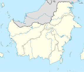 Location of river mouth  Kayan River (Indonesia) | |
| Location | |
| Country | Indonesia |
| Physical characteristics | |
| Source | |
| • location | Borneo |
| • elevation | 2,015 metres (6,611 ft) |
| Mouth | |
• location | Sulawesi Sea |
• coordinates | 2°54′41.29″N 117°33′14.11″E |
| Length | 576 kilometres (358 mi) |
| Basin size | 33,005 km2 (12,743 sq mi) 33,171.8 km2 (12,807.7 sq mi) |
| Discharge | |
| • location | Kayan III Hydropower Station, 72 km upstream of Tanjung Selor (basin size 26,260 km2 (10,140 sq mi)[1] |
| • average | 2,184 m3/s (77,100 cu ft/s)[1] |
| Discharge | |
| • location | Tanjung Selor |
| • average | 2,454 m3/s (86,700 cu ft/s)[1] (Period of data: 2016–2020)2,261 m3/s (79,800 cu ft/s)[2] |
| Discharge | |
| • location | Kayan Delta, Sulawesi Sea |
| • average | 77.738 km3/a (2,463.4 m3/s) |

Hydrology
The Kayan River rises on Mount Ukeng, passing Tanjung Selor city and discharges into the Sulawesi Sea, with a total length about 576 km (358 mi) and a basin size of 33,005 km2 (12,743 sq mi), forming a wide area at the upstream and narrower in the center until downstream.[5]
Uses
Transportation
For ages the Kayan River served as a main transportation route for the inhabitants of Malinau and Bulungan Regency to reach the inland region of Malinau Regency using traditional boats or out of the Bulungan Regency using speed boats, while at the downstream there are some river ports for passengers and goods, such as Port of Kayan and Port of Pesawan.[6]
Fishery and agriculture
The people along the Kayan River utilize the water for agriculture and fishery, either by traditional fishing or netting, especially in the upstream area, whereas about 30,000 hectare land of the Delta Kayan is used as Food Estate area, for fish ponds and farmlands.[7]
Hydroelectricity
The Kayan River is used to produce hydroelectricity using some power plants, such as the Diesel-powered one in village of Long Nawang, Kayan Hulu subdistrict.[8] The river can produce around 900 Megwatts (MW).[9] There is also a dam for Hydroelectric Power Plant in the village of Desa Long Peso, Peso subdistrict, Bulungan Regency.[10]
Villages along the Kayan River
Antutan
Antutan village (Bahasa Indonesia – Desa Antutan) is one of the many villages situated along the Kayan River. The population of the village compromises of Dayak sub-tribes: the Kenyah and the Kayan, also the Tidung and the Bulungan. There are several main sources of income in this village, such as paddy plantation, farming, fishing and crafts selling. Majority of the villagers heavily depended on the paddy rice plantation to make a living. However, some are also public servants, for example, teachers, nurses, armies and police.
See also
References
- Hanergy Holding Group (March 2013). Indonesia East Kalimantan Kayan River Basin Hydropower and Aluminum smelting Project (Slide deck). Archived from the original on 24 September 2021. Retrieved 24 September 2021 – via Scribd.
- Delphine, Dobler; Elodie, Martinez; Rinny, Rahmania; Budhi Gunadharma, Gautama; A. Riza, Farhan (2021). Floating Marine Debris Along Indonesian Coasts: An Atlas of Strandings Based on Lagrangian Modelling (PDF). Archived (PDF) from the original on 7 January 2022. Retrieved 7 January 2022.
- McNally, Rand (1993). The New International Atlas.
- "Sungai Bulungan". GeoNames. Retrieved 29 June 2022.
- Balai Pengelolaan DAS Mahakam Berau (December 2014). Laporan Hasil Penyusunan Klasifikasi DAS di Wilayah Kerja BPDAS Mahakam Berau Tahun 2014 (PDF) (in Indonesian). Samarinda: Balai Pengelolaan DAS Mahakam Berau. Archived from the original (PDF) on 28 March 2018. Retrieved 25 January 2019.
- Dewi Agustina, ed. (26 January 2017). "Pelabuhan Pesawan Siap Ramaikan Jalur Perdagangan di Indonesia Timur". TribunNews.com (in Indonesian). Archived from the original on 26 January 2019. Retrieved 25 January 2019.
- "Kemenakertrans Buka Lahan 30.000 Hektar di Kaltim". Berita Satu (in Indonesian). 6 May 2012. Archived from the original on 29 June 2022. Retrieved 29 June 2022.
- Mathias Masan Ola, ed. (3 February 2018). "PLTD Long Nawang di Malinau Dibantu Mesin Pembangkit Listrik Milik Desa". TribunKaltim.co (in Indonesian). Archived from the original on 5 July 2018. Retrieved 25 January 2019.
- Firsta Susan Ferdiany, ed. (29 January 2018). "Kaltara Fokus Realisasi Bendungan PLTA Kayan 900 MW". Antara Kaltara (in Indonesian). Archived from the original on 26 January 2019. Retrieved 29 June 2022.
- Mediatama, Grahanusa (16 June 2016). "Pemerintah bangun PLTA Kayan di Kaltara". Kontan.co.id (in Indonesian). Archived from the original on 29 June 2022. Retrieved 29 June 2022.
Другой контент может иметь иную лицензию. Перед использованием материалов сайта WikiSort.org внимательно изучите правила лицензирования конкретных элементов наполнения сайта.
WikiSort.org - проект по пересортировке и дополнению контента Википедии