geo.wikisort.org - River
The Jelai-Bila River is a river of Central Kalimantan, Indonesia, about 600 km northeast of the capital Jakarta.[1] Much of the land between the Lamandau River and the Jelai-Bila River is developed by agriculture.[2]
| Jelai-Bila River Sungai Jelai, Sungai Jelai-Bila, Sungai Djelai, Jelai | |
|---|---|
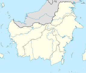 Location of river mouth  Jelai-Bila River (Indonesia) | |
| Location | |
| Country | Indonesia |
| Physical characteristics | |
| Source | |
| • location | Kalimantan |
| Mouth | Java Sea |
Geography
The river flows in the central south of Borneo with predominantly tropical monsoon climate (designated as Am in the Köppen-Geiger climate classification).[3] The annual average temperature in the area is 24 °C. The warmest month is September, when the average temperature is around 26 °C, and the coldest is January, at 20 °C.[4] The average annual rainfall is 2760 mm. The wettest month is December, with an average of 531 mm rainfall, and the driest is September, with 45 mm rainfall.[5]
See also
References
- Sungai Jelai at Geonames.org (cc-by); Last updated 2013-06-04; Database dump downloaded 2015-11-27
- H. D. Rijksen, E. Meijaard (1999). Our vanishing relative: the status of wild orang-utans at the close of the twentieth century. Springer. pp. 209–210. ISBN 0-7923-5754-X.
{{cite book}}: CS1 maint: uses authors parameter (link) - Peel, M C; Finlayson, B L; McMahon, T A (2007). "Updated world map of the Köppen-Geiger climate classification". Hydrology and Earth System Sciences. 11 (5): 1633–1644. Bibcode:2007HESS...11.1633P. doi:10.5194/hess-11-1633-2007. Retrieved 30 January 2016.
- "NASA Earth Observations Data Set Index". NASA. 30 January 2016.
- "NASA Earth Observations: Rainfall (1 month - TRMM)". NASA/Tropical Rainfall Monitoring Mission. 30 January 2016.
Текст в блоке "Читать" взят с сайта "Википедия" и доступен по лицензии Creative Commons Attribution-ShareAlike; в отдельных случаях могут действовать дополнительные условия.
Другой контент может иметь иную лицензию. Перед использованием материалов сайта WikiSort.org внимательно изучите правила лицензирования конкретных элементов наполнения сайта.
Другой контент может иметь иную лицензию. Перед использованием материалов сайта WikiSort.org внимательно изучите правила лицензирования конкретных элементов наполнения сайта.
2019-2026
WikiSort.org - проект по пересортировке и дополнению контента Википедии
WikiSort.org - проект по пересортировке и дополнению контента Википедии