geo.wikisort.org - River
The Kama (Russian: Ка́ма, IPA: [ˈkamə]; Tatar: Чулман; Udmurt: Кам) is a 1,805-kilometre (1,122 mi) long[1][2] river in Russia. It has a drainage basin of 507,000 square kilometres (196,000 sq mi).[2] It is the longest left tributary of the Volga and the largest one in discharge. At their confluence, in fact, the Kama is even larger than the Volga.
This article needs additional citations for verification. (January 2014) |
| Kama | |
|---|---|
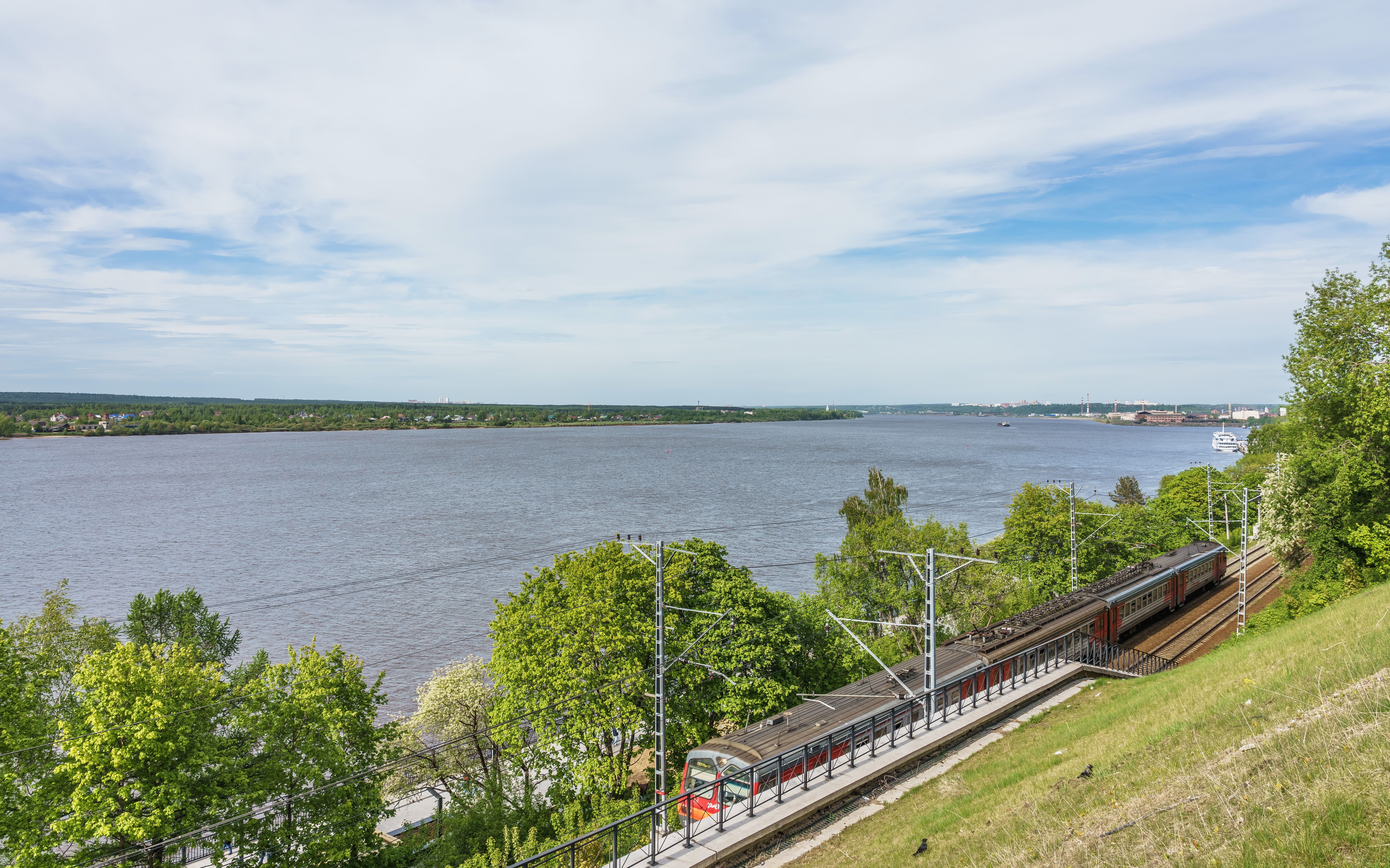 The Kama River in the city of Perm | |
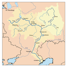 Map of the Volga's watershed with the Kama's watershed highlighted | |
| Location | |
| Country | Russia |
| Physical characteristics | |
| Source | |
| • location | Udmurtia |
| • elevation | 360 m (1,180 ft) |
| Mouth | Volga River |
• coordinates | 55°21′50″N 49°59′52″E |
| Length | 1,805 km (1,122 mi) |
| Basin size | 507,000 km2 (196,000 sq mi) |
| Discharge | |
| • average | 4,100 m3/s (140,000 cu ft/s) 4,320 m3/s (153,000 cu ft/s) |
| Basin features | |
| Progression | Volga→ Caspian Sea |
It starts in the Udmurt Republic, near Kuliga, flowing northwest for 200 kilometres (120 mi), turning northeast near Loyno for another 200 kilometres (120 mi), then turning south and west in Perm Krai, flowing again through the Udmurt Republic and then through the Republic of Tatarstan, where it meets the Volga.
Before the advent of railroads, important portages connected the Kama with the basins of the Northern Dvina and the Pechora. In the early 19th-century the Northern Ekaterininsky Canal connected the upper Kama with the Vychegda River (a tributary of the Northern Dvina), but was mostly abandoned after just a few years due to low use.
The Kama featured in the 2013 Russian film The Geographer Drank His Globe Away, in the climactic rapids scene.
Dams and reservoirs
The Kama is dammed at several locations:
- At Perm, by the dam of the Kama Hydroelectric Station, forming the Kama Reservoir;
- At Chaykovsky, by the dam of the Votkinsk Hydroelectric Station, forming the Votkinsk Reservoir;
- At Naberezhnye Chelny, by the dam of the Nizhnekamsk Hydroelectric Station, forming the Nizhnekamsk Reservoir.
Tributaries
The largest tributaries of the Kama are, from source to mouth:[2]
Gallery
 Crossing of the rivers Chusovaya (tributary) and Kama
 View in Yelabuga
 A Russian truss bridge by Lavr Proskuryakov. Early colour photograph, taken ca. 1912.


References
- "Definition of Kama River in English". Oxford Dictionaries. Oxford University Press. Archived from the original on March 8, 2016. Retrieved January 11, 2014.
- «Река КАМА», Russian State Water Registry
External links
 Media related to Kama River at Wikimedia Commons
- Naberezhnye Chelny and the Kama River
The river Kama | ||
|---|---|---|
Left tributary of the Volga | ||
| Tributaries |  | |
| Reservoirs | ||
| Hydroelectric stations |
| |
Volga River | ||
|---|---|---|
| Tributaries |
| |
| Reservoirs | ||
| Hydroelectric stations | ||
| Canals | ||
| Cities | ||
Authority control | |
|---|---|
| General | |
| National libraries | |
На других языках
[de] Kama (Fluss)
Die Kama (russisch Кама, udmurtisch Кам) ist ein 1805 km langer, linker und nordöstlicher und zugleich der größte Nebenfluss der Wolga im europäischen Teil Russlands und der fünftlängste Fluss Europas.- [en] Kama (river)
[es] Río Kama
El río Kama (en ruso, река Кама; en tártaro: Чулман) es un río del este de la Rusia europea, el principal afluente del río Volga. Tiene una longitud de 1805 km (7° más largo de Europa) y drena una cuenca de 507 000 km². Administrativamente, discurre por las repúblicas de Udmurtia y Tartaristan, y el krai de Perm.[it] Kama (affluente del Volga)
La Kama (in russo: Ка́ма?; in tartaro Çulman) è un fiume della Russia europea orientale, importantissimo affluente del Volga nel quale confluisce dalla sinistra idrografica; è in realtà anche più grande del Volga stesso prima della loro unione.[ru] Кама
Ка́ма (удм. Кам, коми-перм. Кама, тат. Чулман) — река в европейской части России, левый и самый крупный приток Волги.Другой контент может иметь иную лицензию. Перед использованием материалов сайта WikiSort.org внимательно изучите правила лицензирования конкретных элементов наполнения сайта.
WikiSort.org - проект по пересортировке и дополнению контента Википедии