geo.wikisort.org - River
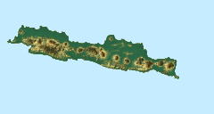
The Bodri River is a river in Kendal Regency, northern Central Java, Indonesia.[1][2] The Bodri River flows from the south to north into Java Sea.
| Bodri River Kali Bodri, Sungai Lutut | |
|---|---|
 River mouth location | |
| Location | |
| Country | Indonesia |
| Physical characteristics | |
| Source | Mount Sundoro |
| • location | Temanggung Regency |
| Mouth | Java Sea |
• location | Semarang |
• coordinates | 6.8532°S 110.1755°E |
| Basin size | 610.8 km2 (235.8 sq mi) |
Geography
The river flows along the central north area of Java with predominantly tropical monsoon climate. The annual average temperature in the area is 25 °C. The warmest month is October, when the average temperature is around 28 °C, and the coldest is January, at 24 °C.[3] The average annual rainfall is 3459 mm. The wettest month is January, with an average of 713 mm rainfall, and the driest is September, with 33 mm rainfall.[4]
Hydrology
The Bodri River rises in North Serayu Mountains from Mount Sundoro (3,150 m) at the village of Canggal, Candiroto District, Temanggung Regency. It also receives streams from the north slope of Mount Prahu (2,590 m) at Dieng Plateau, Mount Beser (1,036 m), Mount Kepiting (1,169 m) and also from Mount Ungaran (2,050 m) in Semarang Regency. The upstream in Temanggung Regency is called "Lutut River" (Sungai Lutut). The river discharges into Java Sea.
The river flows through two regencies: Temanggung Regency at the upstream and Kendal Regency in the middle and the downstream. In Temanggung Regency, this river traverses the districts of Candiroto, Bejen, and Gemawang. In Kendal Regency it crosses the districts of Singorojo, Patean, Pegandon, Gemuh, Cepiring and Patebon. The basin size (Indonesian: Daerah aliran sungai or "DAS") of Bodri until the river mouth is about 610.8 km2 (235.8 sq mi), divided into 5 smaller sub-DAS: Sub-DAS Lutut, Sub-DAS Logung, Sub-DAS Putih, Sub-DAS Blorong and Sub-DAS Bodri Hilir, comprising 4 regencies: Temanggung Regency (4 districts), Kendal Regency (12 districts), Semarang Regency (1 district) and 2 districts in the City of Semarang.[5]
Tributaries
Some main tributaries of the Bodri River are:
- Penggung River
- Logung River
- Ringin River
- Kaliputih River
- Kalipupu River
- Lowungu River
- Trocoh River
- Manggung River
Use
The inhabitants along the Bodri River use the water for fisheries, either by traditional fishing or with nets. The high discharge of the river is also used for irrigation passing some dams, such as Juwero Dam at the border of Wonosari village, Pegandon District, with Triharjo village, Gemuh District, Kendal Regency.[6] In the river mouth area it has a port for the fishermen in the north coast with a fish auction place. There is a tourist attraction "Curug Guwung" at the upstream of the Bodri River, at the Gunungpayung village, Candiroto District, Temanggung Regency[7]
See also
References
- Rand McNally, The New International Atlas, 1993.
- Kali Bodri at Geonames.org (cc-by); Last updated 4 June 2013; Database dump downloaded 27 November 2015
- "NASA Earth Observations Data Set Index". NASA. 30 January 2016. Archived from the original on 10 May 2020. Retrieved 3 December 2018.
- "NASA Earth Observations: Rainfall (1 month – TRMM)". NASA/Tropical Rainfall Monitoring Mission. 30 January 2016. Archived from the original on 19 April 2019. Retrieved 3 December 2018.
- "Konservasi SDA pada Ruas Hilir Sungai". Archived from the original on 21 August 2016. Retrieved 3 December 2018.
- Sungai Bodri di Bendung Juwero
- Potensi Wisata Temanggung Utara
Другой контент может иметь иную лицензию. Перед использованием материалов сайта WikiSort.org внимательно изучите правила лицензирования конкретных элементов наполнения сайта.
WikiSort.org - проект по пересортировке и дополнению контента Википедии