geo.wikisort.org - River
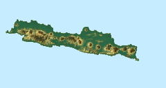
The Setail River is a river in southeastern Java, Indonesia.[1][2][3]
| Setail River | |
|---|---|
  | |
| Location | |
| Country | Indonesia |
| Physical characteristics | |
| Source | |
| • location | Mount Raung area, East Java |
| Mouth | |
• location | Strait of Bali |
Geography
The river flows in the southeastern area of Java with predominantly tropical monsoon climate (designated as Am in the Köppen–Geiger climate classification).[4] The annual average temperature in the area is 24 °C. The warmest month is October, when the average temperature is around 26 °C, and the coldest is July, at 22 °C.[5] The average annual rainfall is 2160 mm. The wettest month is January, with an average of 475 mm rainfall, and the driest is August, with 31 mm rainfall.[6]
See also
References
- Rand McNally, The New International Atlas, 1993.
- "Peta Jawa Timur" (East Java Map). C.V. Pradika, Jakarta. Retrieved 1 July 2017.
- Kali Setail – Geonames.org.
- Peel, M C; Finlayson, B L; McMahon, T A (2007). "Updated world map of the Köppen-Geiger climate classification". Hydrology and Earth System Sciences. 11 (5): 1633–1644. doi:10.5194/hess-11-1633-2007.
- "NASA Earth Observations Data Set Index". NASA. 30 January 2016.
- "NASA Earth Observations: Rainfall (1 month – TRMM)". NASA/Tropical Rainfall Monitoring Mission. 30 January 2016.
Текст в блоке "Читать" взят с сайта "Википедия" и доступен по лицензии Creative Commons Attribution-ShareAlike; в отдельных случаях могут действовать дополнительные условия.
Другой контент может иметь иную лицензию. Перед использованием материалов сайта WikiSort.org внимательно изучите правила лицензирования конкретных элементов наполнения сайта.
Другой контент может иметь иную лицензию. Перед использованием материалов сайта WikiSort.org внимательно изучите правила лицензирования конкретных элементов наполнения сайта.
2019-2026
WikiSort.org - проект по пересортировке и дополнению контента Википедии
WikiSort.org - проект по пересортировке и дополнению контента Википедии