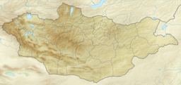
geo.wikisort.org - Reservoir
Uvs Lake (Mongolian: Увс нуур, romanized: Uws nuur, pronounced [ʊw̜s ˈnʊːr]; Russian: Озеро Убсу-Нур, romanized: Ozero Ubsu-Nur; Chinese: 乌布苏湖, pinyin: Wū Bù Sū hú) is a highly saline lake in an endorheic basin—Uvs Nuur Basin in Mongolia with a small part in Russia. It is the largest lake in Mongolia by surface area, covering 3,350 km2 at 759 m above sea level.[2] The northeastern tip of the lake is situated in the Tuva Republic of the Russian Federation. The largest settlement near the lake is Ulaangom. This shallow and very saline body of water is a remainder of a huge saline sea which covered a much larger area several thousand years ago.
| Uvs Lake | |
|---|---|
 | |
 Uvs Lake | |
| Coordinates | 50°18′N 92°42′E |
| Type | Saline |
| Primary inflows | Tesiin gol and others |
| Primary outflows | none |
| Basin countries | Mongolia and Russia |
| Max. length | 84 km (52 mi) |
| Max. width | 79 km (49 mi) |
| Surface area | 3,350 km2 (1,290 sq mi) |
| Average depth | 6 m (20 ft) |
| Surface elevation | 759 m (2,490 ft) |
| Settlements | Ulaangom |
Ramsar Wetland | |
| Official name | Lake Uvs and its surrounding wetlands |
| Designated | 22 March 2004 |
| Reference no. | 1379[1] |
Name
The name Uvs Nuur (sometimes spelled Ubsa Nor or Ubsunur) derives from subsen, a Turkic/Mongolian word referring to the bitter dregs left behind in the making of airag (Mongolian milk wine), and nuur, the Mongolian word for lake. The name is a reference to the lake's salty, undrinkable water. In one Mongolian folk tale a character named Sartaktai, known for digging wondrous canals and setting courses for rivers, tries to connect Uvs lake to another nearby lake by digging a canal between them. But when the water of Uvs lake refuses to flow, Sartaktai angrily declares "Be thy name Subsennor!" A name that is defined as "bad wine, dregs of the spirit that comes from the still..."[3]
Geography

Uvs Lake has a length of 84 km and a width of 79 km, with an average depth of 6 m. Its basin is separated from the rest of the Great Lakes Depression by the Khan Khökhii ridge; however, it is not a rift lake as some mistakenly think.[citation needed]
The main feeding rivers are the Baruunturuun, Nariin gol, and Tes (primary feed of the lake) from Khangai Mountains in the east, and the Kharkhiraa River and Sangil gol from the Altai Mountains in the west.[4]
Ecology
The very large catchment area with no exit results in highly saline water, primarily due to sulphate and sodium ions. It has a salinity of 18.8 ppt, or 1.88%, making it half as salty as the oceans.
The lake freezes over from October to May. In summer, it exhibits a temperature gradient from 25 °C at the surface to 19 °C at the bottom.[4]
29 different species of fish are known from Uvs Lake,[5] and one of them, the Potanini altai osman (Oreoleuciscus potanini),[6] is suitable for human consumption.
Protected sites
All of the lake and many parts of its surroundings have been declared protected sites. The UNESCO is using the designation "Uvs Lake site" as an umbrella term to summarize twelve separate clusters of protected sites, each a representative of a major eastern Eurasian biome.[7]

Lake Uvs Basin
The Uvs Lake is the terminal basin for the Uvs Lake Basin, which covers an area of 70,000 km2 and represents one of the best-preserved natural steppe landscapes of Eurasia. The border between Mongolia and Russia runs through the northern periphery of the basin. Here the world's most northern desert meets the world's most southern tundra zone.[8] Apart from the Uvs Lake, the basin comprises several smaller lakes. As these lakes lie to the north of other inland seas of Central Asia, they are of key importance for waterfowl migration.

Since the basin spans the geoclimatic boundary between Siberia and Central Asia, temperatures may vary from −58 °C in winter to 47 °C in summer. Despite its harsh climate, the depression is home to 173 bird species and 41 mammal species, including the globally endangered snow leopard, argali, and Asiatic ibex. The population density is low here. The lack of industry and the reliance of the inhabitants on traditional ways such as nomadic pasturing have little impact on the landscape and allow the ecosystem to remain relatively pristine.[9]
In 2003, the UNESCO listed the Uvs Lake Basin as a natural World Heritage Site.[10] It was nominated as "one of the largest intact watersheds in Central Asia where 40,000 archeological sites can be found from historically famous nomadic tribes such as the Scythians, the Turks and the Huns."[11] This transboundary patrimony is one of the largest sites inscribed in the World Heritage List to date.
References
- "Lake Uvs and its surrounding wetlands". Ramsar Sites Information Service. Retrieved 25 April 2018.
- "Увс нуур". www.medeelel.mn. Archived from the original on 2012-08-04. Retrieved 2008-02-08.
- The Folk-lore Journal. (1886). United Kingdom: Folk-lore Society. P. 32 Folk-lore Society IV
- Jon Davies. "Mongolia" (PDF). International Water Management Institute. Archived from the original (PDF) on 2008-05-28. Retrieved 2008-02-10.
- Erdene-Ochir Badarch. "Uvs Nuur Basin; World Natural Heritage Site" (PDF). United Nations Institute for Training and Research. Archived from the original (PDF) on 2008-05-28. Retrieved 2008-02-10.
- The Integrated Taxonomic Information System (ITIS)&Species 2000. "Catalogue of Life: 2007 Annual Checklist". The Integrated Taxonomic Information System (ITIS)&Species 2000. Retrieved 2008-06-27.
- "World Heritage Protection Extended to Five Natural Sites". Environmental News Service. 2003. Retrieved 2008-02-10.
- "Ubsu-Nur Accepted into World Network of Biosphere Reserves". ISAR. Archived from the original on 2007-09-20. Retrieved 2006-12-31.
- "The Ubsunur Hollow". Greenpeace. Retrieved 2006-12-31.
- "Uvs Nuur Basin". whc.unesco.org. Retrieved 2007-01-16.
- "Russia's First World Heritage Site". Retrieved 2006-12-31.
External links
- UNESCO evaluation of the property
- Data summary Uvs Nuur
- Protected areas of the world Uvs Nuur Basin, Russian Federation (Tuva) & Mongolia
- Natural Heritage Protection Fund - The Uvs Nuur Basin
- Notes on the Cladoceran and Copepod Fauna of the Uvs Nuur Basin (Northwest Mongolia)
- Uvs Lake, Mongolia
- The Ubsunur Hollow State Biosphere Reserve
- Ubsu-Nur Accepted into World Network of Biosphere Reserves
- Singing Stones - The Republic of Tuva
- Ubsu Nur satellite photo
- The distribution of the vegetation in the Uvs-nuur basin and its surrounding mountain ranges
- Lake Uvs and its surrounding wetlands
- Limnological Catalog of Mongolian Lakes
World Heritage Sites in Mongolia | ||
|---|---|---|
|  | |
Authority control | |
|---|---|
| General |
|
| National libraries | |
На других языках
[de] Uws Nuur
Der Uws Nuur (mongolisch Увс Нуур; tuwinisch Успа-Холь, Uspa-Chol; russisch Убсу-Нур, Ubsu-Nur) ist mit einer Fläche von etwa 3350 km²[1] der größte See der Mongolei. Kleine Teile des Salzsees gehören zur autonomen Republik Tuwa (Russland).- [en] Uvs Lake
[es] Lago Uvs
El lago Uvs o Uvs Nuur es un lago salino, el mayor lago de Mongolia.[fr] Uvs nuur
Le lac Uvs (en mongol : Увс нуур, Uvs nuur ; en touvain : Успа-Холь, Uspa-Khol ; en russe : Убсу-Нур, Oubsou-Nour) est le plus grand lac de Mongolie. L'extrémité nord-est du lac se trouve sur le territoire de la République autonome de Touva, en Russie, où il est appelé « lac Oubsou-Nour ». Il s'agit d'un lac salé, de faible profondeur.[it] Uvs Nuur
Uvs Nuur (mongolo:Увс Нуур; tuvano: Убсу-Нур, Ubsu-Nur) è il più grande lago della Mongolia che, a circa 753 metri s.l.m., occupa un'area di 3.350 km².[ru] Убсу-Нур
У́бсу-Нур (монг. Увс нуур, тув. Успа-Холь), ранее Убса, на современных российских картах после 1989 г. также даётся вариант названия Увс-Нуур — озеро в Монголии и России (Республика Тыва, в которой находится небольшой северный фрагмент побережья и акватории озера), самое большое по площади на территории Монголии и самое известное из котловины Больших озёр. С 2003 года оно является составной частью объекта Всемирного наследия ЮНЕСКО Бассейн Убсу-Нур.Другой контент может иметь иную лицензию. Перед использованием материалов сайта WikiSort.org внимательно изучите правила лицензирования конкретных элементов наполнения сайта.
WikiSort.org - проект по пересортировке и дополнению контента Википедии