geo.wikisort.org - Reservoir
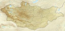
Dayan Lake (Mongolian: Даян нуур, Chinese: 达彥湖) is a lake located the district of Sagsai, in the Bayan-Ölgii Province of western Mongolia. It is recognized by BirdLife International as an Important Bird Area since 2009. It is located in the Altai Tavan Bogd National Park.
| Dayan Lake | |
|---|---|
 | |
 Dayan Lake | |
| Location | Bayan-Ölgii Province, Mongolia |
| Coordinates | 48°21′32″N 88°49′55″E |
| Basin countries | Mongolia |
| Max. length | 18 km (11 mi) |
| Max. width | 9 km (5.6 mi) |
| Surface area | 67 km2 (26 sq mi) |
| Average depth | 2.3 m (7 ft 7 in) |
| Max. depth | 4 m (13 ft) |
| Water volume | 0.157 km3 (127,000 acre⋅ft) |
| Surface elevation | 2,232 m (7,323 ft) |
Dayan Lake remains frozen from October to June. In the area, there are wolves (Canis lupus), red foxes (Vulpes vulpes) and Pallas's cat (Felis manul). From the lake area, there is a view of the Altai Mountains; potentially the place may turn out to be interesting from the point of view of ecotourism.[1]
Due to the six species of birds breeding in the surrounding areas, the lake, along with Khar Lake south-east of Dayan lake and coastal areas, was considered a bird sanctuary. Six species nest around the lakes that BirdLife has identified as key. One, the saker falcon (Falco cherrug), is in danger of extinction, and the white-throated bush chat (Saxicola insignis) is in danger. The other three are considered to be of least concerns; they include: northern lapwing (Vanellus vanellus), lesser kestrel (Falco naumanni) and bar-headed goose (Anser indicus).[1]
Climate
The climate is cold.[2] The average temperature is -5 °C. The warmest month is August, at 14 °C, and the coldest is December, at -24 °C.[3] The average rainfall is 278 millimeters per year. The wettest month is July, with 55 millimeters of rain, and the driest is February, with 6 millimeters.[4]
References
- "MN003 Dayan Lake". BirdLife Data Zone. Retrieved 31 December 2014.
- Peel, M C; Finlayson, B L (2007). "Updated world map of the Köppen-Geiger climate classification". Hydrology and Earth System Sciences. 11 (5): 1633–1644. doi:10.5194/hess-11-1633-2007. Retrieved 30 January 2016.
- "NASA Earth Observations Data Set Index". NASA. Archived from the original on 6 August 2013. Retrieved 30 January 2016.
- "NASA Earth Observations: Rainfall (1 month - TRMM)". NASA/Tropical Rainfall Monitoring Mission. Archived from the original on 10 June 2021. Retrieved 30 January 2016.
На других языках
- [en] Dayan Lake
[it] Dajan nuur
Il Dajan nuur (in mongolo: Даян нуур) è un lago d'acqua dolce che si trova nella Mongolia occidentale, nella provincia del Bajan-Ôlgij, distretto di Sagsaj. Il lago si trova a un'altitudine di 2.232 m sul livello del mare. La superficie totale del lago è di 67 km², è lungo 18 km e largo 9 km. 10 piccoli fiumi e sorgenti alimentano il lago, emissario è solo il fiume Hatan che si fonde poi nel fiume Hovd .[ru] Даян-Нуур
Даян-Нуур — горное пресноводное озеро в западной части Монголии в аймаке Баян-Улгий. Находится на высоте 2232,4 м над уровнем моря. Общая площадь этого озера составляла около 67 км², длина — 18 км, ширина — 9 км. Максимальная глубина озера 4 м.Другой контент может иметь иную лицензию. Перед использованием материалов сайта WikiSort.org внимательно изучите правила лицензирования конкретных элементов наполнения сайта.
WikiSort.org - проект по пересортировке и дополнению контента Википедии