geo.wikisort.org - Reservoir
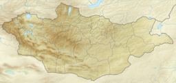
Khar-Us Lake (Mongolian: Хар-Ус нуур, romanized: Har-Us nuur; "Black-Aqua Lake", Chinese: 哈尔乌斯湖, 黑水湖) is a lake in western Mongolia in the Great Lakes Depression. It is the upper one in a system of the interconnected lakes: Khar-Us, Khar, Dörgön, Airag and Khyargas. The lake is located in Har Us Nuur National Park.
| Khar-Us Lake | |
|---|---|
 Khar-Us Lake frozen, Khar Lake fragment is at the western edge of the image, Jargalant-Khaikhan Mounts are south from Lake Khar-Us (NASA astronauts image 2002-12-13). | |
 Khar-Us Lake | |
| Location | Khovd aimag, Mongolia |
| Coordinates | 48°02′N 92°17′E |
| Type | freshwater |
| Primary inflows | Khovd River |
| Primary outflows | Chono Kharaikh gol |
| Catchment area | 74,500 km2 (28,800 sq mi) |
| Basin countries | Mongolia, Russia |
| Max. length | 72.2 km (44.9 mi) |
| Max. width | 36.5 km (22.7 mi) |
| Surface area | 1,578 km2 (609 sq mi) |
| Average depth | 2.2 m (7 ft 3 in) |
| Max. depth | 4.5 m (15 ft) |
| Water volume | 3.432 km3 (2,782,000 acre⋅ft) |
| Surface elevation | 1,156.7 m (3,795 ft) |
| Frozen | November - April |
| Islands | Agbash (Ak-Bashi) |
| Settlements | Dörgön |
Ramsar Wetland | |
| Designated | 13 April 1999 |
| Part of | Har Us Nuur National Park |
Its area value (1,852 km2) includes the island Agbash (or Ak-Bashi, white head) area (274 km2), so the water surface area is 1,578 km2 only.[1]
Some sources are using different Khar-Us Lake Lake statistics values:[2]
- Water level: 1,160.08 m
- Surface area: 1,496.6 km2
- Average depth: 2.1 m
- Volume: 3.12 km³.
| Surface input | Surface output | Groundwater inflow- outflow |
Retention time, years | ||
|---|---|---|---|---|---|
| Precipitation | Inflow | Evaporation | Outflow | ||
| 56.4 | 1,979.2 | 942.7 | 675.3 | -417.6 | 1.1 |
Primary inflow is the Khovd River, which creates a large river delta.
So called Genghis Khan's wall runs along the western shore of the Khar-Us Lake. It is possible to find it at the Google Map and Google Earth satellite maps 47°53′29″N 91°59′37″E.
References
- "Khar-Us Nuur", Great Soviet Encyclopedia
- "Surface Water of Mongolia", Gombo Davaa, Dambaravjaa Oyunbaatar, Michiaki Sugita
На других языках
[de] Char Us Nuur
Der Char Us Nuur (mongolisch Хар Ус нуур, Schwarzwassersee) ist ein großer Süßwassersee im Westen der Mongolei. Er liegt im Norden des Chowd-Aimag östlich der Stadt Chowd. Der See liegt etwa 1160 m über dem Meeresspiegel, die Wasserfläche bedeckt 1486 Quadratkilometer[1]. Die tiefste Stelle des Sees ist lediglich 4,5 m tief. Der größte Zufluss ist der Fluss Chowd Gol, der an der Mündung in den See ein Delta bildet.- [en] Khar-Us Lake
[fr] Lac Khar-Us
Le lac Khar-Us (mongol : Хар-Ус нуур, lit. "lac à l'eau noire") est un lac situé à l'ouest de la Mongolie.[it] Har-Us nuur
Il lago Har-Us nuur (in mongolo: Хар-Ус нуур) si trova in Mongolia occidentale, nella depressione dei Grandi Laghi, un bacino chiuso situato a nord-est della catena montuosa dell'Altaj e nella parte centro-settentrionale della provincia di Hovd, tra i quattro distretti di Mjangad, Dôrgôn, Čandman' e Bujant.[ru] Хар-Ус-Нуур (озеро, Ховд)
Хар-Ус-Нуур (до 1989 г. по-русски именовался Хара-Ус-Нур монг. Хар-Ус нуур) — озеро в Котловине Больших Озёр в Монголии, целиком находится на территории одноимённого национального парка на западе Монголии, второе по площади пресноводное озеро страны. Бассейн озера включает не только территорию Монголии, но и России. Соединено протоками с озёрами Хар-Нуур и Дурген-Нуур. Берега низкие. Островом Ак-Баши делится на 2 водоёма. Объём воды — 3,12 км³.[1] Площадь поверхности — 1486 км²[2].Другой контент может иметь иную лицензию. Перед использованием материалов сайта WikiSort.org внимательно изучите правила лицензирования конкретных элементов наполнения сайта.
WikiSort.org - проект по пересортировке и дополнению контента Википедии