geo.wikisort.org - Reservoir
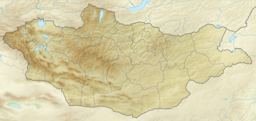
Khurgan Lake (Mongolian: Хурган нуур is a lake located in the district of Tsengel, in the Bayan-Ölgii Province of western Mongolia.
| Khurgan Lake | |
|---|---|
 View of lake taken during ISS Expedition 28 | |
 Khurgan Lake | |
| Location | Bayan-Ölgii Province, Mongolia |
| Coordinates | 48°32′46″N 88°36′22″E |
| Primary inflows | Khovd River |
| Basin countries | Mongolia |
| Max. length | 23.3 km (14.5 mi) |
| Max. width | 6 km (3.7 mi) |
| Surface area | 71 km2 (27 sq mi) |
| Average depth | 7.8 m (26 ft) |
| Max. depth | 28 m (92 ft) |
| Water volume | 0.537 km3 (435,000 acre⋅ft) |
| Surface elevation | 2,072 m (6,798 ft) |
The lake is connected to Khoton Lake by a wide and short channel (about 2 km (1 mi)); both, together with the Dayan Lake, feed the Khovd River.[1] Khurgan Lake is located within the Altai Tavan Bogd National Park.[2]
Climate
The climate is cold.[3] The average temperature is -4 ° C. The warmest month is July, at 14 ° C, and the coldest is December, at -24 ° C.[4] The average rainfall is 278 millimeters per year. The wettest month is July, with 55 millimeters of rain, and the wettest is February, with 6 millimeters.[5]
References
- Khoton and Khurgan lakes
- Altaj Tavan Bogd Archived 18 June 2011 at the Wayback Machine
- Peel, M C; Finlayson, B L (2007). "Updated world map of the Köppen-Geiger climate classification". Hydrology and Earth System Sciences. 11 (5): 1633–1644. doi:10.5194/hess-11-1633-2007. Retrieved 30 January 2016.
- "NASA Earth Observations Data Set Index". NASA. Retrieved 30 January 2016.
- "NASA Earth Observations: Rainfall (1 month - TRMM)". NASA/Tropical Rainfall Monitoring Mission. Retrieved 30 January 2016.
This Mongolia location article is a stub. You can help Wikipedia by expanding it. |
На других языках
- [en] Khurgan Lake
[it] Hurgan nuur
Il lago Hurgan o Hurgan nuur (in mongolo: Хурган нуур) è un lago d'acqua dolce che si trova nella Mongolia occidentale, nella provincia del Bajan-Ôlgij, distretto di Cėngėl. Il lago si trova a un'altitudine di 2.072 m sul livello del mare. La superficie totale del lago è di 71 km², è lungo 23 km e largo 6 km e ha una profondità massima di 28 m.[ru] Хурган-Нуур
Ху́рган-Нуур[3][4] (монг. Хурган нуур)[5] — пресноводное озеро в сомоне Цэнгэл аймака Баян-Улгий в Монголии. Расположено на высоте 2072,7 метра над уровнем моря[1]. Площадь поверхности озера составляет 71 км², средняя глубина 8 метров при максимальной, равной 28. Объём воды — 0,5366 км³[2].Текст в блоке "Читать" взят с сайта "Википедия" и доступен по лицензии Creative Commons Attribution-ShareAlike; в отдельных случаях могут действовать дополнительные условия.
Другой контент может иметь иную лицензию. Перед использованием материалов сайта WikiSort.org внимательно изучите правила лицензирования конкретных элементов наполнения сайта.
Другой контент может иметь иную лицензию. Перед использованием материалов сайта WikiSort.org внимательно изучите правила лицензирования конкретных элементов наполнения сайта.
2019-2025
WikiSort.org - проект по пересортировке и дополнению контента Википедии
WikiSort.org - проект по пересортировке и дополнению контента Википедии