geo.wikisort.org - Mountains
The Khangai Mountains (Mongolian: Хангайн нуруу, romanized: Hangain nuruu, pronounced [χaɴˈɢæːɴ noˈɾʊː]); form a range in central Mongolia,[1] some 400 km (250 mi) west of Ulaanbaatar.
| Hangai Mountains | |
|---|---|
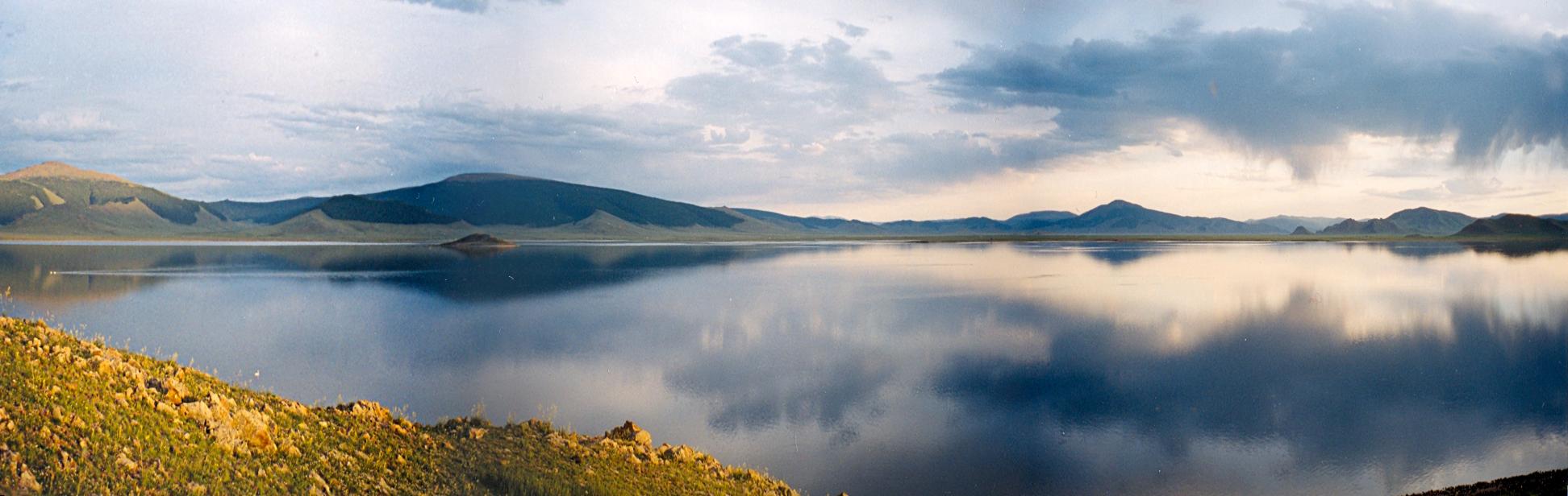 Panorama of Lake Terkhiin Tsagaan in the Khangai Mountains | |
| Highest point | |
| Peak | Otgontenger |
| Elevation | 4,031 m (13,225 ft) |
| Naming | |
| Native name | Mongolian: Хангай / Hangai |
| Geography | |
 | |
| Country | Mongolia |
| Aimags | Arkhangai, Övörkhangai, Bayankhongor and Zavkhan |
| Rivers | Ider River and Orkhon River |
| Settlements | Tsetserleg, Bayankhongor and Uliastai |
| Range coordinates | 47°30′N 100°0′E |
Name
This section does not cite any sources. (December 2014) |
Two provinces of Mongolia are named after the Khangai mountains: Arkhangai (North Khangai) and Ovorkhangai (South Khangai). The mild climate area where the two provinces meet (in eastern Khangai) is known as the cradle of Mongolian and nomadic civilization. The plains at the foot of the eastern Khangai host the Orkhon Valley World Heritage Site. The Xiongnu capital Luut Khot (Lungcheng), the Xianbei capital Ordo and the Rouran capital Moomt (Mume) are said to have been located there. Later empires also established their capitals there: e.g. the Uyghur Khaganate (745–840) built their capital Ordu-Baliq in the region.
Features


The tallest mountain is Otgontenger (lit. "Youngest sky"), which is about 4,000 metres tall. It is revered by the Mongols and state ceremonies are held there.
Suvraga Khairkhan, 3,117 metres tall, is another sacred mountain to the east of Tsetserleg.
Taryatu-Chulutu is an extinct volcanic field on the northern slopes of the Khangai Mountains.
The mountains feed the rivers Orkhon, Selenge, Ider, Zavkhan and the lakes Orog and Böön tsagaan. In the west, the Khangai mountains transition into the Great Lakes Depression.
The Khangai mountain region is known for its mild microclimates in certain areas. Winters there are not as harsh as in other parts of the country.[2]
Because of strong winter inversions which have become known as a singularity of the mesoclimate of Mongolia (Gavrilova 1974) the Khangai tends to be some 10°C warmer than the surrounding areas. It is likely that even the highest mountain tops are some 5°C warmer than the sub-Khangai basins.

References
- McDannell, Kalin T.; Zeitler, Peter K.; Idleman, Bruce D. (2018-07-21). "Relict topography within the Hangay Mountains in central Mongolia: Quantifying long-term exhumation and relief change in an old landscape". Tectonics. 37 (8): 2531–2558. doi:10.1029/2017TC004682. ISSN 0278-7407.
- Vertical Variability of Climatic Conditions in the Khangai Mountains (1980). Brzezniak, Eligiusz; Niedzwiedz, Tadeusz. p.34.
Authority control | |
|---|---|
| General |
|
| National libraries | |
| Other | |
На других языках
[de] Changai-Gebirge
Das Changai-Gebirge (mongolisch Хангайн нуруу) ist ein Hochgebirge in der zentralen Mongolei. Es hat eine Ausdehnung von rund 500 km in Ost-West-Richtung und bis zu 300 km in Nord-Süd-Richtung.- [en] Khangai Mountains
[es] Montañas Jangái
Las montañas Jangái (en mongol, Хангайн нуруу, Jangain nuruu) son una cadena montañosa localizada en la parte central de Mongolia, a unos 400 km al oeste de Ulán Bator. En el oeste, las montañas Jangái hacen la transición hacia la Depresión de los Grandes Lagos. La cumbre más alta es el Otgontenger Uul (la montaña celeste más joven), con una altura, según la fuente, de 3905, 4021 o 4031 m. Las montañas alimentan los ríos Ideriin Gol, Orjón (1124 km), Selengá (1480 km) y Zavjan y a los lagos Orog y Tsagaan Boon.[fr] Monts Khangaï
Les monts Khangaï (.mw-parser-output .sep-liste{font-weight:bold}mongol : ᠬᠠᠩᠭᠠᠢᠨᠢᠷᠤᠭᠤ, VPMC : qanggai niruɣu, cyrillique : Хангай нуруу, MNS : Khangai nuruu) sont un massif montagneux de Mongolie, à 400 km environ à l'ouest d'Oulan-Bator. Ils s'étendent sur environ 500 km d'est en ouest et 300 km du nord au sud, et culminent au mont Otgontenger. Les rivières Orkhon, Selenga (par une de ses sources, l'Ider), Zavkhan, Orog, Ongi, Tchuluut, Tes et Böön Tsagaan en sont issues.[it] Monti Khangai
I monti Hangaj (mongolo Хангайн нуруу, Hangajn nuruu), Khangai secondo la traslitterazione anglosassone, sono una catena montuosa nella Mongolia centrale, situata circa 400 km ad ovest di Ulaanbaatar. Si estendono per circa 500 km di lunghezza (direzione est-ovest) e 300 km di larghezza (nord-sud), nelle province dell'Arhangaj, Bajanhongor, Ôvôrhangaj e Zavhan.[ru] Хангай
Ханга́й (монг. Хангайн нуруу) — хребет в Монголии.Другой контент может иметь иную лицензию. Перед использованием материалов сайта WikiSort.org внимательно изучите правила лицензирования конкретных элементов наполнения сайта.
WikiSort.org - проект по пересортировке и дополнению контента Википедии