geo.wikisort.org - Mountains
The Titiwangsa Range (Malay: Banjaran Titiwangsa, بنجرن تيتيوڠسا, pronounced [ˈband͡ʒaˈran titiwaŋˈsa]), also known as "Banjaran Besar" (Big Range) by locals, is the chain of mountains that forms the backbone of the Malay Peninsula. The northern section of the range is in southern Thailand, where it is known as Sankalakhiri Range (Thai: ทิวเขาสันกาลาคีรี, pronounced [tʰīw kʰǎw sǎn.kāːlāːkʰīːrīː]).
| Titiwangsa Range | |
|---|---|
| Banjaran Titiwangsa/Besar (Malay) ทิวเขาสันกาลาคีรี (Thai) | |
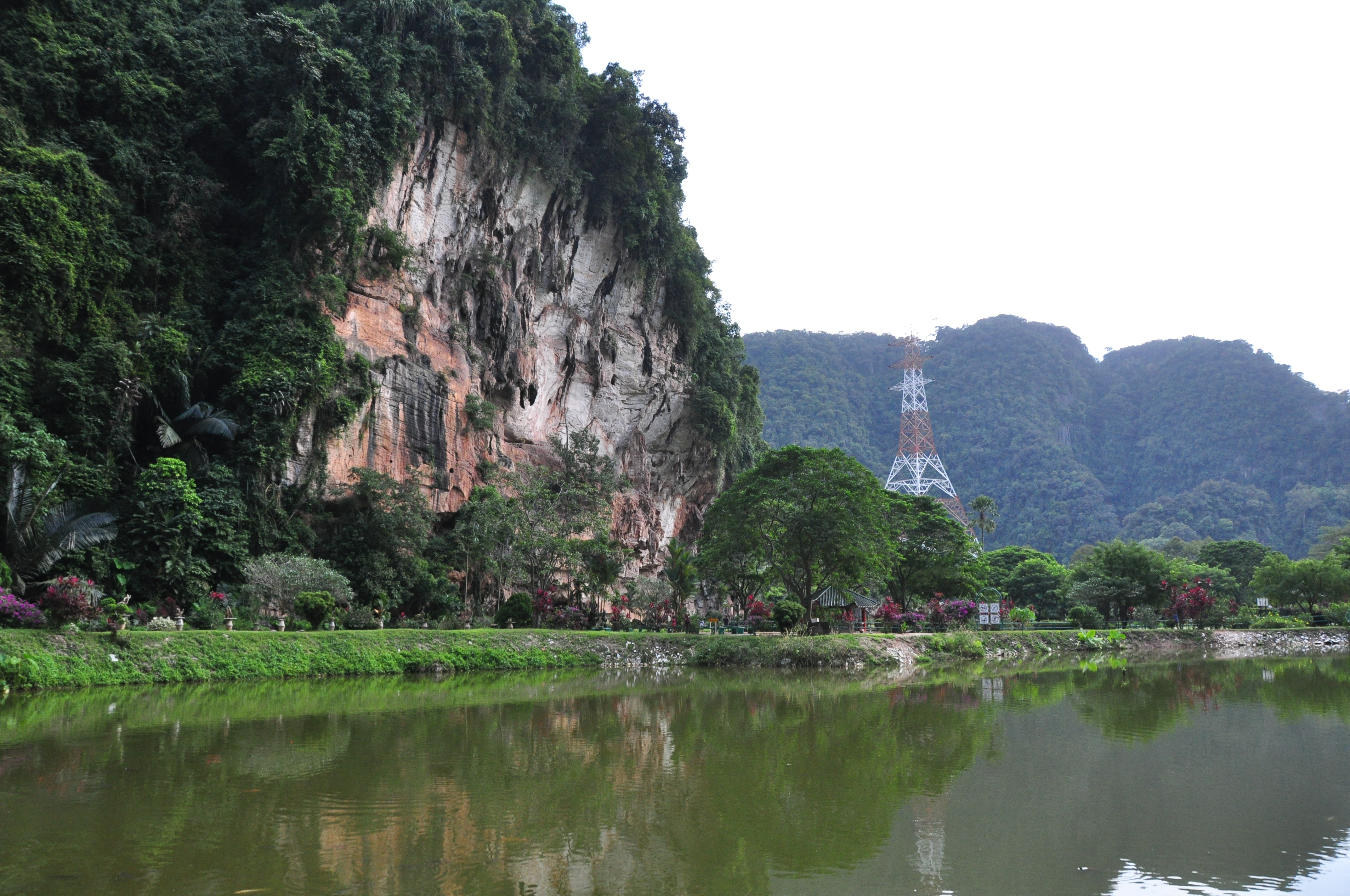
 The view of the Titiwangsa Mountains at Ulu Bernam Rest Area, North-South Expressway Northern Route | |
| Highest point | |
| Peak | Gunung Korbu |
| Elevation | 2,183 m (7,162 ft) |
| Dimensions | |
| Length | 480 km (300 mi) NW/SE |
| Width | 120 km (75 mi) NE/SW |
| Geography | |
| Countries | Malaysia and Thailand |
| Range coordinates | 5°58′12″N 101°19′37″E |
| Parent range | Tenasserim Hills |
| Geology | |
| Age of rock | Permian and Triassic |
| Type of rock | Granite and limestone |
The range acts as a natural divider, dividing Peninsular Malaysia, as well as southernmost Thailand, into east and west coast regions. It is also the source of some major rivers of Peninsular Malaysia such as the Pahang, Perak, Kelantan, Klang and Muar. The length of mountain range is about 480 km from north to south.
Geology

The Titiwangsa Range is part of a suture zone that runs north-south, starting in Thailand at the Nan-Uttaradit suture zone (partly coincident with the Dien Bien Phu fault), and extending south towards Peninsular Malaysia (Bentong-Raub suture zone).[1] The western half of the Titiwangsa Mountains in Peninsular Malaysia is an amalgamation of continental terranes known as Cimmeria or Indochina, whereas the eastern half is an amalgamation of continental terranes Sinoburmalaya or Sibumasu. These two halves of terranes were separated by the Paleo-Tethys Ocean.[2][3]
The Cimmeria was separated from Gondwana around 400 mya during the Devonian and rifted towards Laurasia, the northeastern arm of Pangea. It attached to Laurasia completely around 280 mya during the Late Permian.
Sibumasu terranes on the other hand, only started to separate from Gondwana during the Early Permian and rifted towards Indochina. The collision of Sibumasu terranes and Indochina terranes during 200mya Late Triassic resulted in the closure of the Paleo-Tethys Ocean and formation of the modern Titiwangsa Mountain belts.
Geography

This mountain range is a part of the wider Tenasserim Hills system. It forms the southernmost section of the Indo-Malayan cordillera which runs from Tibet through the Kra Isthmus into the Malay Peninsula.[4]
The Titiwangsa Mountains begins in the north as the Sankalakhiri Range, a prolongation of the Nakhon Si Thammarat Range which includes the smaller Pattani, Taluban, and Songkhla sub-ranges. The Sankalakhiri marks the border between the Southern Thailand provinces of Yala in west and Narathiwat in the east. Across the border into Malaysia, the main stretch of the range runs in a northwest-southeast orientation, straddling the borders between the west coast states of Perak and Selangor with Kelantan and Pahang on the eastern side of the peninsula. From the tripoint of Pahang, Selangor and Negeri Sembilan near Mount Nuang, it then transverses through the middle of the state of Negeri Sembilan, also a west coast state, thus dividing the state into two regions - western Negeri Sembilan, which consists of Seremban, Port Dickson and Rembau Districts, and eastern Negeri Sembilan, composed of the districts of Jelebu, Kuala Pilah, Jempol and Tampin - and ends in the south near Tampin, in the southern part of the state. Foothills extend further southeastwards into Melaka and Johor with its terminus at Mount Pulai.
The highest elevation is 2,183 m (7,162 ft) Gunung Korbu. On the Thai side the highest point is 1,533 m Ulu Titi Basah (ยูลูติติ บาซาห์), at the Thai/Malaysian border between Yala Province and Perak.[5] In the southern foothills, the highest is 1,276 m Mount Ledang.
Features

Several popular tourist destinations such as Royal Belum, Cameron Highlands, Genting Highlands and Fraser's Hill are located on the range.
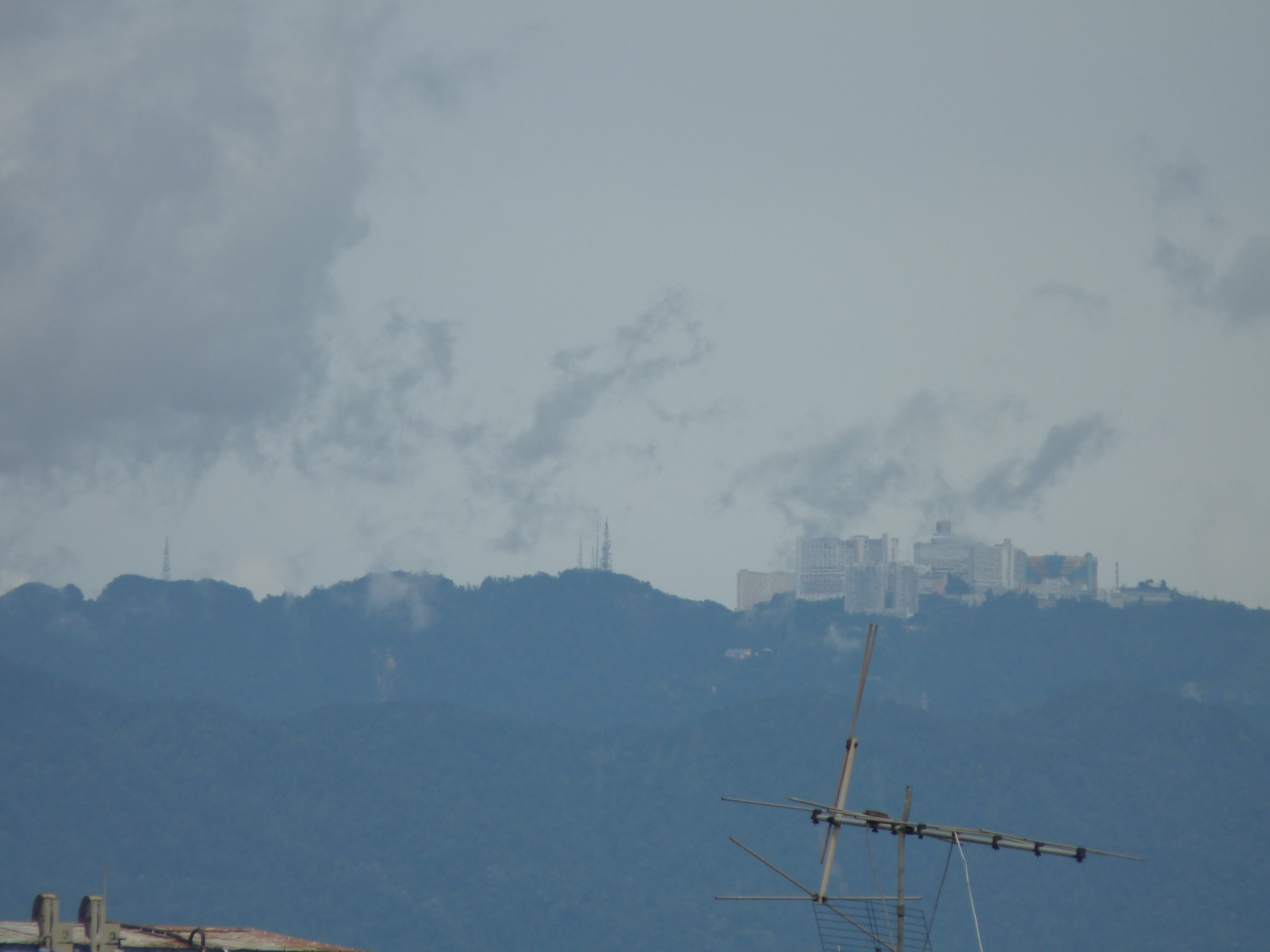
Two of Malaysia's largest metropolitan areas are located along the western fringes of the range, namely Greater Kuala Lumpur (ranked #1) and Kinta Valley (ranked #4). The Kinta Valley Geopark encompasses the entirety of Kinta Valley, where kegelkarst topography is prevalent.
A number of roads cut through the Titiwangsa Forest Complex within the larger Central Forest Spine (CFS) conservation area.
Protected areas
Thailand
- San Kala Khiri National Park
- Budo - Su-ngai Padi National Park
- Namtok Sai Khao National Park
- Hala Bala Wildlife Sanctuary
Malaysia
- Gunung Stong State Park
- Royal Belum State Park
- Taman Negara
- Krau Wildlife Reserve
- Kinta Valley National Geopark
Gallery


References
- Racey, Andrew (2009). "Mesozoic red bed sequences in SE Asia and the significance of the Khorat Group of NE Thailand". In Buffetaut, Eric (ed.). Late Palaeozoic and Mesozoic Ecosystems in SE Asia. Geological Society of London. p. 46. ISBN 9781862392755. Retrieved 20 June 2019.
- Metcalfe, I., 2000, "The Bentong-Raub Suture Zone", Journal of Asian Earth Sciences, v. 18, p. 691-712
- Metcalfe, I., 2002, "Permian tectonic framework and palaeogeography of SE Asia", Journal of Asian Earth Sciences, v. 20, p. 551-566
- Avijit Gupta, The Physical Geography of Southeast 0Asia, Oxford University Press, 2005. ISBN 978-0-19-924802-5
- "Gunong Ulu Titi Basah, Thailand - Geographical Names, map, geographic coordinates".
External links
- Perak Tourism - Royal Belum State Park
- Gunung Stong State Park
- San Kara Khiri National Park
- Budo - Su-ngai Padi National Park
- Namtok Sai Khao National Park
- Hala Bala Wildlife Sanctuary
На других языках
[de] Sankarakhiri
Das Sankarakhiri-Gebirge (Thai: .mw-parser-output .Thai{font-size:115%}เทือกเขาสันการาคีรี, ausgesprochen [.mw-parser-output .IPA a{text-decoration:none}tʰʉ̂ak-kʰăo săn-kaːraː-kiːriː], andere Schreibweise: San Kala Khiri, oder Sankala Khiri) ist der nördliche Teil der Titiwangsa-Bergkette, die wichtigste Berglandschaft auf der Malaiischen Halbinsel, die eine natürliche Grenze zwischen der Westküste und der Ostküste bildet. Die Titiwangsa-Bergkette zieht sich durch die Provinzen Songkhla, Pattani und Narathiwat im Süden von Thailand und über die Staatsgrenze bis Negeri Sembilan in Malaysia. Der höchste Berg der Sankarakhiri Bergkette, Ulu Titi Basah (ยูลูติติ บาซาห์) mit 1533 m Höhe, befindet sich an der Grenze zwischen Yala und Perak.- [en] Titiwangsa Mountains
[fr] Monts Titiwangsa
Les monts Titiwangsa (en malais : Banjaran Titiwangsa / بنجرن تيتيوڠسا / API : [ˈband͡ʒaˈran titiwaŋˈsa]), aussi appelés localement Banjaran Besar (littéralement « chaîne principale » ou « chaîne centrale ») et connus dans l'extrême Sud de la Thaïlande sous le nom de monts Sankalakhiri (en thaï : ทิวเขาสันกาลาคีรี / API : [tʰīw kʰǎw sǎn.kāːlāːkʰīːrīː]), sont une chaîne de montagnes de Malaisie péninsulaire et du Sud de la Thaïlande.[it] Monti Titiwangsa
I Monti Titiwangsa (in lingua malese: Banjaran o anche Barisan Titiwangsa, letteralmente: "grande catena Titiwangsa") sono una catena montuosa e costituiscono parte della spina dorsale della penisola malese, nella quale si estendono per 480 km da nord a sud. Sono considerati la sezione meridionale dei Monti del Tenasserim, che fanno da confine tra Birmania e Thailandia, e della lunga cordigliera che ha origine nel Tibet ed attraversa la penisola malese passando per l'Istmo di Kra.[1][ru] Титивангса
Горы Титивангса (малайск. Banjaran Titiwangsa), известные также как «Банджаран Бесар» (Главный хребет) — один из основных горных хребтов Малайзии. Его северная часть расположена в Южном Таиланде, где он носит название хр. Санкалахири (тайск. เทือกเขาสันกาลาคีรี, IPA: [sǎn.kaːlaːkʰiːriː]).Другой контент может иметь иную лицензию. Перед использованием материалов сайта WikiSort.org внимательно изучите правила лицензирования конкретных элементов наполнения сайта.
WikiSort.org - проект по пересортировке и дополнению контента Википедии