geo.wikisort.org - Mountains
The Hazards are a mountain range located in the Freycinet National Park on the east coast of Tasmania, Australia. The range is positioned between Coles Bay and Wineglass Bay and are said to be named after local whaler, African-American Captain Richard Hazard. The range consists of 5 mountains; Mayson (415 m), Amos (454 m), Dove (485 m), Baudin (413 m) and Parson (331 m).[2]
| The Hazards | |
|---|---|
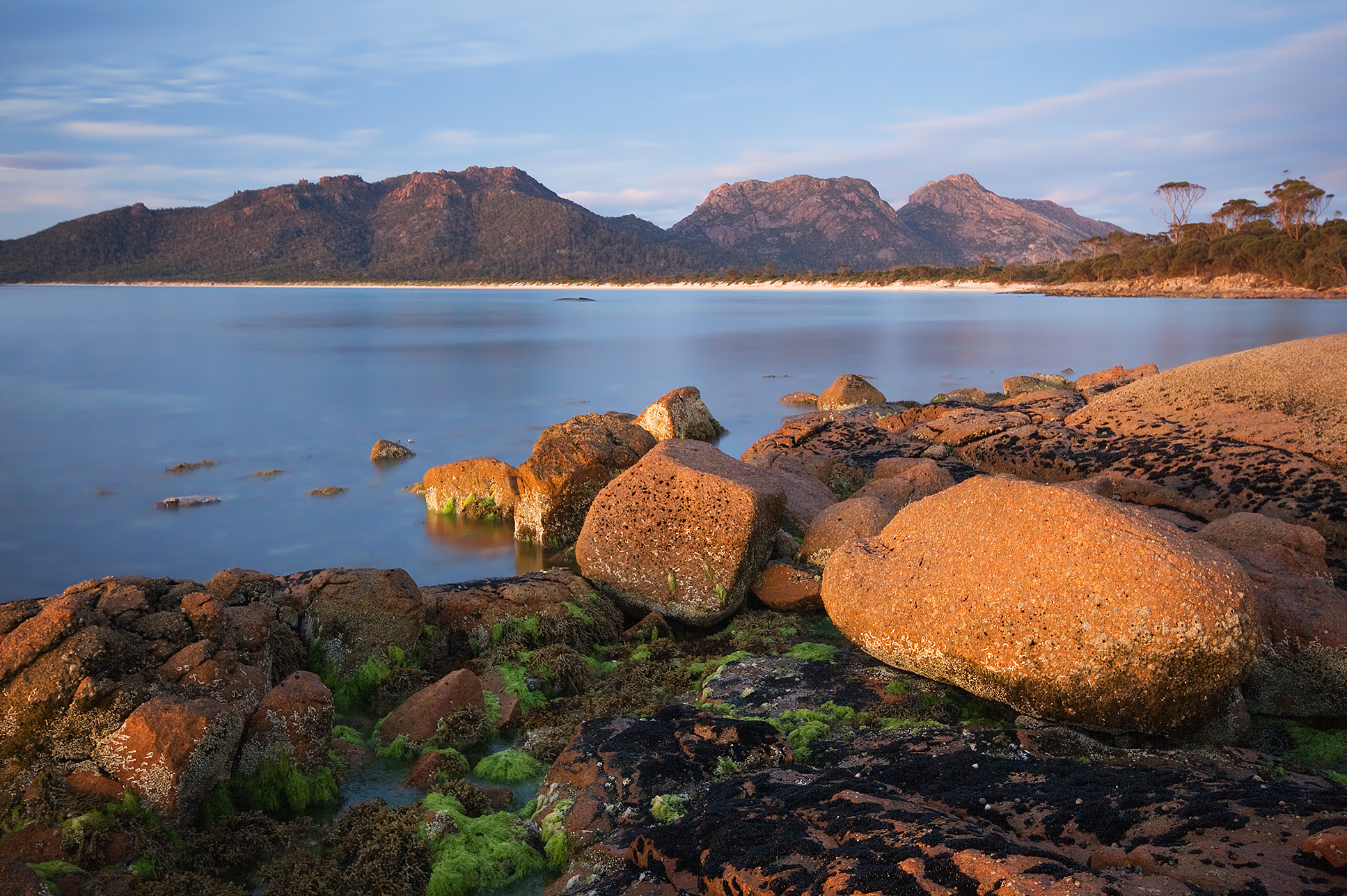 The Hazards from the southern section of Hazard Beach. | |
| Highest point | |
| Elevation | 485 m (1,591 ft) |
| Coordinates | 42°09′S 148°18′E[1] |
| Geography | |
 The Hazards Location in Tasmania | |
| Location | East Coast Tasmania |
| Geology | |
| Mountain type | Granite |
Features and location
The Hazards are made of granite. Orthoclase, a pink feldspar, gives the mountains their pink tint.[2][3] The track to Wineglass Bay and lookout runs over the saddle between Mounts Mayson and Amos.
There is also a resort in Coles Bay utilising the name of the geographical feature,[4] and travel information also includes local information about locations from where the hazards can be viewed.[5]
See also
References
- "The Hazards (TAS)". Gazetteer of Australia online. Geoscience Australia, Australian Government.
- TASMAP - Freycinet National Park. Department of Primary Industries and Water.
- State Library of Tasmania; Tasmania. Archives Office (1800), Distant view of the Hazards, East Coast, 1 photographic print, retrieved 17 June 2015
- "Six practices have been shortlisted for The Hazards at Freycinet, a resort at Coles Bay.(Tasmania)(Brief Article)". Architecture Australia. Architecture Media. 92 (4): 14(1). 1 July 2003. ISSN 0003-8725. OCLC 44653494.
- "Hazards loom large". The Sydney Morning Herald. 24 July 2010. Archived from the original on 23 July 2010. Retrieved 12 August 2015.
External links
East Coast region of Tasmania, Australia | |||||
|---|---|---|---|---|---|
| Settlements | |||||
| Governance former |
| ||||
| Mountains | |||||
| Protected areas, parks and reserves |
| ||||
| Harbours, bays, inlets and estuaries | |||||
| Landmarks |
| ||||
| People of note |
| ||||
| Islands |
| ||||
| Books and newspapers |
| ||||
| Flora, fauna, and fishlife |
| ||||
| Bioregions |
| ||||
| |||||
This Tasmania geography article is a stub. You can help Wikipedia by expanding it. |
На других языках
[de] The Hazards
The Hazards sind ein Gebirgszug im Osten des australischen Bundesstaates Tasmanien. Die wilde Gegend liegt im Freycinet-Nationalpark an der Ostküste, östlich von Swansea, zwischen Coles Bay und der Wineglass Bay.- [en] The Hazards
Другой контент может иметь иную лицензию. Перед использованием материалов сайта WikiSort.org внимательно изучите правила лицензирования конкретных элементов наполнения сайта.
WikiSort.org - проект по пересортировке и дополнению контента Википедии