geo.wikisort.org - Mountains
Mount Pelion East is a mountain located in the Central Highlands region of Tasmania, Australia. The mountain is situated within the Cradle Mountain-Lake St Clair National Park.
| Mount Pelion East | |
|---|---|
 Mount Pelion East | |
| Highest point | |
| Elevation | 1,461 m (4,793 ft)[1][2] |
| Prominence | 335 m (1,099 ft)[2] |
| Parent peak | Mount Ossa |
| Isolation | 3.23 km (2.01 mi)[2] |
| Listing | 25th highest mountain in Tasmania |
| Coordinates | 41°51′00″S 146°03′36″E[3] |
| Geography | |
 Mount Pelion East Location in Tasmania | |
| Location | Central Highlands, Tasmania, Australia |
| Parent range | Pelion |
| Topo map | Tasmap Cathedral 1:25000 |
| Geology | |
| Age of rock | Jurassic |
| Mountain type | Dolerite |
| Climbing | |
| Easiest route | Walk / hike via the Overland Track from Pelion Gap |
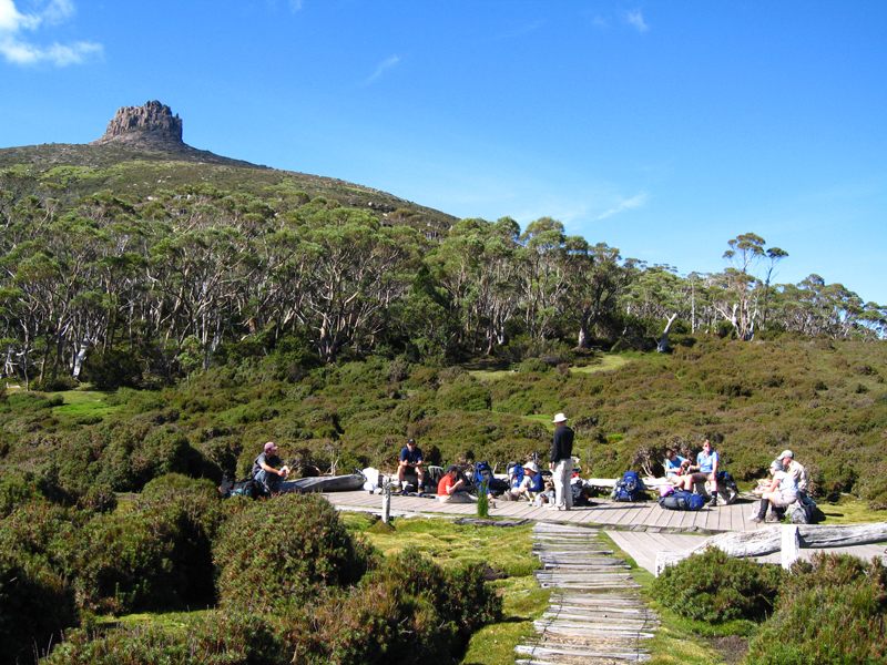
With an elevation of 1,461 metres (4,793 ft) above sea level, the mountain is the 25th highest mountain in Tasmania, slightly higher than the better known Frenchmans Cap at 1,446 metres (4,744 ft). Unlike Mount Pelion West, Pelion East is not a massive mountain, more pinnacle-like, the spire shape having been caused by harsh glacial erosion many thousands of years ago.
Location and access
The mountain summit is at grid reference 225655 UTM Zone 55S and high resolution topographical information is available on Tasmap Cathedral 1:25000. To the west is Mount Pelion West, due north is Lake Ayr, due east is Curate Bluff in the Cathedral Mountain range, and due south is Mount Massif. The mountain is made up of dolerite and the lower slopes are covered in low scrub, including scoparia. This mountain is approximately midway between Pelion Hut and Kia Ora Hut on the Overland Track which passes within 1,000 metres (3,300 ft) of the summit.
Mount Pelion East may be accessed via the Overland Track from Cradle Mountain during the main walking season from November to April when a booking and fee system applies. During this walking period the track is restricted to limited numbers and north-south traffic only is permitted. In the off-season, walking is also allowed from the south at Lake St Clair. Another access route is the combined Arm River and Innes Tracks which passes Lake Ayr and joins the Overland Track at Pelion Plains. A wider overview of the area and access points is available on the Tasmap Cradle Mountain-Lake St Clair map and notes publication.
This mountain can be climbed from the Overland Track which passes by very closely at Pelion Gap, at an elevation of 1,126 metres (3,694 ft).
|


See also
References
- "LISTmap (Mount Pelion East)". Department of Primary Industries and Water. Government of Tasmania. Retrieved 29 February 2008.
- "Mount Pelion East, Australia". Peakbagger.com. Retrieved 7 June 2015.
- "Mount Pelion East (TAS)". Gazetteer of Australia online. Geoscience Australia, Australian Government.
External links
 Media related to Mount Pelion East at Wikimedia Commons
На других языках
[de] Mount Pelion East
Der Mount Pelion East ist ein Berg im Zentrum des australischen Bundesstaates Tasmanien. Er liegt am Ostrand des Cradle-Mountain-Lake-St.-Clair-Nationalparks und ist mit 1.446 m Höhe der sechzehnt-höchste Gipfel in Tasmanien, wenig höher als die bekanntere Frenchmans Cap. Anders als der Mount Pelion West ist der Mount Pelion East kein massiver Berg, sondern besitzt die Form eines Spitztürmchens, die auf massive Gletschererosion vor Tausenden von Jahren zurückzuführen ist.- [en] Mount Pelion East
[it] Monte Pelion Est
Il Pelion Est[1][2] (in inglese Mount Pelion East) è una montagna situata nella regione degli altipiani centrali della Tasmania, in Australia, all'interno del Parco nazionale del monte Cradle e del lago St Clair. L'origine geologica della cima risale al Giurassico e la composizione delle rocce corrisponde a blocchi di dolerite: l'isolamento topografico ammonta a 323 km.[3][ru] Пелион-Ист
Гора Пелион-Ист (англ. Mount Pelion East — Восточный Пелион) расположена в Национальном парке Крейдл-Маунтин — Лейк-Сент-Клэр, находящегося на территории острова (и одноимённого штата) Тасмания, входящего в состав Австралии. Этот парк является частью территории, называемой «Дикая природа Тасмании» (англ. Tasmanian Wilderness), являющейся объектом Всемирного наследия ЮНЕСКО. Как и многие другие горы региона, гора Пелион-Ист сложена из долерита.Другой контент может иметь иную лицензию. Перед использованием материалов сайта WikiSort.org внимательно изучите правила лицензирования конкретных элементов наполнения сайта.
WikiSort.org - проект по пересортировке и дополнению контента Википедии