geo.wikisort.org - Coast
The Bay of Fires (palawa kani: larapuna)[1][2] is a bay on the northeastern coast of Tasmania in Australia, extending from Binalong Bay to Eddystone Point. The bay was given its name in 1773 by Captain Tobias Furneaux in Adventure,[3] who saw the fires of Aboriginal people on the beaches.

Bay whaling activities were carried out in the area in the 1840s.[4]
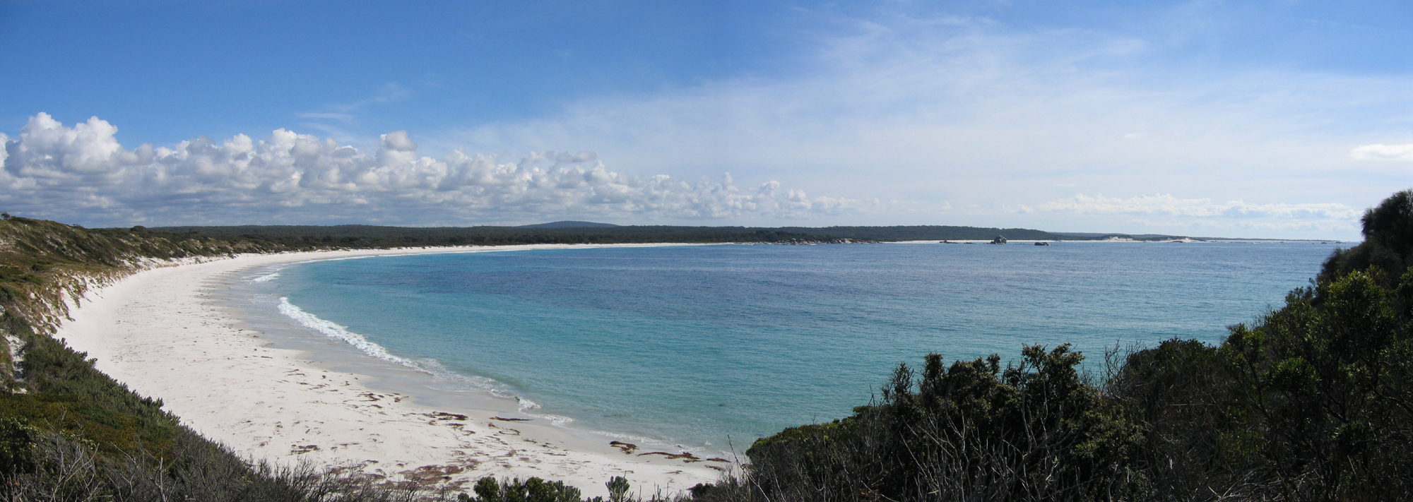
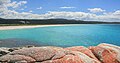
The Bay of Fires is a region of white beaches, blue water and orange-hued granite (the colour of which is actually produced by a lichen). The northern section of the bay is part of Mount William National Park; the southern end is a conservation area.[5]
A wide range of activities can be pursued in the Bay of Fires area, including camping, beach activities, boating, bird watching, fishing, swimming, surfing and walking.[6][7][8]
Tourism
In the 2000s, the Bay of Fires received several tourism accolades. In 2005, it was named as the world's second best beach by Condé Nast.[9] In 2008, it was named the world's "hottest" travel destination for 2009 by international guide book Lonely Planet.[10]
History
The Bay of Fires was a meeting place for Aboriginal family groups such as Panpe-kanner, Leener-rerter and Pinter-rairer.[11]
Pictures
 Binalong Bay Beach
 Beach and Rocks


| Wikimedia Commons has media related to Bay of Fires. |
References
- Tasmanian Aboriginal Centre Inc. (2015). "Healthy Country Plan 2015" (PDF).
- "Tasmanian Aboriginal Centre – Official Aboriginal and Dual Names of places". tacinc.com.au. Retrieved 2 March 2022.
- Sprod, Dan (2005). "Furneaux, Tobias (1735 - 1781)". Australian Dictionary of Biography. Melbourne University Press. ISSN 1833-7538. Retrieved 5 May 2008 – via National Centre of Biography, Australian National University.
- Evans, Kathryn (1993). Shore-based whaling in Tasmania historical research project: Volume 2; site histories. Hobart: Parks & Wildlife Service. p. 66.
- Fitzgerald, Nick; Bay of Fires Coastal Preservation Lobby (Tas.); North-East Bioregional Network (Tas.) (2009), The Bay of Fires a new national park for Northeast Tasmania, North-East Bioregional Network, retrieved 10 January 2013
- "Bay of Fires". North East Tasmania. Archived from the original on 9 January 2008. Retrieved 13 January 2008.
- "Bay of Fires Conservation Area". Parks and Wildlife Service Tasmania. Archived from the original on 30 January 2009. Retrieved 13 January 2008.
- Richardson, Garry (2006), The Bay of Fires, St Helens and the Hinterland : a brief history and activities to enjoy, G. Richardson,c[2006], retrieved 10 January 2013
- "Bay of Fires named world's second-best beach". ABC News. 12 June 2005. Retrieved 24 December 2020.
- "Tasmania's Bay of Fires world's top spot: Lonely Planet". Sydney Morning Herald. 20 October 2008. Retrieved 24 December 2020.
- "Bay of Fires Conservation Area | Parks & Wildlife Service Tasmania". parks.tas.gov.au. Retrieved 18 April 2021.
East Coast region of Tasmania, Australia | |||||
|---|---|---|---|---|---|
| Settlements | |||||
| Governance former |
| ||||
| Mountains | |||||
| Protected areas, parks and reserves |
| ||||
| Harbours, bays, inlets and estuaries | |||||
| Landmarks |
| ||||
| People of note |
| ||||
| Islands |
| ||||
| Books and newspapers |
| ||||
| Flora, fauna, and fishlife |
| ||||
| Bioregions |
| ||||
| |||||
This Tasmania geography article is a stub. You can help Wikipedia by expanding it. |
Другой контент может иметь иную лицензию. Перед использованием материалов сайта WikiSort.org внимательно изучите правила лицензирования конкретных элементов наполнения сайта.
WikiSort.org - проект по пересортировке и дополнению контента Википедии