geo.wikisort.org - Mountains
Sugarloaf Hill (Irish: Cnoc na Binne) is a mountain peak located in the Knockmealdown Mountains on the border between County Tipperary and County Waterford.
| Sugarloaf Hill | |
|---|---|
| Cnoc na Binne | |
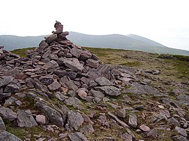
 Summit cairn of Sugarloaf Hill | |
| Highest point | |
| Elevation | 663 m (2,175 ft)[1] |
| Prominence | 118 m (387 ft) |
| Listing | Hewitt |
| Geography | |
 Sugarloaf Hill Location in Ireland | |
| Location | County Tipperary / County Waterford, Ireland |
| Parent range | Knockmealdown Mountains |
| OSI/OSNI grid | S039105 |
| Topo map | OSi Discovery 74 |
See also
- List of mountains in Ireland
- Sugarloaf (mountain)
References
- Hiking in Ireland, Helen Fairbairn, Gareth Mc Cormack, Lonely Planet, 2010, see Googlwe books
This article needs additional citations for verification. (January 2017) |
На других языках
- [en] Sugarloaf Hill (Knockmealdowns)
[it] Sugarloaf Hill
La Sugarloaf Hill (in gaelico irlandese Cnoc na Binne) è una montagna irlandese facente parte dei Monti Knockmealdown, che dividono le contee di Tipperary e Waterford. Il monte in questione è interamente situato nella seconda delle due.Текст в блоке "Читать" взят с сайта "Википедия" и доступен по лицензии Creative Commons Attribution-ShareAlike; в отдельных случаях могут действовать дополнительные условия.
Другой контент может иметь иную лицензию. Перед использованием материалов сайта WikiSort.org внимательно изучите правила лицензирования конкретных элементов наполнения сайта.
Другой контент может иметь иную лицензию. Перед использованием материалов сайта WikiSort.org внимательно изучите правила лицензирования конкретных элементов наполнения сайта.
2019-2025
WikiSort.org - проект по пересортировке и дополнению контента Википедии
WikiSort.org - проект по пересортировке и дополнению контента Википедии
