geo.wikisort.org - Mountains
The Mullaghareirk Mountains (from Irish: Mullach an Radhairc, meaning 'the summit of the view')[1] is a range of hills in Ireland on the borders of County Cork, County Kerry and County Limerick. The area is also known as Sliabh Luachra (sometimes anglicised 'Slieve Logher'). The highest point is Baraveha (Barr an Bheithe) at 451 metres (1,480 ft).[2] It is bordered by the Blackwater valley to the south, Castleisland to the west, Athea to the north and the Deel valley to the east. Villages in the hills include Rockchapel, Ballydesmond, Brosna, Gneevgullia, Mountcollins, Newmarket, Meelin and Tournafulla. The Allaughaun River, a tributary of the River Feale, rises at the east end of the range.[3]
| Mullaghareirk Mountains | |
|---|---|
| Mullach an Radhairc | |
 Mullaghareirk Mountains | |
| Highest point | |
| Elevation | 408 m (1,339 ft) |
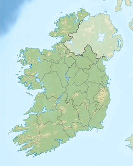
| Coordinates | 52°20′N 9°08′W |
| Geography | |
| Country | Republic of Ireland |
| Provinces of Ireland | Munster |
Stack’s to Mullaghareirk Mountains, West Limerick Hills and Mount Eagle SPA
The Mullaghareirk Mountains form part of the Stack’s to Mullaghareirk Mountains, West Limerick Hills and Mount Eagle Special Protection Area which, although large areas are under commercial conifer forestry, protects blanket bog, wet heath and dry heath. The area has been designated as a Special Protection Area under the European Union's Birds Directive and was so designated to protect the hen harrier. A survey in 2005 found 45 breeding pairs, representing more than 20% of the total for the whole island of Ireland. Other rare birds found here include breeding short-eared owl, merlin and red grouse, a species which is now listed as endangered in Ireland.[3] The SPA was designated in 2007 and has a total area of 556 square kilometres (215 sq mi).[4]
History
The Mullaghareirk Mountains were used as a sanctuary by the Rockites, the "followers" of the mythical folk hero Captain Rock, in the Agrarian risings of 1821 to 1824, to hide from the authorities.[5]
References
- Mullaghareirk Mountains. Placenames Database of Ireland.
- Baraveha. MountainViews.ie
- "SITE SYNOPSIS Site Name: Stack's to Mullaghareirk Mountains, West Limericvk Hills and Mount Eagle SP Site Code: 004161" (PDF). Department for Arts, Heritage and the Gaeltacht. Retrieved 28 March 2020.
- "Stack's to Mullaghareirk Mountains, West Limerick Hills and Mount Eagle SPA in Ireland". Protected Planet. Retrieved 28 March 2020.
- James S. Donnelly, Jr (2009). Captain Rock: The Irish Agrarian Rebellion of 1821–1824. Univ of Wisconsin Press. p. 82. ISBN 978-0299233136.
Mountains and hills of Munster | |||||||
|---|---|---|---|---|---|---|---|
| Ballyhoura Mountains |  | ||||||
| Boggeragh Mountains | |||||||
| Caha Mountains | |||||||
| Comeragh Mountains | |||||||
| Derrynasaggart Mountains | |||||||
| Dingle Peninsula |
| ||||||
| Galty Mountains | |||||||
| Iveragh Peninsula | |||||||
| Knockmealdown Mountains | |||||||
| MacGillycuddy's Reeks |
| ||||||
| Mangerton Mountains | |||||||
| Shehy Mountains | |||||||
| Silvermine Mountains | |||||||
| Slieve Miskish Mountains | |||||||
| Others |
| ||||||
На других языках
[de] Mullaghareirk Mountains
Die Mullaghareirk Mountains (irisch: Mullach an Radhairc, „der Gipfel der Aussicht“) sind eine Bergkette in Irland, die sich über eine Länge von 32 km zwischen den Städten Abbeyfeale und Dromcolliher in der Grafschaft Limerick und Newmarket in der Grafschaft Cork erstrecken. Die Ortschaften Mountcollins und Rockchapel liegen im Gebirge. Die höchste Erhebung wird mit 408 m erreicht.- [en] Mullaghareirk Mountains
[it] Mullaghareirk
Le Mullaghareirk Mountains (dal gaelico irlandese Mullach an Radhairc, che significa "sommità della vista") sono una catena montuosa situata in Irlanda, più precisamente a cavallo di tre contee: quella di Kerry, quella di Cork e quella di Limerick. Tutte queste fanno parte della provincia amministrativa del Munster. Su queste montagne sono situati alcuni villaggi, tra cui Mountcollins, Tournafulla, Brosna e Rockchapel.Другой контент может иметь иную лицензию. Перед использованием материалов сайта WikiSort.org внимательно изучите правила лицензирования конкретных элементов наполнения сайта.
WikiSort.org - проект по пересортировке и дополнению контента Википедии