geo.wikisort.org - Mountains
The Boggeragh Mountains (Irish: An Bhograch) are located in County Cork, Ireland, with the Munster Blackwater to the north and the River Lee to the south of the hills. With an elevation of 644 m (2,113 ft), the highest peak is Musheramore (Irish: Muisire Mór). The landscape consists of peat blanket bog, grassland, streams and areas of forestry. The mountains were formed from Old Red Sandstone deposited during the Devonian Period. They were shaped by glacial erosion during the last glacial period.
| Boggeragh Mountains | |
|---|---|
| Irish: An Bhograch | |
 Boggeragh Mountains | |
| Highest point | |
| Peak | Musheramore |
| Elevation | 644 m (2,113 ft) |
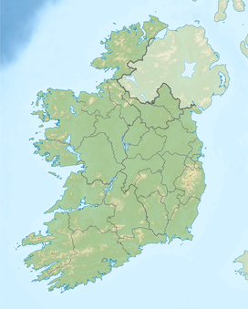
| Coordinates | 52°01′N 8°55′W |
| Geography | |
| Country | Republic of Ireland |
| Provinces of Ireland | Munster |

Construction of a wind farm in the area started in September 2009. In February 2010 19 units of Vestas V90-3MW MW wind turbines are up and running.[1]
References
- "Turbines ordered for Ireland's largest wind power plant | Wind Energy Update". Archived from the original on 9 April 2009. Retrieved 9 January 2009.
Mountains and hills of Munster | |||||||
|---|---|---|---|---|---|---|---|
| Ballyhoura Mountains |  | ||||||
| Boggeragh Mountains | |||||||
| Caha Mountains | |||||||
| Comeragh Mountains | |||||||
| Derrynasaggart Mountains | |||||||
| Dingle Peninsula |
| ||||||
| Galty Mountains | |||||||
| Iveragh Peninsula | |||||||
| Knockmealdown Mountains | |||||||
| MacGillycuddy's Reeks |
| ||||||
| Mangerton Mountains | |||||||
| Shehy Mountains | |||||||
| Silvermine Mountains | |||||||
| Slieve Miskish Mountains | |||||||
| Others |
| ||||||
This geographical article about County Cork is a stub. You can help Wikipedia by expanding it. |
На других языках
- [en] Boggeragh Mountains
[fr] Montagnes de Boggeragh
Les montagnes de Boggeragh sont situées dans le comté de Cork, en Irlande. La Lee passe au sud de la chaîne. Le point culminant, Musheramore, s'élève à 644 mètres d'altitude.[it] Boggeragh
Boggeragh (in gaelico irlandese: An Bhograch) è una catena montuosa localizzata nella contea di Cork, facente parte del Munster, provincia della Repubblica d'Irlanda. È lambita da due fiumi: il Munster Blackwater a Nord e il Lee a Sud. Con un'altitudine di 643 m s.l.m. la cima più elevata è Musheramore (in gaelico irlandese Muisire Mor). Nel settembre 2009 iniziò la costruzione di una centrale eolica sulla collina che fu ultimata nel febbraio 2010. La centrale è dotata di 19 unità di Vestas V90-3MW.Текст в блоке "Читать" взят с сайта "Википедия" и доступен по лицензии Creative Commons Attribution-ShareAlike; в отдельных случаях могут действовать дополнительные условия.
Другой контент может иметь иную лицензию. Перед использованием материалов сайта WikiSort.org внимательно изучите правила лицензирования конкретных элементов наполнения сайта.
Другой контент может иметь иную лицензию. Перед использованием материалов сайта WikiSort.org внимательно изучите правила лицензирования конкретных элементов наполнения сайта.
2019-2026
WikiSort.org - проект по пересортировке и дополнению контента Википедии
WikiSort.org - проект по пересортировке и дополнению контента Википедии