geo.wikisort.org - Mountains
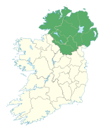
Slieve-na-Aura, also known as Slieveanorra, (from Irish Sliabh an Earra 'mountain of the tail/ridge')[1] is a 1,676-foot-high (511 m) mountain in County Antrim, Northern Ireland. Situated near the village of Loughguile, the mountain sits above Slieveanorra Forest.
This article needs additional citations for verification. (January 2021) |
| Slieve-na-Aura | |
|---|---|
| Highest point | |
| Elevation | 511 m (1,677 ft) |
| Geography | |
| Location | Loughguile, County Antrim, Northern Ireland |
References
- "Orra More or Slieveanorra, County Antrim". Retrieved 28 August 2019.
Текст в блоке "Читать" взят с сайта "Википедия" и доступен по лицензии Creative Commons Attribution-ShareAlike; в отдельных случаях могут действовать дополнительные условия.
Другой контент может иметь иную лицензию. Перед использованием материалов сайта WikiSort.org внимательно изучите правила лицензирования конкретных элементов наполнения сайта.
Другой контент может иметь иную лицензию. Перед использованием материалов сайта WikiSort.org внимательно изучите правила лицензирования конкретных элементов наполнения сайта.
2019-2025
WikiSort.org - проект по пересортировке и дополнению контента Википедии
WikiSort.org - проект по пересортировке и дополнению контента Википедии

