geo.wikisort.org - Mountains
Saint Nicholas Peak is a 2,938-metre (9,639-foot) mountain summit in the Rocky Mountains of Canada. It is located on the Continental Divide, on the Alberta-British Columbia border, in both Banff National Park and Yoho National Park. It lies at the eastern edge of the Wapta Icefield, and is part of the Waputik Mountains which are a sub-range of the Canadian Rockies.
| Saint Nicholas Peak | |
|---|---|
 Mount Olive (left) with Saint Nicholas Peak (right) seen from Bow Lake | |
| Highest point | |
| Elevation | 2,938 m (9,639 ft)[1][2] |
| Prominence | 38 m (125 ft)[1] |
| Parent peak | Mount Olive (3,126 m) |
| Listing | |
| Coordinates | 51°37′40″N 116°30′09″W[3] |
| Geography | |
Saint Nicholas Peak Location in western Alberta  Saint Nicholas Peak Saint Nicholas Peak (British Columbia)  Saint Nicholas Peak Saint Nicholas Peak (Canada) | |
| Country | Canada |
| Provinces | Alberta and British Columbia |
| National Parks | Banff and Yoho |
| Parent range | Waputik Mountains Canadian Rockies |
| Topo map | NTS 82N10 Blaeberry River[3] |
| Climbing | |
| First ascent | 1930 by J. Monroe Thorington, Peter Kaufmann[4][5] |
Name
It was named in 1916 by Arthur O. Wheeler; a particular gendarme on the mountain is said to resemble Santa Claus.[4][1]
Geology
The peak is composed of sedimentary rock laid down during the Precambrian to Jurassic periods.[6] Formed in shallow seas, this sedimentary rock was pushed east and over the top of younger rock during the Laramide orogeny.[7]
Climate
Based on the Köppen climate classification, it is located in a subarctic climate zone with cold, snowy winters, and mild summers.[8] Temperatures can drop below -20 C with wind chill factors below -30 C.
Gallery
- Views of Saint Nicholas Peak
 Saint Nicholas Peak
 Saint Nicholas Peak and Bow Hut
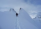 Approaching summit of Saint Nicholas Peak
 Saint Nicholas Peak summit


See also
- Geography of British Columbia
- List of peaks on the British Columbia–Alberta border
References
- "Saint Nicholas Peak". Bivouac.com. Retrieved 2009-01-02.
- British Columbia Official Map Site (click on "Provincial Basemap")
- "St. Nicholas Peak". BC Geographical Names. Retrieved 2013-06-08.
- "St. Nicholas Peak". PeakFinder.com. Retrieved 2007-09-01.
- Thorington, J. Monroe (1966) [1921]. "Kicking Horse Pass to Howse Pass". A Climber's Guide to the Rocky Mountains of Canada. With the collaboration of Putnam, William Lowell (6th ed.). American Alpine Club. p. 150. ISBN 978-1376169003.
- Belyea, Helen R. (1960). The Story of the Mountains in Banff National Park (PDF). parkscanadahistory.com (Report). Ottawa: Geological Survey of Canada. Archived (PDF) from the original on 2015-10-02. Retrieved 2019-09-13.
- Gadd, Ben (2008). Geology of the Rocky Mountains and Columbias.
- Peel, M. C.; Finlayson, B. L.; McMahon, T. A. (2007). "Updated world map of the Köppen−Geiger climate classification". Hydrol. Earth Syst. Sci. 11: 1633–1644. ISSN 1027-5606.
Further reading
- Dave Birrell, 50 Roadside Panoramas in the Canadian Rockies, P 51
External links
- Parks Canada web site: Banff National Park
- Parks Canada web site: Yoho National Park
- Saint Nicholas Peak weather: Mountain Forecast
- Saint Nicholas Peak photo (with Mt. Olive in the back left): Flickr
This Alberta location article is a stub. You can help Wikipedia by expanding it. |
This article about a location in the Interior of British Columbia, Canada is a stub. You can help Wikipedia by expanding it. |
Другой контент может иметь иную лицензию. Перед использованием материалов сайта WikiSort.org внимательно изучите правила лицензирования конкретных элементов наполнения сайта.
WikiSort.org - проект по пересортировке и дополнению контента Википедии