geo.wikisort.org - Mountains
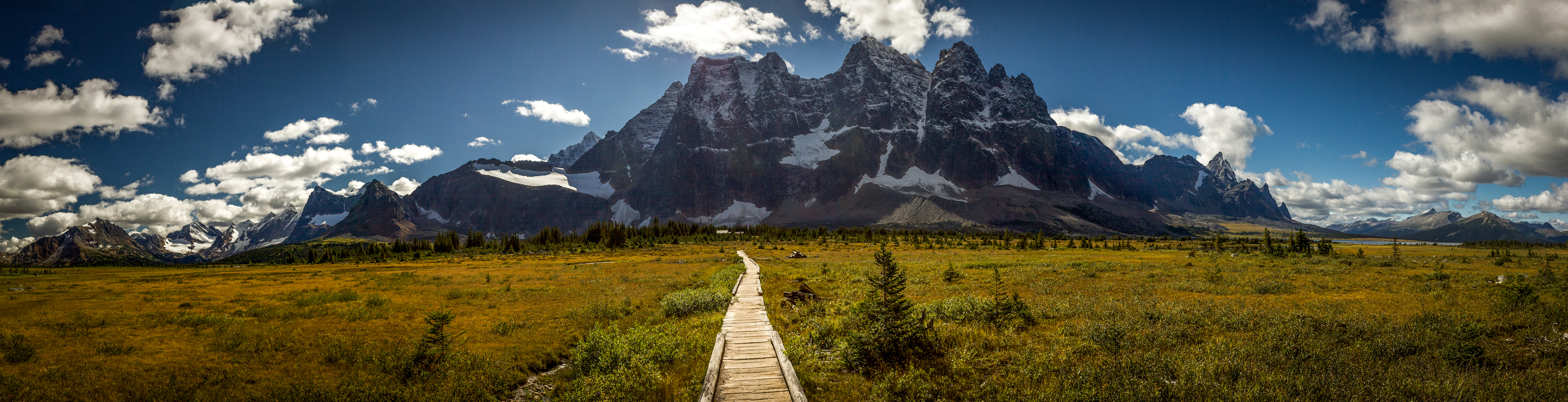
Redoubt Peak is a 3,115-metre (10,220 ft) mountain summit located on the shared border of Jasper National Park in Alberta, and Mount Robson Provincial Park in British Columbia, Canada. Redoubt Peak is part of The Ramparts in the Canadian Rockies. It was named in 1920 because it has an appearance similar to that of a redoubt on a castle.[3] Its nearest higher peak is Dungeon Peak, 0.6 km (0.37 mi) to the southeast.[3]
| Redoubt Peak | |
|---|---|
 Redoubt Peak seen from Amethyst Lakes at sunrise | |
| Highest point | |
| Elevation | 3,115 m (10,220 ft)[1][2] |
| Prominence | 179 m (587 ft)[3] |
| Listing | |
| Coordinates | 52°41′22″N 118°17′57″W[4] |
| Geography | |
Redoubt Peak Location in Alberta and British Columbia  Redoubt Peak Redoubt Peak (British Columbia) | |
| Country | Canada |
| Provinces | Alberta and British Columbia |
| Protected areas |
|
| Parent range | Park Ranges Canadian Rockies |
| Topo map | NTS 83D9 Amethyst Lakes[4] |
| Climbing | |
| First ascent | 1927 F. H. Slark; F. Rutishauser |
| Easiest route | North-West Ridge III 5.6 East Face IV 5.7 |
History
The first ascent was made in 1927 by F. H. Slark and F. Rutishauser, who both perished on the descent. Their summit record was found on the top the following summer (in 1928).[3] The mountain's name became official in 1935 by the Geographical Names Board of Canada.[4]
Climate
Based on the Köppen climate classification, Redoubt Peak is located in a subarctic climate zone with cold, snowy winters, and mild summers.[5] Temperatures can drop below -20 °C with wind chill factors below -30 °C. Precipitation runoff from Redoubt Peak drains into the Athabasca River on its east side, and the Fraser River from the west side.
See also
References
- "Redoubt Peak". PeakFinder.com. Retrieved 2021-10-24.
-
"Topographic map of Redoubt Peak". opentopomap.org. Retrieved 2021-10-24.
{{cite web}}: CS1 maint: url-status (link) - "Redoubt Peak". Bivouac.com. Retrieved 2018-10-18.
- "Redoubt Peak". Geographical Names Data Base. Natural Resources Canada. Retrieved 2018-10-18.
- Peel, M. C.; Finlayson, B. L.; McMahon, T. A. (2007). "Updated world map of the Köppen−Geiger climate classification". Hydrol. Earth Syst. Sci. 11: 1633–1644. ISSN 1027-5606.
External links
- Parks Canada web site: Jasper National Park
- Provincial Park web site: Mount Robson Provincial Park
Gallery

Другой контент может иметь иную лицензию. Перед использованием материалов сайта WikiSort.org внимательно изучите правила лицензирования конкретных элементов наполнения сайта.
WikiSort.org - проект по пересортировке и дополнению контента Википедии