geo.wikisort.org - Mountains
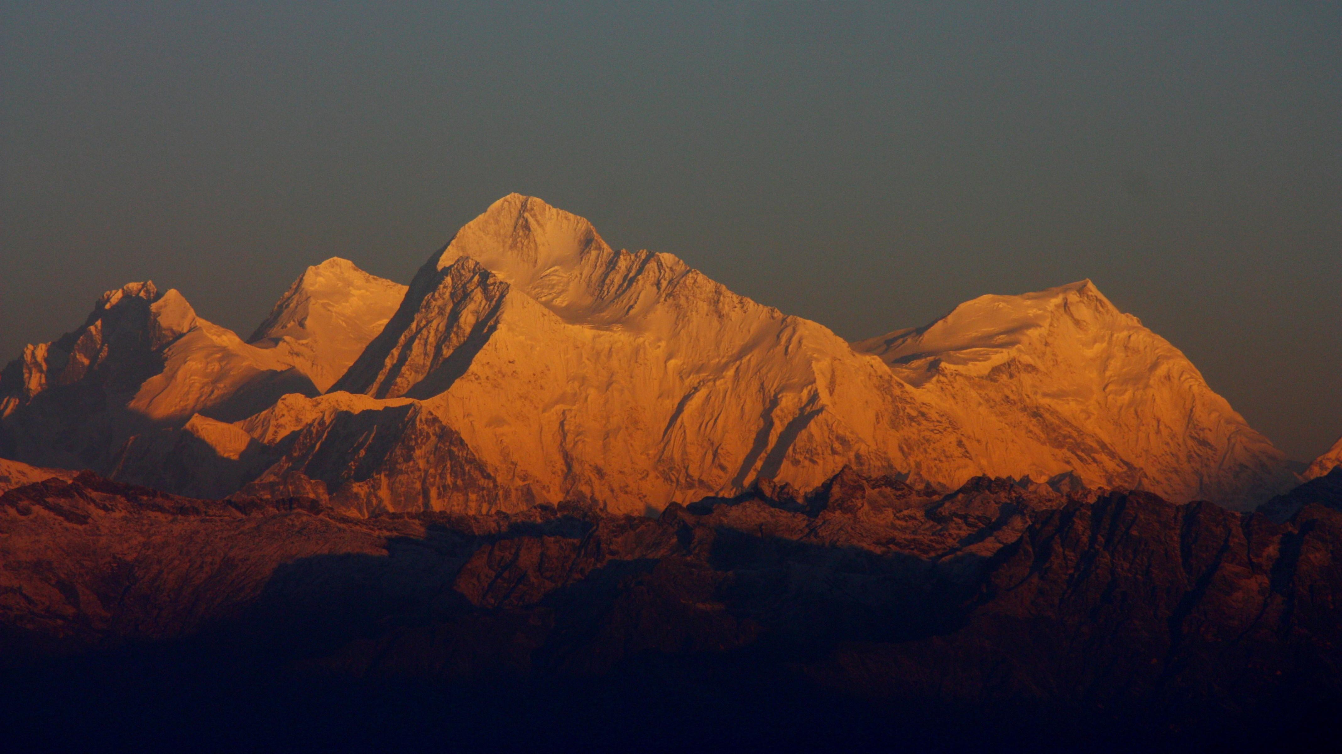
Phalut or Falut 3,600 metres (11,800 ft) is the second highest peak of West Bengal, India. Part of the Singalila Ridge in the Himalayas, it is located at the border of the Indian states of West Bengal and Sikkim and of Nepal. It is located inside the Singalila National Park. A small bunkhouse is near the top of the peak and is administered by the Indian army. Singalila Pass is 17 km away from Phalut.
This article needs additional citations for verification. (March 2013) |
Phalut | |
|---|---|
Village | |
 Phalut Location in West Bengal, India  Phalut Phalut (India) | |
| Coordinates: 27°10′16″N 88°01′12″E | |
| Country | |
| State | West Bengal |
| District | Darjeeling |
| Population (2011) | |
| • Total | 1,633 |
| Languages | |
| • Official | Nepali, English |
| Time zone | UTC+5:30 (IST) |
| Vehicle registration | WB |
| Website | www |
The indigenous tribes surrounding the mountain peak are known as Falutians by outsiders. Falutians have a 300-year history of worshipping the mountain peak, and believe that Phalut is an omniscient god. They refer to the mountain peak as "Omna Re Ay".
CT: census town, R: rural/ urban centre, N: neighbourhood, H: hill centre, NP: national park/ wildlife sanctuary, TE: tea estate, TA: tourist attraction
Abbreviations used in names – TG for Tea Garden (town/village), TE for Tea Estate
Owing to space constraints in the small map, the actual locations in a larger map may vary slightly

This article about a location in the Darjeeling district of West Bengal is a stub. You can help Wikipedia by expanding it. |
На других языках
- [en] Phalut
[fr] Falut
Le Falut (ou Phalut), avec 3 595 m, est le second plus haut sommet de l'État du Bengale-Occidental, Inde. Il appartient à l'arête de Singalila, dans l'Himalaya, et est situé à la frontière des états indiens du Bengale-Occidental et du Sikkim, et du Népal. Il se trouve dans le parc national de Singalila. Un petit refuge, proche du sommet du pic est administré par l'armée indienne.Другой контент может иметь иную лицензию. Перед использованием материалов сайта WikiSort.org внимательно изучите правила лицензирования конкретных элементов наполнения сайта.
WikiSort.org - проект по пересортировке и дополнению контента Википедии