geo.wikisort.org - Montagne
Le Falut (ou Phalut), avec 3 595 m, est le second plus haut sommet de l'État du Bengale-Occidental, Inde. Il appartient à l'arête de Singalila, dans l'Himalaya, et est situé à la frontière des états indiens du Bengale-Occidental et du Sikkim, et du Népal. Il se trouve dans le parc national de Singalila. Un petit refuge, proche du sommet du pic est administré par l'armée indienne.
 Portail du Bengale-Occidental
  Portail de l’Inde
  Portail du Népal
  Portail de la montagne
Cet article est une ébauche concernant la montagne.
Vous pouvez partager vos connaissances en l’améliorant (comment ?) selon les recommandations des projets correspondants.
| Falut | |||||
 |
|||||
| Géographie | |||||
|---|---|---|---|---|---|
| Altitude | 3 595 m | ||||
| Massif | Himalaya | ||||
| Coordonnées | 27° 12′ 47″ nord, 88° 00′ 50″ est | ||||
| Administration | |||||
| Pays | |||||
| États Province |
Bengale-Occidental Sikkim No 1 |
||||
| Districts indien District népalais |
Darjeeling Sikkim de l'Ouest Panchthar |
||||
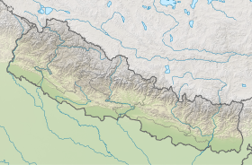
| Géolocalisation sur la carte : Inde
Géolocalisation sur la carte : Népal
Géolocalisation sur la carte : Bengale-Occidental
Géolocalisation sur la carte : Sikkim
| |||||
| modifier |
|||||


На других языках
[en] Phalut
Phalut or Falut 3,600 metres (11,800 ft) is the second highest peak of West Bengal, India. Part of the Singalila Ridge in the Himalayas, it is located at the border of the Indian states of West Bengal and Sikkim and of Nepal. It is located inside the Singalila National Park. A small bunkhouse is near the top of the peak and is administered by the Indian army. Singalila Pass is 17 km away from Phalut.- [fr] Falut
Текст в блоке "Читать" взят с сайта "Википедия" и доступен по лицензии Creative Commons Attribution-ShareAlike; в отдельных случаях могут действовать дополнительные условия.
Другой контент может иметь иную лицензию. Перед использованием материалов сайта WikiSort.org внимательно изучите правила лицензирования конкретных элементов наполнения сайта.
Другой контент может иметь иную лицензию. Перед использованием материалов сайта WikiSort.org внимательно изучите правила лицензирования конкретных элементов наполнения сайта.
2019-2026
WikiSort.org - проект по пересортировке и дополнению контента Википедии
WikiSort.org - проект по пересортировке и дополнению контента Википедии