geo.wikisort.org - Mountains
Mount Verendrye is a 3,086-metre (10,125-foot) mountain summit located in British Columbia, Canada.
| Mount Verendrye | |
|---|---|
 East aspect | |
| Highest point | |
| Elevation | 3,086 m (10,125 ft)[1][2] |
| Prominence | 515 m (1,690 ft)[3] |
| Parent peak | Foster Peak (3,201 m)[3] |
| Isolation | 9.14 km (5.68 mi)[3] |
| Listing | Mountains of British Columbia |
| Coordinates | 51°00′20″N 116°04′31″W[4] |
| Naming | |
| Etymology | Pierre de La Vérendrye |
| Geography | |
 Mount Verendrye Location of Mount Verendrye in British Columbia  Mount Verendrye Mount Verendrye (Canada) | |
| Location | Kootenay National Park British Columbia, Canada |
| District | Kootenay Land District |
| Parent range | Vermilion Range Canadian Rockies |
| Topo map | NTS 82N1 Mount Goodsir |
| Geology | |
| Age of rock | Cambrian[5] |
| Type of rock | Ottertail Limestone[5] |
| Climbing | |
| First ascent | 1922 |
Description
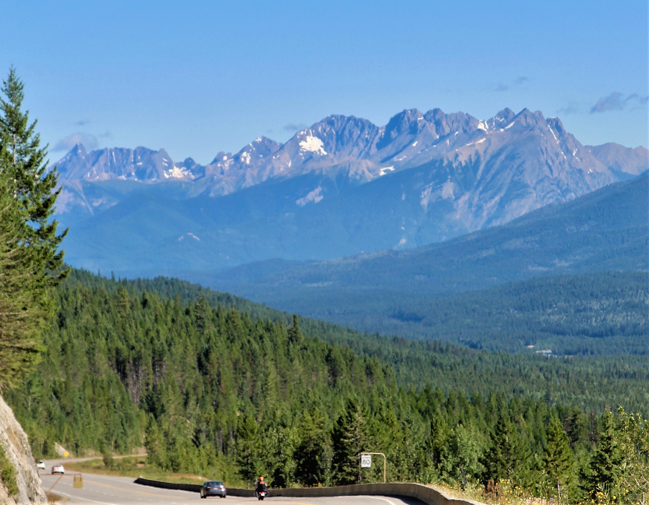
Mount Verendrye is situated on the western boundary of Kootenay National Park near the southern end of the Vermilion Range, which is a sub-range of the Canadian Rockies. The peak is the southern end of what is known as the Rockwall which is an escarpment of the Vermilion Range.[2] The Rockwall Trail is a scenic 55 kilometer (34 mile) traverse of alpine passes, subalpine meadows, hanging glaciers, and limestone cliffs, in some places in excess of 900 m (2,953 ft) above the trail.[6] Neighbors include Floe Peak six kilometers to the northwest and Mount Wardle six kilometers to the southeast. Topographic relief is significant as the summit rises 1,820 meters (5,970 feet) above the Banff–Windermere Highway in six kilometers (3.7 miles). A roadside pullout along the highway near Verendrye Creek provides a view of the mountain and the scorched Verendrye Creek valley which burned in 2003.[7] Precipitation runoff from the mountain drains west to the Kootenay River via Whitetail Creek, and east into Verendrye and Serac Creeks which are tributaries of the Vermilion River. Mount Verendrye is composed of Ottertail limestone, a sedimentary rock laid down during the Cambrian period and pushed east and over the top of younger rock during the Laramide orogeny.[8]
History

The mountain's toponym was applied in 1884 by Canadian surveyor George Mercer Dawson and was officially adopted in 1952 by the Geographical Names Board of Canada to honor Pierre Gaultier de Varennes, sieur de La Vérendrye (1685–1749), a French Canadian military officer, fur trader, and explorer.[9][10] The first ascent of the summit was made in 1922 by Morrison P. Bridgland (1878–1948), a Dominion Land Surveyor who climbed and named many peaks in the Canadian Rockies.[11][12]
Climate
Based on the Köppen climate classification, Mount Verendrye is located in a subarctic climate zone with cold, snowy winters, and mild summers.[13] Winter temperatures can drop below −20 °C with wind chill factors below −30 °C.
Gallery
 Distant view looking north at Mt. Verendrye (center)
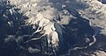 Aerial view of Mt. Wardle (centered), Mt. Verendrye (top, left) and Vermilion River (right)

See also
- Geography of British Columbia
References
- AnneLise Sorensen, Christian Williams (2010), The Rough Guide to Canada, 7th edition, ISBN 978-1-84836-503-2, p. 690
- Bob Hahn (2000), Kootenay National Park, Rocky Mountain Books, ISBN 9780921102748, p. 77
- "Mount Verendrye, British Columbia". Peakbagger.com. Retrieved 2022-10-20.
- "Mount Verendrye". Geographical Names Data Base. Natural Resources Canada. Retrieved 2022-10-20.
-
Baird, David M. (1964). Kootenay National Park: Wild mountains and great valleys (PDF) (Report). Geological Survey of Canada. Miscellaneous Report 9. Retrieved 2020-01-06.
{{cite report}}: CS1 maint: url-status (link) - "Backpacking - Kootenay National Park". pc.gc.ca. Parks Canada. 2020-01-02. Retrieved 2020-01-06.
- Brian Patton (2007), Parkways of the Canadian Rockies, Summerthought Publishing Limited, ISBN 9780978237523, p. 60
- Gadd, Ben (2008). Geology of the Rocky Mountains and Columbias.
- "Mount Verendrye". BC Geographical Names. Retrieved 2022-10-19.
- Glen W. Boles, 2006, Mountain Place Names: The Rockies and Columbia Mountains, Rocky Mountain Books, ISBN 978-1-894765-79-4, p. 260
- MacLaren, I.S. (2005). Mapper of Mountains M.P. Bridgland in the Canadian Rockies 1902-1930. With Eric Higgs, Gabrielle Zezulka-Mailloux. Edmonton, AB: The University of Alberta Press. ISBN 0-88864-456-6.
- "Mount Verendrye". PeakFinder.com. Retrieved 2022-10-20.
- Peel, M. C.; Finlayson, B. L.; McMahon, T. A. (2007). "Updated world map of the Köppen−Geiger climate classification". Hydrol. Earth Syst. Sci. 11: 1633–1644. ISSN 1027-5606.
External links
- Weather: Mount Verendrye
- Parks Canada web site: Kootenay National Park
Places adjacent to Mount Verendrye | ||||||||||||||||
|---|---|---|---|---|---|---|---|---|---|---|---|---|---|---|---|---|
| ||||||||||||||||
Другой контент может иметь иную лицензию. Перед использованием материалов сайта WikiSort.org внимательно изучите правила лицензирования конкретных элементов наполнения сайта.
WikiSort.org - проект по пересортировке и дополнению контента Википедии