geo.wikisort.org - Mountains
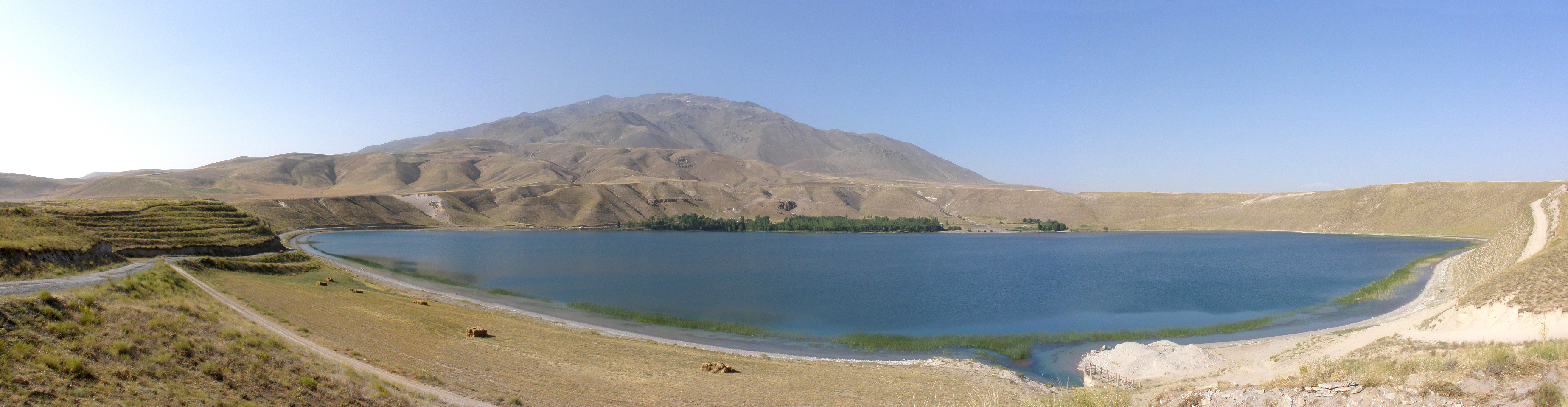
Mount Süphan (Turkish: Süphan Dağı, Kurdish: Sîpanê Xelatê, Armenian: Սիփան, Sipan) is a stratovolcano located in eastern Turkey, immediately north of Lake Van. It is the second highest volcano in Turkey, with an elevation of 4,058 metres (13,314 feet), and has the third highest prominence of the Armenian Highlands, after Mount Ararat (5,137 m) and Mount Aragats (4,090 m).
| Mount Süphan | |
|---|---|
 Mount Süphan in October 2007 | |
| Highest point | |
| Elevation | 4,058 m (13,314 ft)[1][2] |
| Prominence | 2,189 m (7,182 ft)[2][3] |
| Listing | Ultra |
| Coordinates | 38°55′54″N 42°50′03″E[3][4] |
| Geography | |
 Mount Süphan Location in Turkey | |
| Location | Bitlis Province, Turkey |
| Parent range | Armenian Highlands |
| Geology | |
| Age of rock | Holocene[4] |
| Mountain type | Stratovolcano[5] |
| Last eruption | 8050 BCE (?)[4] |
The mountain has two peaks, east and west, separated by a 1.5 km-wide basin; there are two small lakes in this basin.[6] The eastern summit is much larger in area and consists of "a wide snow-covered platform of cairn-like bare rock peaks".[6] From here, the whole northern shore of Lake Van is visible, along with Mount Ararat, the Murat Su plain, and even the Palandöken Dag south of Erzurum.[6] The smaller western summit has fields of lava boulders.[6] A narrow ridge connects the two peaks.[6] All sides of the mountain are marked by lava "ribs".[6] The slope is fairly gentle on all sides except the north.[6]
The remains of the small Urartian fort of Kefirkalesi are located on the southwest slope at a height of 2400 m.[6] This was probably never intended to have a permanent garrison and was mostly to keep local nomadic groups in check.[6] Today, there are a few small villages along the mountain's lower slopes.[6] About 1.5 km west of the village of Harmantepe (formerly Norsunçuk), there is also an ancient cemetery with urns that may have once contained cremated remains.[6]
Gallery

See also
References
- Kurter, Ajun (20 May 1988). "Glaciers of the Middle East and Africa: Turkey" (PDF). United States Geological Survey Professional Paper. Archived from the original on 11 October 2017.
{{cite journal}}: Cite journal requires|journal=(help)CS1 maint: bot: original URL status unknown (link) - "Suphan Dagi, Turkey". Peakbagger.com. Retrieved January 25, 2014.
- "Turkey Mountain Ultra-Prominence". Peaklist.org. Retrieved January 25, 2014.
- "Suphan Dagi". Global Volcanism Program. Smithsonian Institution. Retrieved 2021-01-10.
- "Mount Sipan Stratovolcano North of Lake Van, Turkey". Earth Snapshot. Retrieved January 25, 2014.
- Sinclair, T.A. (1987). Eastern Turkey: An Architectural & Archaeological Survey, Volume I. London: Pindar Press. pp. 272–3, 278. ISBN 0-907132-32-4. Retrieved 20 May 2022.
External links
| Mountain ranges | |
|---|---|
| Mountains |
|
This article about an Eastern Anatolia Region of Turkey location is a stub. You can help Wikipedia by expanding it. |
На других языках
[de] Süphan Dağı
Der Süphan Dağı (kurdisch Çiyayê Sîpan, armenisch Սիփան Սար) ist ein 4058 Meter[1] hoher ruhender Schichtvulkan im Osten von Anatolien in der Türkei. Er liegt am Nordufer des Vansees an der Grenze der beiden Provinzen Ağrı und Bitlis. Am Gipfel befinden sich das ganze Jahr über Schneefelder.- [en] Mount Süphan
[fr] Süphan Dağı
Le Süphan Dağı, en kurde Sîpana Xelatêest ou çiyayê Sîpan, en arménien Սիփան լեռ, est un stratovolcan turc situé au nord du lac de Van, sur le Haut-plateau arménien.[it] Monte Süphan
Il monte Süphan (in turco Süphan Dağı) è uno stratovulcano della Turchia orientale, nell'Altopiano armeno, subito a nord del lago di Van. Raggiunge un'altitudine di 4.058 m s.l.m.[ru] Сюпхан
Сюпхан или Сюпхандаг[3] (тур. Süphan Dağı, арм. Սիփան լեռ (Sipʰɑn lɛṙ), курд. Sîpana Xelatê) — потухший стратовулкан, расположенный в восточной Турции, в непосредственной близости от озера Ван. Последнее извержение вулкана по оценкам учёных произошло около 100 тыс. лет назад (± 20 тыс. лет)[1]. Сюпхан достигает высоты 4033 м над уровнем моря и является вторым по высоте (после Арарата) вулканом в Турции и третьим — во всем Армянском нагорье. Расположен в зоне столкновения Аравийской и Евразийской тектонических плит, которое предопределяет сейсмическую и вулканическую активность региона.Другой контент может иметь иную лицензию. Перед использованием материалов сайта WikiSort.org внимательно изучите правила лицензирования конкретных элементов наполнения сайта.
WikiSort.org - проект по пересортировке и дополнению контента Википедии