geo.wikisort.org - Mountains
Mount Indefatigable is a 2,667-metre (8,750-foot) mountain summit located in Peter Lougheed Provincial Park in the Canadian Rockies of Alberta, Canada. The peak is visible from Alberta Highway 40, and the Kananaskis Lakes area. Mount Indefatigable's nearest higher neighbor is Mount Invincible, 1.8 km (1.1 mi) to the northwest.[1]
| Mount Indefatigable | |
|---|---|
 The southern aspect of Mount Indefatigable | |
| Highest point | |
| Elevation | 2,667 m (8,750 ft)[1] |
| Prominence | 198 m (650 ft)[1] |
| Parent peak | Mount Invincible (2700 m)[1] |
| Listing | Mountains of Alberta |
| Coordinates | 50°39′12″N 115°10′19″W[2] |
| Geography | |
Mount Indefatigable Location of Mount Indefatigable in Alberta  Mount Indefatigable Mount Indefatigable (Canada) | |
| Location | Alberta, Canada |
| Parent range | Spray Mountains Canadian Rockies |
| Topo map | NTS 82J11 Kananaskis Lakes[2] |
| Climbing | |
| First ascent | 1901 by Walter D. Wilcox[3] |
| Easiest route | Scrambling |
Like so many of the mountains in Kananaskis Country, Mount Indefatigable received its name from the persons and ships involved in the 1916 Battle of Jutland, the only major sea battle of the First World War.[4]
History
Mount Indefatigable was named in 1917 for HMS Indefatigable, a British battlecruiser that sank during the Battle of Jutland in World War I.[3][5] The mountain's name was officially adopted in 1922 by the Geographical Names Board of Canada.[2]
The first ascent of the peak was made in 1901 by Walter D. Wilcox.[3]
In 2005, the popular trail to the summit of Mount Indefatigable was decommissioned to protect prime grizzly bear habitat. Though the unmaintained trail still exists, travel is discouraged by Alberta Parks.[6]
Geology
Mount Indefatigable is composed of sedimentary rock laid down during the Precambrian to Jurassic periods. Formed in shallow seas, this sedimentary rock was pushed east and over the top of younger rock during the Laramide orogeny.[7]
Climate
Based on the Köppen climate classification, Mount Indefatigable is located in a subarctic climate with cold, snowy winters, and mild summers.[8] Temperatures can drop below −20 °C with wind chill factors below −30 °C. Precipitation runoff from the mountain drains east into the Kananaskis River, thence into the Bow River.
Gallery
 Mount Indefatigable in winter
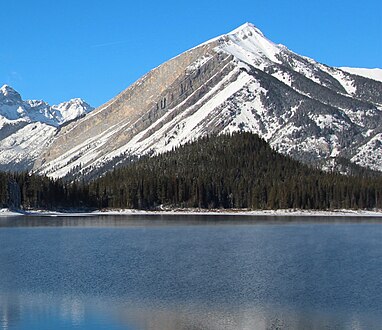 Mount Indefatigable
 Mount Indefatigable reflected in Upper Kananaskis Lake
 Indefatigable on the right side


See also
- List of mountains in the Canadian Rockies
- Geography of Alberta
References
- "Mount Indefatigable". Bivouac.com. Retrieved 2018-12-07.
- "Mount Indefatigable". Geographical Names Data Base. Natural Resources Canada. Retrieved 2018-12-07.
- "Mount Indefatigable". PeakFinder.com. Retrieved 2021-03-30.
- Battle of Jutland Alberta Historic Places
- Place-names of Alberta. Ottawa: Geographic Board of Canada. 1928. p. 67.
- "Why you shouldn't go up the Mt. Indefatigable trail". Friends of Kananaskis Country.
- Gadd, Ben (2008), Geology of the Rocky Mountains and Columbias
- Peel, M. C.; Finlayson, B. L.; McMahon, T. A. (2007). "Updated world map of the Köppen−Geiger climate classification". Hydrol. Earth Syst. Sci. 11 (5): 1633–1644. Bibcode:2007HESS...11.1633P. doi:10.5194/hess-11-1633-2007. ISSN 1027-5606. S2CID 9654551.
External links
- Mount Indefatigable weather: Mountain Forecast
Places adjacent to Mount Indefatigable | |
|---|---|
Другой контент может иметь иную лицензию. Перед использованием материалов сайта WikiSort.org внимательно изучите правила лицензирования конкретных элементов наполнения сайта.
WikiSort.org - проект по пересортировке и дополнению контента Википедии