geo.wikisort.org - Mountains
Mount Davidson is a 2,919-metre (9,577-foot) mountain summit located to the north of the head of Waiparous Creek, Municipal District of Bighorn No. 8, southwestern Alberta, Canada. Visible from Calgary, it is situated 18 km (11 mi) north of Lake Minnewanka. Its nearest higher peak is Waiparous Peak, located on the same ridge 3.5 km (2 mi) to the northeast.[4] The first ascent of the mountain was made in October 1988 by Frank Campbell and Karl Nagy.[3]
| Mount Davidson | |
|---|---|
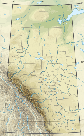
 Mount Davidson Location in Alberta  Mount Davidson Mount Davidson (Canada) | |
| Highest point | |
| Elevation | 2,919 m (9,577 ft)[1] |
| Listing | Mountains of Alberta |
| Coordinates | 51°24′21″N 115°20′24″W[2] |
| Geography | |
| Location | Don Getty Wildland Provincial Park Alberta, Canada |
| Parent range | Rocky Mountains |
| Climbing | |
| First ascent | 1988 Frank Campbell and Karl Nagy[3] |
Mount Davidson is named after James Wheeler Davidson (1872 – 1933).[3][5]
See also
- Geography of Alberta
- Geology of Alberta
References
- Peakery - Mount Davidson Alberta
- Geographical Names
- Spectacular Mountains - Mount Davidson & Waiparous Peak
- "Mount Davidson, British Columbia". Peakbagger.com. Retrieved 2019-11-12.
- Peakfinder - Mount Davidson
External links
- Weather: Mount Davidson
Текст в блоке "Читать" взят с сайта "Википедия" и доступен по лицензии Creative Commons Attribution-ShareAlike; в отдельных случаях могут действовать дополнительные условия.
Другой контент может иметь иную лицензию. Перед использованием материалов сайта WikiSort.org внимательно изучите правила лицензирования конкретных элементов наполнения сайта.
Другой контент может иметь иную лицензию. Перед использованием материалов сайта WikiSort.org внимательно изучите правила лицензирования конкретных элементов наполнения сайта.
2019-2025
WikiSort.org - проект по пересортировке и дополнению контента Википедии
WikiSort.org - проект по пересортировке и дополнению контента Википедии