geo.wikisort.org - Mountains
Mount Chephren is a mountain located in the Mistaya River Valley of Banff National Park, Canada.
| Mount Chephren | |
|---|---|
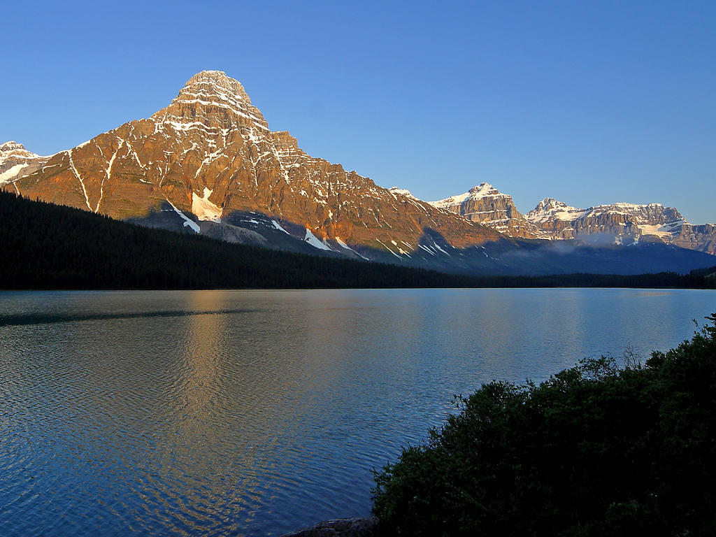 Mount Chephren and Waterfowl Lake seen from the Icefields Parkway | |
| Highest point | |
| Elevation | 3,266 m (10,715 ft)[1][2][3]: 306 [lower-alpha 1] |
| Prominence | 443 m (1,453 ft)[5][lower-alpha 2] |
| Parent peak | Howse Peak (3295 m)[5] |
| Listing | Mountains of Alberta |
| Coordinates | 51°50′25″N 116°40′59″W[7] |
| Geography | |
Mount Chephren Location in Alberta | |
| Location | Alberta, Canada |
| Parent range | Waputik Mountains |
| Topo map | NTS 82N15 Mistaya Lake |
| Geology | |
| Type of rock | Quartzite, Limestone, Dolomite[3]: 306 |
| Climbing | |
| First ascent | 1913 by J.W.A. Hickson, guided by Edward Feuz jr.[2] |
| Easiest route | Scramble (difficult) on south face |
Mount Chephren was named after Chephren, the 4th Dynasty Egyptian pharaoh. The mountain was originally named Pyramid Mountain in 1897 by J. Norman Collie, but it conflicted with an identically named peak in Jasper National Park, so it was renamed in 1924 to its present name.[8][4][2]
Routes
Scramble
Mount Chephren is rated a difficult scramble on the south face due to its steep upper slopes with possible snow and ice difficulties. Considerable snow on the route would likely require crampons and an ice axe, thereby pushing the climb into the realm of technical mountaineering. The best conditions for scrambling would normally be late July and August.[4]
The trail head is located at the west end of the Waterfowl Lakes campground off the Icefields Parkway in Banff National Park. The elevation gain from the trail head to the summit is 1,630 m (5,348 ft).[4]
Technical
There are three main routes:[2][9]
- South Face/West Ridge (Normal Route) II
- East Face V 5.9 A1
- The Wild Thing VI 5.9 A3 WI4
References
- Bow Lake and Saskatchewan Crossing (Map). Cochrane, AB: Gem Trek Publishing. 1995. ISBN 1-895526-10-8. Retrieved 2021-06-13.
- "Mount Chephren". PeakFinder.com. Retrieved 2003-11-08.
- Gadd, Ben (2008). Canadian Rockies Geology Road Tours. Jasper, AB: Corax Press. ISBN 978-0-9692631-2-8.
- Kane, Alan (1999). Scrambles in the Canadian Rockies. Calgary: Rocky Mountain Books. pp. 300–301. ISBN 0-921102-67-4.
- "Mount Chephren". Bivouac.com. Retrieved 2013-05-18.
- "Mount Chephren". Peakbagger.com. Retrieved 2021-06-13.
- "Mount Chephren". Geographical Names Data Base. Natural Resources Canada. Retrieved 2013-05-18.
- "Official naming date". Natural Resources Canada. Retrieved 2019-05-07.
- Dougherty, Sean (1991). Selected Alpine Climbs in the Canadian Rockies. Rocky Mountain Books. p. 174. ISBN 9780921102144.
- Notes
На других языках
[de] Mount Chephren
Der Mount Chephren ist ein in den kanadischen Ausläufern der Rocky Mountains liegender Berg, der auf Grund seiner Form nach der Chephren-Pyramide benannt wurde. Der 3274 m hohe Berg liegt etwa sechs Kilometer nordwestlich vom Howse Peak, dem höchsten Gipfel der Waputik-Kette im Banff-Nationalpark, und ist vom Icefields Parkway aus gut zu sehen.- [en] Mount Chephren
[fr] Mont Chephren
Le mont Chephren (en anglais : Mount Chephren) est une montagne située dans la vallée de la rivière Mistaya (en), dans le parc national Banff, en Alberta (Canada). Le mont Chephren a été nommé d'après Khéphren, un pharaon de la IVe dynastie égyptienne. La montagne est nommée Pyramid Mountain en 1897 par John Norman Collie mais, un autre sommet portant déjà ce nom dans le parc national de Jasper, elle est renommée en 1918 et reçoit son nom actuel[1],[3].Другой контент может иметь иную лицензию. Перед использованием материалов сайта WikiSort.org внимательно изучите правила лицензирования конкретных элементов наполнения сайта.
WikiSort.org - проект по пересортировке и дополнению контента Википедии