geo.wikisort.org - Mountains
The Long Range Mountains are a series of mountains along the west coast of the Canadian island of Newfoundland. The long range mountains form the northernmost section of the Appalachian mountain chain on the eastern seaboard of North America.
This article may need to be rewritten to comply with Wikipedia's quality standards. (October 2022) |
| Long Range Mountains Mekapiisk (Mi'kmaq)[1] | |
|---|---|
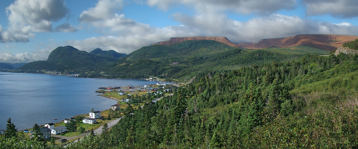
 Western Brook Pond, a fjord in the Long Range Mountains. (Gros Morne National Park, Newfoundland) | |
| Highest point | |
| Peak | The Cabox |
| Elevation | 814 m (2,671 ft) |
| Geography | |
| Country | Canada |
| Province | Newfoundland and Labrador |
| Range coordinates | 49°19.5′N 57°48.25′W |
| Parent range | Appalachian Mountains |
![Table Mountain (518 m [1,699 ft]) along the Trans-Canada Highway](http://upload.wikimedia.org/wikipedia/commons/b/be/NLW_Table1_tango7174.jpg)
Mapping of the Great Northern Peninsula was first done in the early 1900s by Mattie Mitchell, Mi'kmaq chieftain, guide and explorer.[2] In 2003, it was announced that the International Appalachian Trail would be extended through the Long Range Mountains. A portion of the trail opened in 2006.
Description
The Great Northern Peninsula of Western Newfoundland contains the Highlands, the largest external basement massif of the Grenville Orogeny in the Appalachian Orogen. This Precambrian basement is known as the Long Range Inlier, Long Range Complex or Basement Gneiss Complex, consisting of quartz-feldspar gneisses and granites that are up to 1,550 million years in age. The Long Range dikes are mafic in composition and have an age of about 605 million years.[3]
Running along the Gulf of St. Lawrence, the range includes the following sections:
- Anguille Mountains,
- Lewis Hills,
- Tablelands (a section of the Earth's mantle exposed at the surface)
- main section of the Long Range Mountains (running northeast from the Tablelands through Gros Morne National Park)
| Rank | Name | m | ft |
|---|---|---|---|
| 1 | The Cabox | 814 | 2671 |
| 2 | Gros Morne | 807 | 2644 |
| 3 | Blue Mountain | 800 | 2625 |
| 4 | Big Level | 795 | 2608 |
| 5 | Round Hill | 763 | 2653 |
| 6 | Rocky Harbour Hill | 756 | 2480 |
| 7 | Mount Saint Gregory | 686 | 2251 |
| 8 | Gros Paté | 673 | 2208 |
| 9 | Big Hill | 659 | 2162 |
| 10 | Old Crow | 649 | 2129 |
See also
- Avalonia
References
- Hewson, John (1978). KIILUSUAQANEY WI'KATIKIIN. Department of Linguistics, Memorial University of Newfoundland.
- Parks Canada – News Releases and Backgrounders
- Williams, Harold (1995). Geology of the Appalachian-Caledonian Orogen in Canada and Greenland, Geology of Canada, no. 6. Canada: Geological Survey of Canada. pp. 50–54, 63, 67–68, 637. ISBN 0-660-13134-X.
На других языках
[de] Long Range Mountains
Die Long Range Mountains sind eine etwa 450 km lange Bergkette an der Westküste Neufundlands, die geologisch – im Kontext der Kaledonischen Gebirgsbildung – die nördliche Fortsetzung der Appalachen bildet und sich von Port aux Basques bis St. Anthony erstreckt.- [en] Long Range Mountains
[fr] Monts Long Range
Les monts Long Range (anglais : Long Range Mountains) sont une subdivision des Appalaches qui longe l'ouest de l'île de Terre-Neuve ainsi que la péninsule du Nord. La chaîne comprend les deux plus hauts sommets de l'île, soit The Cabox (814 m) et le Gros Morne (806 m).[ru] Лонг-Рейндж
Лонг-Рейндж (англ. Long Range Mountains) — горы на западном побережье острова Ньюфаундленд. Сложены докембрийскими гранитами и гнейссами и кембрийскими диабазами. Максимальная высота — 812 м (гора Кабокс).Другой контент может иметь иную лицензию. Перед использованием материалов сайта WikiSort.org внимательно изучите правила лицензирования конкретных элементов наполнения сайта.
WikiSort.org - проект по пересортировке и дополнению контента Википедии