geo.wikisort.org - Mountains
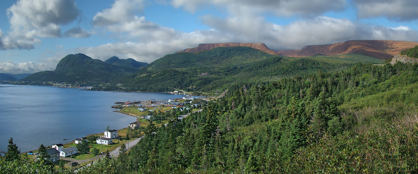
Pic a Tenerife (/tɛnəˈriːf/; Spanish: [teneˈɾife]) is a mountain located in western Newfoundland, near the coastal community of Glenburnie in Gros Morne National Park. It is 545 m (1,788 ft) high and was named by Captain James Cook in 1767. It takes its name from the island of Tenerife in Spain.[1]
| Pic a Tenerife | |
|---|---|
 | |
| Highest point | |
| Elevation | 545 m (1,788 ft) |
| Prominence | 545 m (1,788 ft) |
| Coordinates | 49°26′10″N 57°55′23″W |
| Geography | |
 Pic a Tenerife Newfoundland, Canada | |
| Parent range | Long Range Mountains |
| Topo map | NTS 12H5 Lomond |
| Climbing | |
| Easiest route | class 2 scramble |
See also
References
This Newfoundland and Labrador location article is a stub. You can help Wikipedia by expanding it. |
На других языках
- [en] Pic a Tenerife
[fr] Pic a Tenerife
Le pic a Tenerife est une montagne située dans l'ouest de l'île de Terre-Neuve (Canada), près de la communauté côtière de Glenburnie, dans le parc national du Gros-Morne. Il s'élève à 545 mètres d'altitude. Son nom a été donné par le capitaine James Cook en 1767 d'après l'île de Tenerife dans les îles Canaries d'Espagne[1].Текст в блоке "Читать" взят с сайта "Википедия" и доступен по лицензии Creative Commons Attribution-ShareAlike; в отдельных случаях могут действовать дополнительные условия.
Другой контент может иметь иную лицензию. Перед использованием материалов сайта WikiSort.org внимательно изучите правила лицензирования конкретных элементов наполнения сайта.
Другой контент может иметь иную лицензию. Перед использованием материалов сайта WikiSort.org внимательно изучите правила лицензирования конкретных элементов наполнения сайта.
2019-2026
WikiSort.org - проект по пересортировке и дополнению контента Википедии
WikiSort.org - проект по пересортировке и дополнению контента Википедии