geo.wikisort.org - Mountains
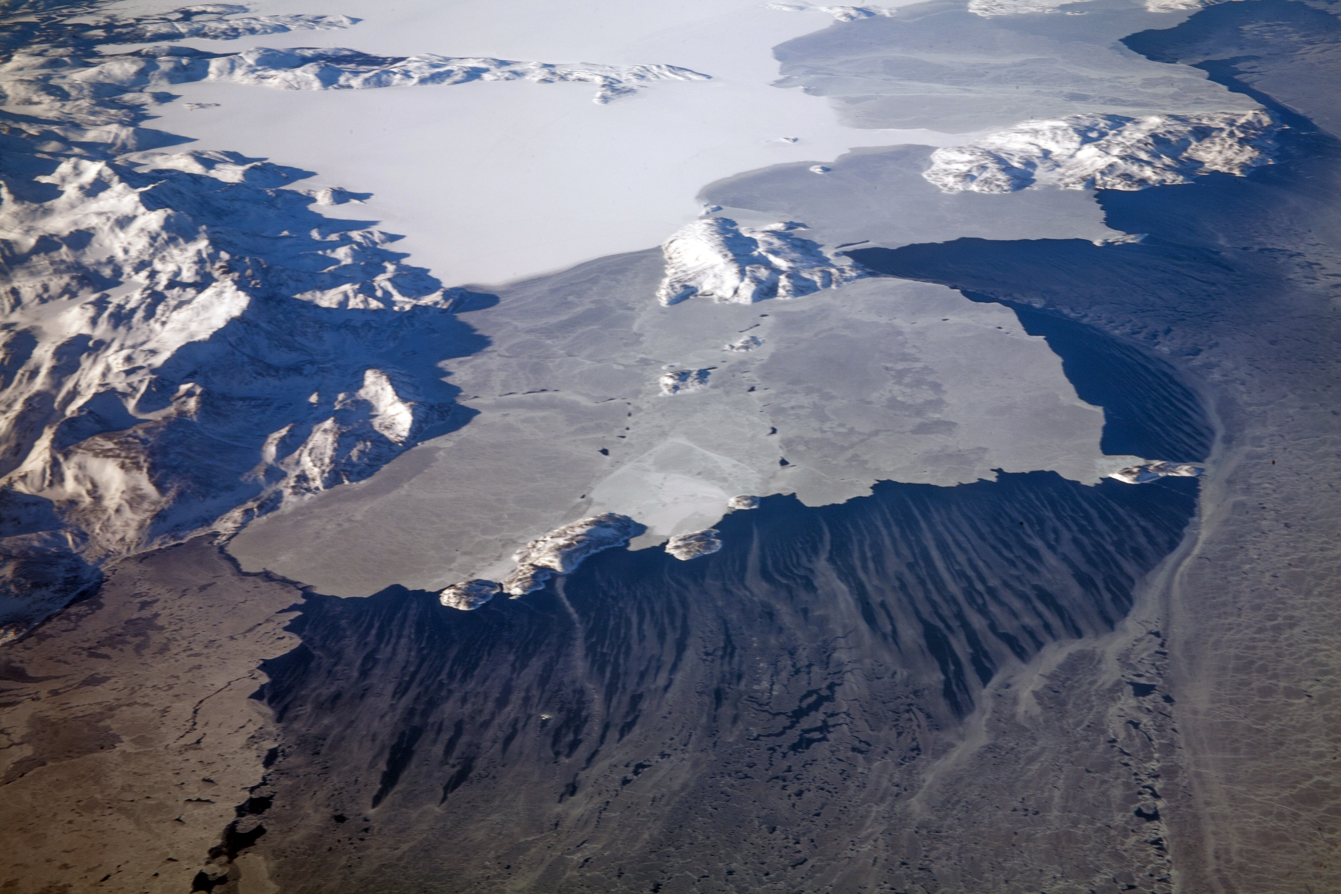
The Kiglapait Mountains lie north of Nain, in northern Labrador, south of the Torngat and Kaumajet Mountains. Not as high as those ranges, they still boast very rugged terrain and many peaks with high prominence values. The name means "dog-tooth."
| Rank | Name | m | ft |
|---|---|---|---|
| 1 | Man O'War Peak | 1050 | 3445 |
| 2 | Peak 3400 (14E/2) | 1036+ | 3400+ |
| 3 | Peak 3300 (14E/1) | 1006+ | 3300+ |
| 4 | Peak 3300 (14E/2) | 1006+ | 3300+ |
| 5 | Peak 3200 (14E/1) | 975+ | 3200 |
| 6 | Peak 3100 (14E/1) | 945+ | 3100+ |
| 7 | Peak 3000#1 (14D/16) | 914+ | 3000+ |
| 8 | Aupalukitak Mountain | 914+ | 3000+ |
| 9 | Mount Thoresby | 914+ | 3000+ |
| 10 | Peak 3000#2 (14D/16) | 914+ | 3000+ |

External links
- "Kiglapait Mountains 2500-foot Peaks". Peakbagger.com.
- Photo gallery, Aerial photos of Kiglapait Mountains by Doc Searls
This Labrador location article is a stub. You can help Wikipedia by expanding it. |
На других языках
- [en] Kiglapait Mountains
[fr] Monts Kiglapait
Les monts Kiglapait[1] sont une chaîne de montagnes faisant partie de la cordillère Arctique dans le bouclier canadien et situés sur la péninsule du Labrador, dans la province de Terre-Neuve-et-Labrador.Текст в блоке "Читать" взят с сайта "Википедия" и доступен по лицензии Creative Commons Attribution-ShareAlike; в отдельных случаях могут действовать дополнительные условия.
Другой контент может иметь иную лицензию. Перед использованием материалов сайта WikiSort.org внимательно изучите правила лицензирования конкретных элементов наполнения сайта.
Другой контент может иметь иную лицензию. Перед использованием материалов сайта WikiSort.org внимательно изучите правила лицензирования конкретных элементов наполнения сайта.
2019-2026
WikiSort.org - проект по пересортировке и дополнению контента Википедии
WikiSort.org - проект по пересортировке и дополнению контента Википедии