geo.wikisort.org - Mountains
Laguna Caldera is a potentially active volcanic caldera and a geographical depression in Rizal, Philippines. It is broadly elliptical in shape, with dimensions of 20 by 10 km. It has a summit elevation of 743 m or 2,438 feet.[1] The caldera forms the middle lobe of Laguna de Bay, bound by the Morong Peninsula and Talim Island to the west, and the Jalajala Peninsula to the east.
This article needs additional citations for verification. (February 2020) |
| Laguna Caldera | |
|---|---|
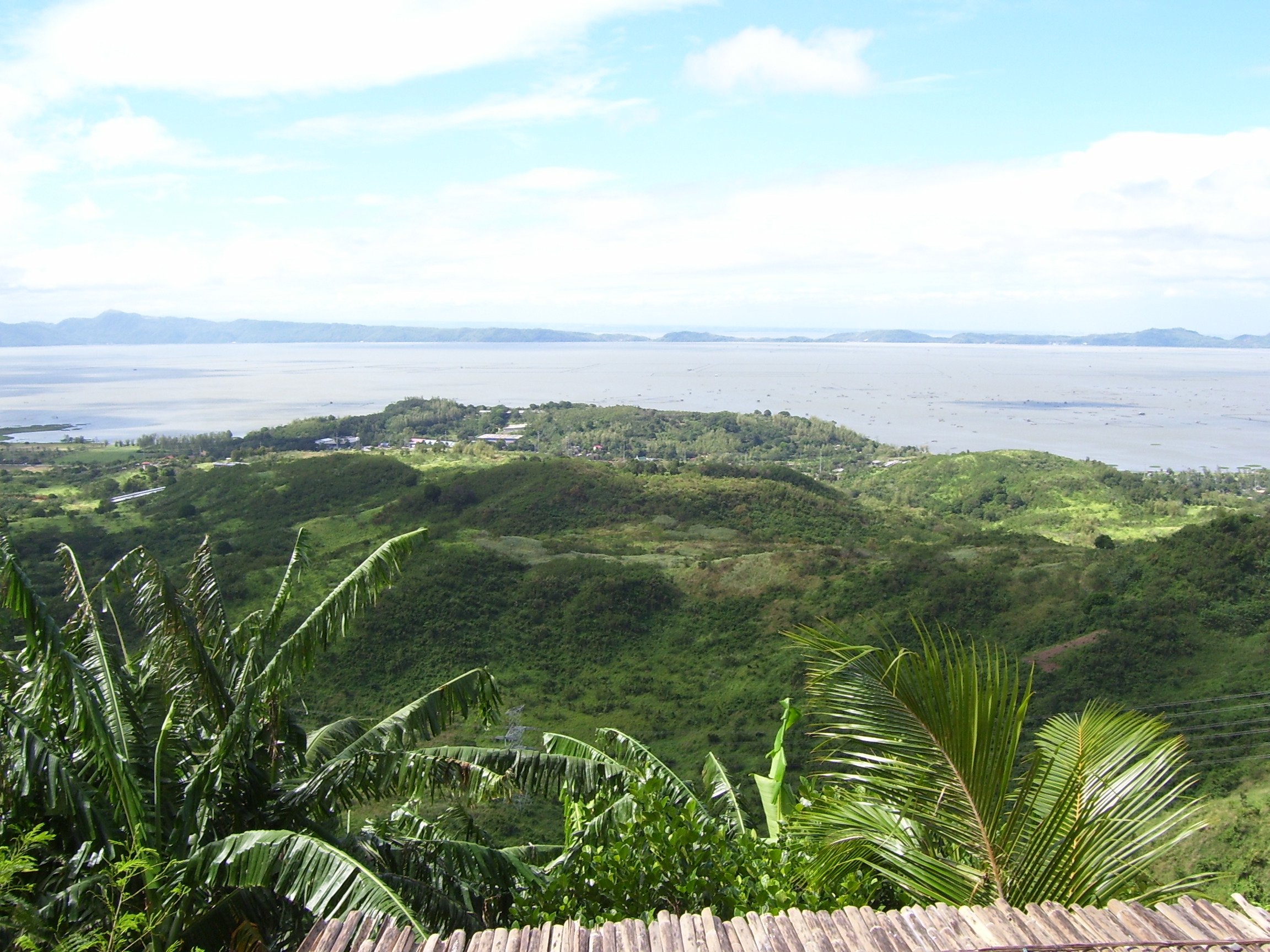
 Laguna Caldera looking northwest | |
| Highest point | |
| Elevation | 743 m (2,438 ft) |
| Coordinates | 14°27′30″N 121°20′46″E |
| Geography | |
 Laguna Caldera Location of Laguna Caldera in the Philippines | |
| Location | Rizal, Philippines |
| Geology | |
| Mountain type | Caldera |
| Volcanic arc/belt | Macolod Corridor |
| Last eruption | Approx. 1.2 Million Years Ago |
The caldera may have formed in two stages about 1 million and 27,000-29,000 years ago, during which time at least two major explosive eruptions took place. It is unknown when the Laguna Caldera last erupted but it may have been active during the Holocene.[1] Deposits from the caldera form thick ignimbrite sheets in Rizal, Metro Manila, Laguna, and Bulacan.[2] Remnants of volcanic activity include undated maars at the southern end of Talim Island and a solfatara field on nearby Mount Sembrano.[1]
Photographs
 Laguna Caldera looking east
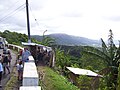 Laguna Caldera looking south-east
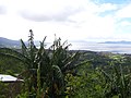 Laguna Caldera looking south
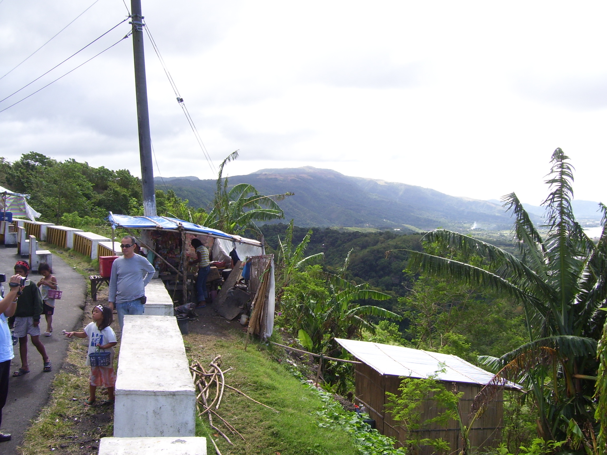
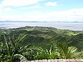 Laguna Caldera looking west


See also
- List of active volcanoes in the Philippines
- List of potentially active volcanoes in the Philippines
- List of inactive volcanoes in the Philippines
- Philippine Institute of Volcanology and Seismology
- Volcano
- Pacific ring of fire
References
- "Laguna Caldera". Global Volcanism Program. Smithsonian Institution. Retrieved 2021-06-25.
- Catane, S. G. (2005). Explosive volcanism in the Philippines. Sendai-shi: Tōhoku Daigaku Tōhoku Ajia Kenkyū Sentā. ISBN 4901449257. OCLC 61505021.
"The Largest Lake in the Philippines" | |||||||
| Location |
|  | |||||
| Basin country |
| ||||||
| Islands | |||||||
| Primary outflow | |||||||
| Primary inflows |
| ||||||
| Settlements |
| ||||||
Luzon, Philippines | |||||||
Другой контент может иметь иную лицензию. Перед использованием материалов сайта WikiSort.org внимательно изучите правила лицензирования конкретных элементов наполнения сайта.
WikiSort.org - проект по пересортировке и дополнению контента Википедии