geo.wikisort.org - Mountains
Mount Banahaw (IPA: [bɐ'nahaʊ]; also spelled as Banahao and Banájao) is an active complex volcano on Luzon in the Philippines. The three-peaked volcano is located at the boundary of Laguna and Quezon provinces. It is the highest mountain in both provinces and Calabarzon region, dominating the landscape for miles around.[4]
| Mount Banahaw | |
|---|---|
| Banahao | |
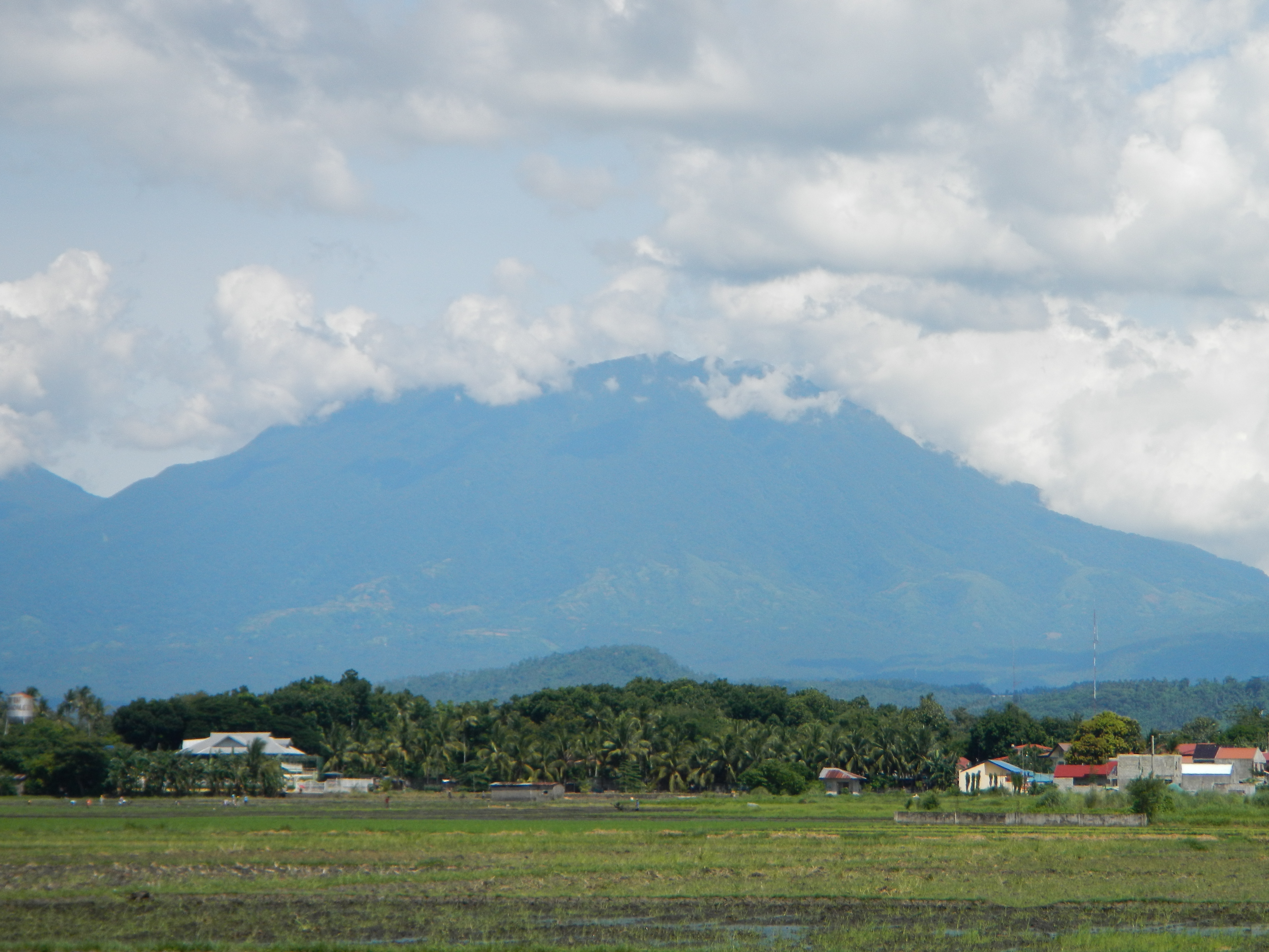 Mount Banahaw, seen from Victoria, Laguna. | |
| Highest point | |
| Elevation | 2,170 m (7,120 ft)[1][2] |
| Prominence | 1,919 m (6,296 ft)[1] |
| Listing | |
| Coordinates | 14°04′03″N 121°29′33″E[1][3] |
| Geography | |
 Mount Banahaw  Mount Banahaw | |
| Country | Philippines |
| Region | Calabarzon |
| Province |
|
| Cities and municipalities |
|
| Topo map | Mount Banahaw Relief Map, SRTM-1.jpg |
| Geology | |
| Mountain type | Complex volcano |
| Volcanic arc/belt | Macolod Corridor |
| Last eruption | 1909 |
 | |
The mountain is considered by many as a holy mountain, thus a bundok dambana, and is popular among pilgrims along with mountain climbers. It is located in a protected area known as Mounts Banahaw–San Cristobal Protected Landscape covering 10,901 hectares (26,940 acres) of land.[5][6]
Physical characteristics
The andesitic Banahaw volcanic complex is composed of several stratovolcanoes with Mount Banahaw, the largest with a maximum elevation of 2,170 metres (7,119 ft) above mean sea level. The summit is topped by a 1.5 by 3.5 kilometres (0.93 mi × 2.17 mi) and 210 metres (690 ft) deep crater that is breached on the southern rim believed to have been caused by the 1730 eruption. Prior to 1730, a lake occupied the summit crater of Mount Banahaw. The resulting flood destroyed the town of Sariaya, Quezon located below the mountain.[7]

- Other peaks:
- Mount San Cristobal (on the western slope)
- Mount Banahaw de Lucban (at northeastern slope)
- Buho Masalukot Domes (at southwestern slope)
- Mount Mayabobo
- Maars: Lake Dagatan/Gunao Lake and Lake Ticob
- Thermal Areas:
- Tiaong-San Pablo hot/warm springs
- Bakia warm/cold springs
- Sampaloc warm springs
- Mainit hot/warm springs
- Cagsiay hot/warm springs
Importance to locals

Banahaw is a custom pilgrimage site for locals, believed by many as a holy mountain, a spiritually-charged location. The mountain and its environs are considered sacred by local residents; the water from its sacred springs are deemed "holy water" for allegedly having beneficial qualities, issuing forth from locations called "puestos" or "holy sites". These sites are unique natural features composed not only of springs, but also caves, streams and boulders; with names with biblical allusions, and shrines erected in, on or around them. These locations were allegedly revealed to a man named Agripino Lontoc by the "Santong Boses" or the "Holy Voices", which also gave the names to these places way back during the Spanish colonial era. Another one of these mountains is the adjacent Mount Banahaw de Lucbán.[7]
Banahaw is also a part of the Makiling-Banahaw Watershed, a reservation of the National Power Corporation (NAPOCOR) providing steam for power generation, as well as water source for domestic and industrial uses.[8]
Hiking activity on Banahaw


The mountain is popular not only with pilgrims but also among mountain climbers being the closest over 2,000-metre (6,600 ft) mountain from Manila. Before 2004, hiking activity peaks during Holy Week each year, with climbers numbering to the thousands. At least four trails exist from Dolores, Sariaya, and other towns of Quezon located on its foothills. The most frequently used trails are the Cristalino and Tatlong Tangke, taking an average of 9 and 5 hours, respectively. These two trails originate from Barangay Kinabuhayan in Dolores, and meet near the summit, which is actually the rim of the Banahaw caldera. On the summit are viewpoints, labeled as Durungawan I, II, and III, which are the usual destination for pilgrims and hikers. Other points of interest include the "Kuweba ng Diyos Ama" (Tagalog: Cave of God the Father) and the spring at Brgy. Kinabuhayan, said to have curative powers.[7]
Pollution
Due to incessant climbing activity the mountain trails have become littered with trash. In March 2004, the Department of Environment and Natural Resources ordered a 5-year suspension of hiking activity in the mountains, covering the Dolores and Sariaya trails. Reopening was delayed was then scheduled to March 2012, but was further extended to February 2015.[4][9][10] Some sections of the mountain were reopened to hikers in 2019,[11] and the mountain observed seasonal openings due to the mountain's religious significance, but most sections of the mountain still remain closed.[12]
Endemic fauna
Frogs endemic to Mount Banahaw include Platymantis banahao, Platymantis indeprensus, Platymantis montanus, Platymantis naomii, and Platymantis pseudodorsalis.
See also
- Sacred mountains
- List of active volcanoes in the Philippines
- List of potentially active volcanoes in the Philippines
- List of inactive volcanoes in the Philippines
- List of protected areas of the Philippines
- Philippine Institute of Volcanology and Seismology
- List of Ultras of the Philippines
References
- "Philippines Mountains" – Ultra Prominence Page. Peaklist.org. Listed here as "Mount Banahao". Retrieved April 5, 2012.
- "Mount Banahao, Philippines". Peakbagger.com. Retrieved April 5, 2012.
- "Banahaw". Global Volcanism Program. Smithsonian Institution. Retrieved December 19, 2010.
- "Mount Banahaw". PinoyMountaineer. January 7, 2009. Archived from the original on April 13, 2009. Retrieved March 20, 2009.
- "Protected Areas in Region IV-A (CALABARZON)" Archived September 29, 2011, at the Wayback Machine. Protected Areas and Wildlife Bureau. Retrieved on September 26, 2011.
- "NIPAS Initial Components (PDF)" Archived March 20, 2012, at the Wayback Machine. Protected Areas and Wildlife Bureau. Retrieved on September 26, 2011.
- "Mount Banahaw". Malapascua. Retrieved on September 25, 2011.
- "Makiling-Banahaw Watershed". www.napocor.gov.ph. Retrieved February 27, 2020.
- "Mountain News: Mt. Halcon and Mt. Banahaw status updated". Pinoy Mountaineer. Retrieved on September 27, 2011.
- "Banahaw, San Cristobal mountains closed to trekkers till 2015". Inquirer News. Retrieved on February 26, 2012.
- Inquirer, Philippine Daily (March 16, 2018). "Respect 'sacred mountain,' DENR reminds Mt. Banahaw trekkers". INQUIRER.net. Retrieved June 1, 2022.
- Villanueva, Rhodina. "Mt. Banahaw still closed to trekkers — DENR". Philstar.com. Retrieved June 1, 2022.
External links
- Philippine Institute of Volcanology and Seismology, Mt Banahaw page
- "Mount Banahao, Philippines" on Peakbagger
Authority control | |
|---|---|
| General |
|
| National libraries | |
На других языках
[de] Banahaw
Der Vulkan Banahaw (auch bekannt unter dem Namen Banahao) ist der höchste einer Gruppe von Vulkanen südlich und östlich der philippinischen Hauptstadt Manila. Die Nachbarvulkane sind der 1.470 Meter hohe San Cristobal und der 1875 Meter hohe Banahaw de Lucban. Einige andesitische und dazitische Lavadome erheben sich an den Flanken des Banahaw. Die Ablagerungen von zwei Gerölllawinen reichen im Nordosten bis in eine Entfernung von 13 Kilometer und im Südosten bis in 26 Kilometer Entfernung. Die Caldera des Vulkans hat einen Durchmesser von 2 Kilometer und eine Tiefe von 600 Metern und ist nach Südsüdwesten aufgebrochen. Bis 1730 befand sich in der Caldera ein Kratersee, welcher sich in Form von Laharen entleerte. Es sind keine wissenschaftlich gesicherten Daten über Ausbrüche bekannt.- [en] Mount Banahaw
[fr] Mont Banahaw
Le mont Banahaw, aussi appelé mont Banáhao ou Majaijai, en tagalog Bundok Banahaw et Bundok Banáhao, est un volcan des Philippines situé sur l'île de Luçon et culminant à 2 158 mètres d'altitude[1].[it] Monte Banahaw
Il monte Banahaw, o Banáhao, (in tagalog: Bundok Banahaw) è, con i suoi 2169 m di altezza, il più alto di un complesso stratovulcanico attivo costituito da tre edifici adiacenti situato nell'isola di Luzon sul confine fra le provincie di Quezon e di Laguna nella parte centrosettentrionale dell'arcipelago delle Filippine. Il complesso vulcanico è completato dai vulcani San Cristóbal a Ovest e Banáhao de Lucban a Nord-est e ha una base di circa 25 chilometri. Nei pressi dell'abitato di Dolores, a Ovest del vulcano che è costituito in prevalenza da andesite, sono presenti due maar che formano il Lago Dagatan e il Lago Ticab.[1][ru] Банахао
Банахао — вулкан, расположен на острове Лусон на границе провинций Лагуна и Кесон, Филиппины.Другой контент может иметь иную лицензию. Перед использованием материалов сайта WikiSort.org внимательно изучите правила лицензирования конкретных элементов наполнения сайта.
WikiSort.org - проект по пересортировке и дополнению контента Википедии